All posts by Joe Bissen

About Joe Bissen

Joe Bissen is a Caledonia, Minnesota, native and former golf letter-winner at Winona State University. He is a retired sports copy editor at the Minneapolis Star Tribune and St. Paul Pioneer Press and former sports editor of the Duluth News-Tribune. His writing has appeared in Minnesota Golfer and Mpls.St.Paul magazines. He lives in South St. Paul, MN. Joe's award-winning first book, "Fore! Gone. Minnesota's Lost Golf Courses 1897-1999," was released in December 2013, and a follow-up, "More! Gone. Minnesota's Lost Golf Courses, Part II" was released in July 2020. The books are most readily available online at Amazon.com or Barnes & Noble (bn.com). He continues to write about lost courses on this website and has uncovered more than 245 of them.

Minnesota’s lost golf courses, since 2000: The list of 85

Since 2000, by my count, 86 golf courses in Minnesota have closed and/or been abandoned (I am continually updating that number as I find more courses, or as they close down). This list, last updated on Aug. 2, 2022, is posted without commentary. Feel free to respond with additions, corrections or opinions.

Thank you to the Minnesota Golf Association for information on some of these courses.

Afton Alps Golf Course, Denmark Township (1990-2019)

Albert Lea Country Club (1912-2006)

All Seasons, Cottage Grove (1993-ca. 2006)

Apple Valley Golf Course, Apple Valley (1974-2019)

B&V Par 3, Plymouth (1962-circa 2006)

Beaver Creek GC, Beaver Creek (2003-2007)

Begin Oaks, Plymouth (2000-2014)

Bentwood, Climax (1987-circa 2019)

Birch Bay, Fairview Township (near Lake Shore) (1965-2015)

Black Bear Golf Complex, Backus (1998-2017)

Black Bear Golf Course, Backus (1998-unknown)

Brainerd Country Club/Pine Meadows (1920s-2004)

The Bridges of Mounds View (1995-2006)

Brockway, Rosemount (1935-2004)

Carriage Hills, Eagan (1967-2004)

Cedar Hills, Eden Prairie (1940-2000)

City View, Cold Spring (1999-2015)

Country Air, Lake Elmo (closed circa 2016)

Countryside, Shafer (2001-circa 2013)

Country View, Maplewood (1930-2004)

Deer Meadows, Cambridge (2000-2008)

Driftwood Golf & Fitness, Clearwater (1994-2019)

Elm Creek, Plymouth (1960-2013)

Fair Havens, Park Rapids (2000-circa 2015)

Fairways at Howard’s Barn, Fifty Lakes (1968-circa 2015)

Far Par Golf, Duluth (unknown-circa 2018)

Fort Ridgely State Park Golf Course, Fairfax (1927-2017)

Fred Richards Executive Course, Edina (1956-2014)

French Lake Open Golf, Dayton (1985-ca. 2015)

Fritz’s Resort Golf Course, Nisswa (1972-2006)

Greenwood, Wyoming (1985-unknown)

The Greens of Howard Lake (1995-2015)

Hampton Hills, Plymouth (1960-2003)

Hayden Hills, Dayton (1972-2018)

Hidden Creek, Owatonna (1996-2009)

Higbee’s, Wahkon (closed 2013)

Hillcrest Golf Club, St. Paul (1921-2017; originally called Lakeview)

Holiday Park, Hayward (1966-2011)

Hollydale, Plymouth (1965-2019)

Irish Hills, Pine River (1985-2009)

Ironman, Detroit Lakes (1960-2016)

KateHaven, Blaine (1981-2014)

Lakeview, Orono (1956-2013)

Links of Byron (1994-ca. 2013)

Lone Pine, Prior Lake (closed circa 2003; I hadn’t previously listed this because the property became the site of The Meadows at Mystic Lake. But Lone Pine shut down, and The Meadows was a complete overhaul of the Lone Pine course.)

Lost River, Gonvick (circa 1958-circa 200)

Maplebrook, Stewartville (1974-unknown)

Maple Hills, Maplewood (1954-2003)

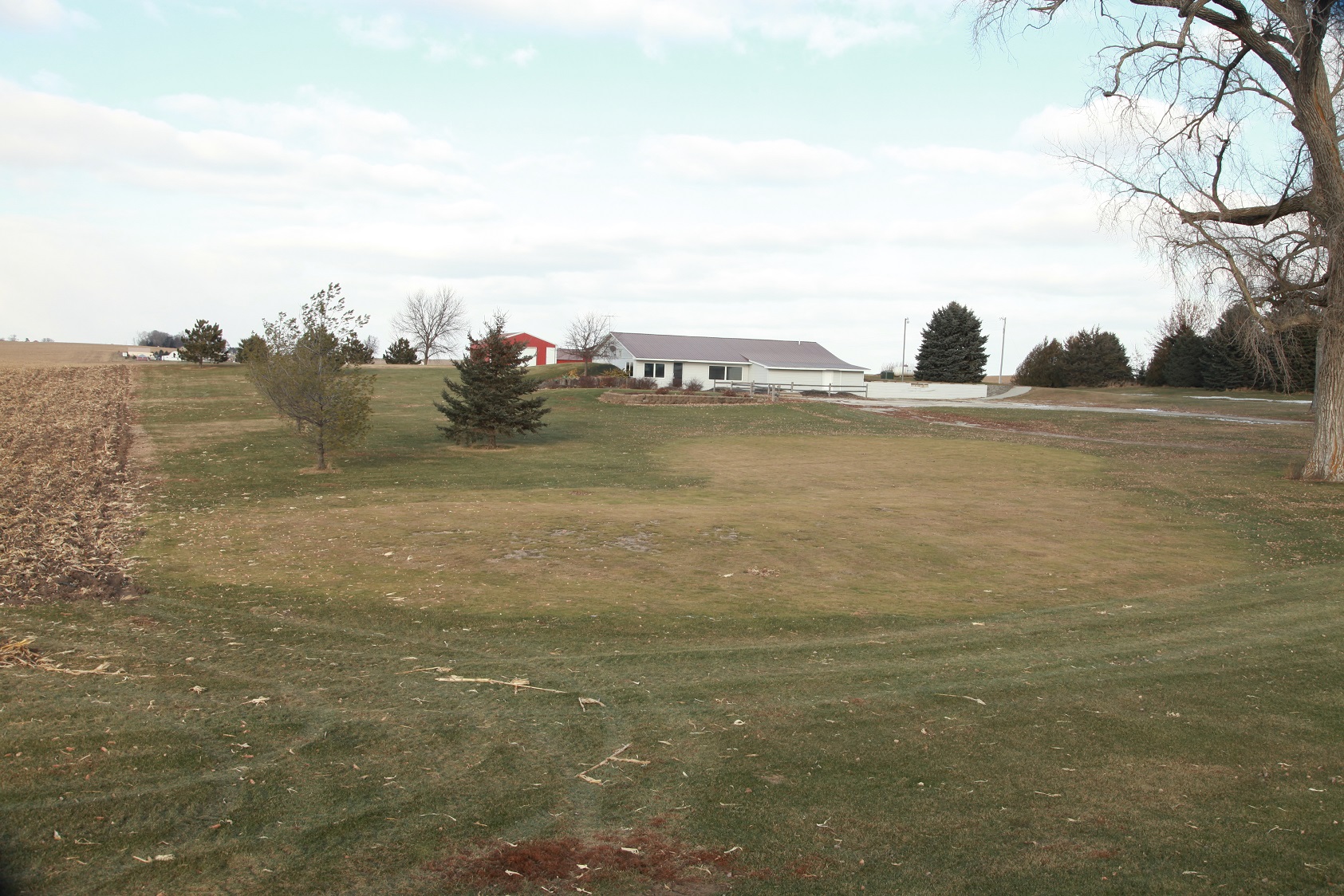
Meadowbrook, Mabel (opened 1984; shown below, 2014 photo, after course’s closing, with the former kidney-shaped ninth green in the foreground and clubhouse in the background, courtesy of Ross Himlie Photography in Rushford) mabel
Meadow Lakes, Rochester (1998-2012)

Meadow Links, Hutchinson (1999-ca. 2015)

Meadowwoods, Minnetonka (1991-ca.-2004)

Minnetonka Country Club, Shorewood (1916-2014)

Mississippi Dunes, Cottage Grove (1995-2017)

Mulligan Masters/Lake Elmo Pines, Lake Elmo (circa 2000-08)

Oakdale Par 3 (1994-2009)

Orchard Gardens, Burnsville (1967-2004)

Parkview, Eagan (1969-2013)

Pine River Country Club, Pine River (1981-2010)

Ponderosa, Glyndon (1962-2015)

Ponds at Battle Creek, Maplewood (2004-2021)

Prairie View Golf Links, Worthington (1983-2015)

Red Oak, Minnetrista (1969-2013)

Red Rock Golf Course, Hoffman (1932-2017)

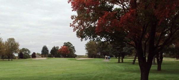
Rich Valley, Rosemount (shown below, October 2021; 1998-2021)
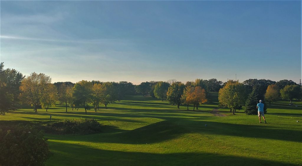

Ridgewood Golf Course, Longville (1987-2016)

River Bend Golf Club, East Grand Forks (second iteration 1995-20022)

Rock Pile, Dent (1999-2013)

Rodina, Alexandria (1998-circa 2015)

Rolling Green Fairways, Fairmont (1976-2003)

Rolling Hills, Pelican Rapids (circa 1970-2016)

Root River Country Club, Spring Valley (1962-2014)

Sanbrook Golf Club, Isanti (1995-2001)

Sauk Centre Country Club (1921-2013) (Note: This course has reopened as Old Course Sauk Centre, partially rerouted and redesigned.)

Silver Springs, Monticello (1974-2009)

Stillwater Oaks (formerly Sawmill), 1983-2019

Stone Bridge, Otsego (1999-2009)

Tartan Park, Lake Elmo (opened 1965, closed December 2015. The grounds have been converted into The Royal Golf Club, which opened in 2018, but it was a total rebuild of Tartan Park, so I’m considering Tartan Park to be a lost course.)

Thompson Oaks, West St. Paul (1997-2017)

Town & Country Golf Course, Moorhead (1963-2007)

Valley View, Belle Plaine (1992-2015)

Wedgewood, Walker (established 1962) reopened as Moonlight Bay, notation made May 2021

Wendigo, Grand Rapids (1995-2011)

Wilderness Hills, Holyoke (1995-unknown)

Wilderness Trail Golf & Village (formerly Chippewa National), Longville, 1987-2016

Woodbury Golf & Fitness (1975-2003)

Woodland Creek, Andover (1989-2008)
 

Westwood Hills: A caddie’s memories

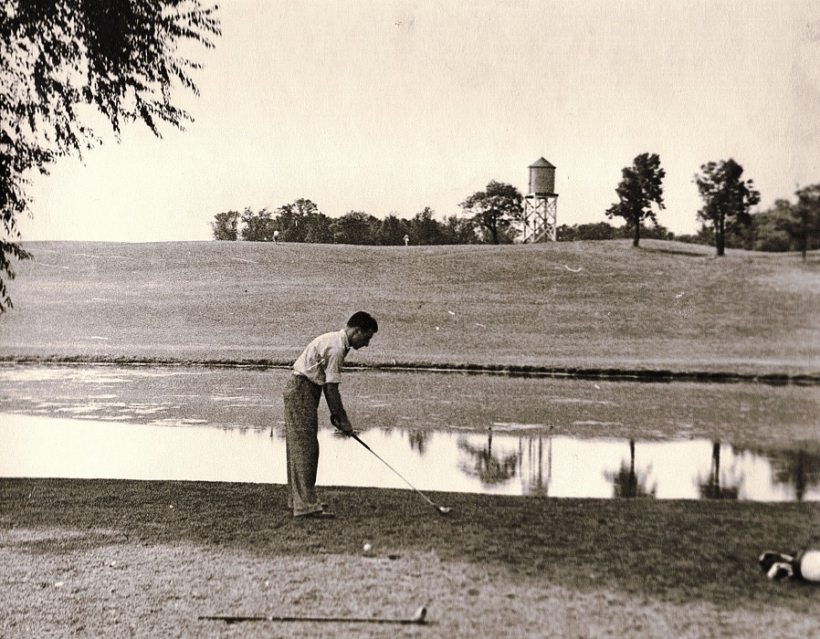
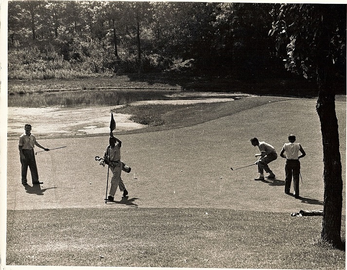
Westwood Hills Golf Course (photos courtesy Jim McNulty)

Why does every golf offseason in Minnesota seem longer than the previous one? I’m pretty sure that’s darn near chronologically impossible, but that’s how it has felt again in 2015-16. Anyway, while all of you wait to play the game again, and while I wait to track down another lost course or three, I thought I would share an email I received recently regarding caddying in the days of yore.

The message came from a fellow familiar with the lost Westwood Hills golf course in St. Louis Park. (The 27-hole course, adjacent to Minneapolis Golf Club, closed in the early 1960s, its land now occupied by housing, a schoolyard and a nature center.) I am not mentioning the fellow by name because he neither granted nor declined permission to use it. Regardless, I appreciate his passing it along.

The email, unedited:

“I started Caddying at Westwood in 1938 at the age of 11. I used to hitchhike to the course from North Mpls. The rates for caddies at that time was 75 cents for 18 holes and 45 cents for Nine. Two of my older brothers also caddied there.  A caddy sandwich (mostly peanut butter on white bread) sold for 15 cents.

“After my first year in order to continue caddying, you had to by a medal pin with a number on it. The lower the number, the caddy had told how long he had been caddying.

“On nights before holidays a lot of the caddies would get there the night before so they could get two ‘loops’ in. There were certain code words we used for each other such as flytrap for a lousy caddy, Bagrat was another word and ball hock for caddies who would rather hunt for lost balls and then sell them to the players. I found out that you could make more money ball hocking. Balls like new could be sold for 50 cents. Po-do was one of the real cheap balls. Wilson, Spalding were the primo balls.

“Monday mornings caddies could play free. I bought a set of hooks fo 10 bucks. The only way I could break ninety was to cheat. It was a great way to make some money as my Dad had never known what allowance meant. I’m 89 now and living in Northern MN but gave up golfing years ago.”

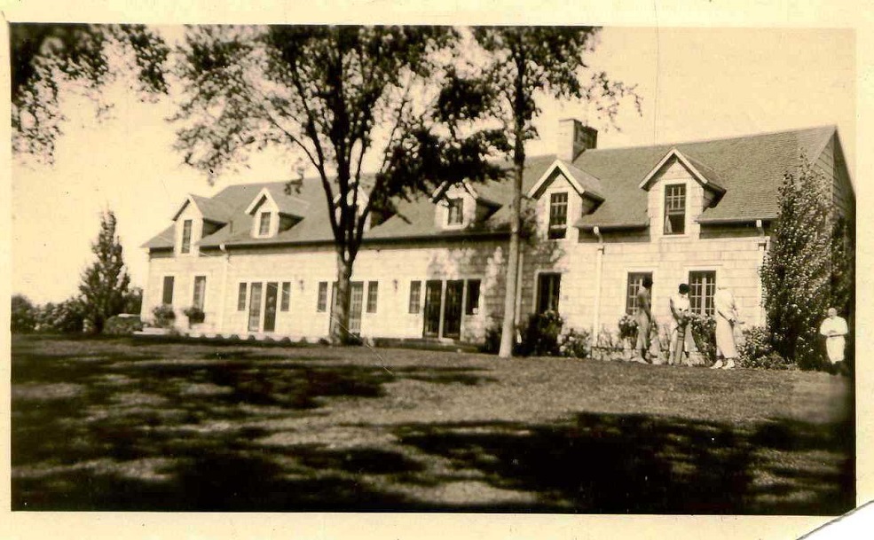
Westwood Hills clubhouse
Westwood Hills clubhouse (near what is now West 18th Street and Virginia Avenue South)
Westwood Hills was designed by Tom Vardon.
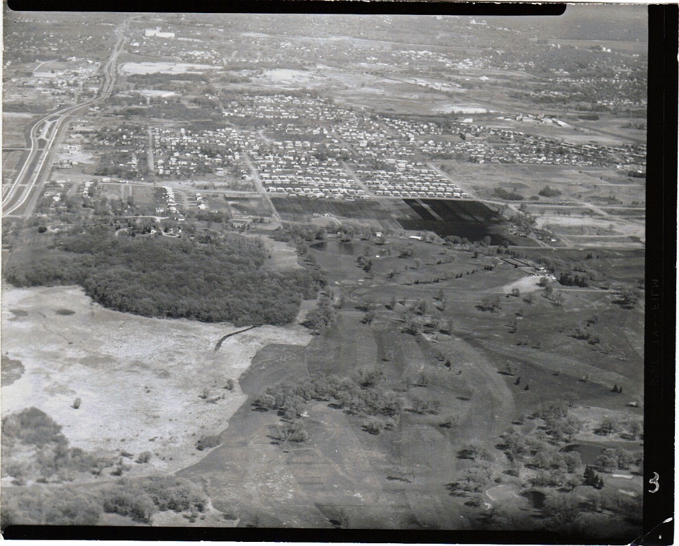
Westwood Hills, aerial view. Top of photo is east; left of photo is north. Large, open area on the left is now Westwood Lake, which was not a lake until the 1960s. The holes at the extreme right of the photo, with bunkers on them, I believe are part of Minneapolis Golf Club.
Westwood Hills, aerial view. Top of photo is east; left of photo is north. Large, open area on the left is now Westwood Lake, which was not a lake until the 1960s. The bunkered holes in the extreme bottom-right corner of the photo I believe are part of Minneapolis Golf Club.

Minnesota golf: More rounds played

Looks like 2015 will go down as a good year for golf in Minnesota.

I received the following email in my work inbox this week, reporting that rounds of golf played in Minnesota through September is up almost 10 percent over last year. The source of the data is reputable. A few observations follow. (Photo above is from Majestic Oaks in Ham Lake, October 2015.)

———–

“PGA PerformanceTrak, a golf data collection and benchmarking service from The PGA of America (@pgaofamerica), reveals that golf rounds played have increased by (+9.5%) across the state of Minnesota, Year-to-date through the end of September, when compared with 2014 data.

“In addition to rounds played, other key performance indicators such as Golf Fee Revenue (+7.9%), Merchandise Revenue (+4.5%), and Food & Beverage Revenue (+8.5%), have also seen an increase throughout the state year-to-date through the end of September 2015, when compared with 2014 data. This information is based on responses from nearly 50 facilities statewide.

“The golf marketplace is trending positively nationwide in 2015, with nationwide golf rounds up (+2.0%), Golf Fee Revenue up (+1.4%), Merchandise Revenue Up (+4.4%) and Food & Beverage Revenue up (+4.6%) based on responses from approximately 2,500 facilities across the U.S.”

—————–

Observations:

— About the source of the data: According to the PGA of America’s website, “PerformanceTrak in Cooperation with NGCOA (National Golf Course Owners Association of America) is the largest single source of rounds played data in the industry. Primary contributors of this monthly data are PGA Professionals and NGCOA member(s) along with other allied partners.”

— On its face, it’s good news for the golf industry in Minnesota. Good for golfers, too: The fact that the increase in rounds played outpaces increases in measures of revenue suggests that course owners and managers are trying to make their venues more affordable. Over and over, golfers have cited cost of play as a key factor in why they have played less golf in the past decade.

A Sept. 27 Star Tribune story went into detail about the increase-in-rounds trend, citing July numbers from PerformanceTrak. The story confirms that cost of play has decreased, reporting that “Minnesota’s median 18-hole greens fee was $26.68, below the $28.28 recorded for 2014 …”

The full Star Tribune story is here: http://strib.mn/1HMPGPD (sorry, I never can get that direct-link coding to work). It’s a good story that balances the positive numbers with the sobering reality that the golf industry remains significantly challenged. Check out the reader comments on the story, too; they are always revealing.

— As mentioned prominently in the Star Tribune story, the fact that we had a terrific run of weather — deserved compensation over a few recent hellacious weather seasons — has much to do with the rise in rounds played. Also, considering how nice October and early November have been, it’s likely that increases in year-end figures will be even greater, across the board.

— Can’t help myself here. The Star Tribune’s story is headlined “Out of the rough: Golf’s exceptional year.” Note to headline writers (and my newspaper is as guilty as any): Can we please stop with the hackneyed clichés about the golf business (“out of bounds,” “in the rough,” etc.). I’ve read far too many of them. They drive me up a wall.

— The data shouldn’t be interpreted as evidence that the business of golf is in recovery after a downward trend of more than a decade. These numbers are from one season only and don’t necessarily constitute a trend. Anecdotally, I have heard of at least a half-dozen Minnesota courses with serious financial issues, and I’m certain there are more than that. I have little doubt that there will be more attrition in the near future, more course closings on the horizon. On the other hand, I know only of one course that’s closing at the end of this season — Tartan Park in Lake Elmo — so that’s a good sign. Right?

Golf up Highway 65, Part III: Bar L Ranch Club (and waterslide)

Fifty years ago in rural Isanti County, there was a golf-and-entertainment establishment that had its somewhat lengthy title pretty much covered. The Bar L Ranch Club featured, all to varying degrees, bar, L, ranch and club.

I know. If you read the title of this post, you might be wondering: What about the waterslide?

As they say, wait for it …

Bar L Ranch Club was both golf course and supper club — more prominently the latter, based on a half-dozen conversations I had with people who remembered the place. The club was situated 1.7 miles northwest of downtown Isanti, in Bradford Township, with the clubhouse/restaurant/dance hall near the corner of what is now County Highway 70 and 297th Avenue Northwest. The golf course, a nine-holer with grass greens, began near the clubhouse and headed west, then south, at one point tracking within 100 yards of the west bank of the Rum River, then heading back on a return trip to the clubhouse. (Its apparent out-and-back routing isn’t significant in a golfing sense, but I can’t say I’ve seen many like it on nine-hole courses in Minnesota.)

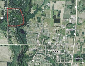
2013 aerial photo of Isanti and area to the northwest. The former Bar L Ranch Club grounds are within the red circle. Photo courtesy of Minnesota Department of Natural Resources.

As for the “L” in Bar L, I never was told by anyone what it meant, and — journalistic blunder here — I must say I failed to ask. But my presumption is that “Bar L” was a hat tip to its owner-founder.

Ray Larowe founded Bar L Ranch Club in the mid- to late 1950s. He had a decent-sized, two-story building in place; the property it was on had served at the Johnson Sisters Rest Home (capacity: 12) from the early 1930s through the early 1950s.

Larowe, by all indications, was an idea man, a forward thinker. His idea in this case was to turn the old rest home and its grounds into a golf course and supper club, then develop the surrounding area.

“Ray began work on a nine-hole golf course and remodeled the former rest home into a restaurant,” a 1993 Isanti County Traveler story reported. “He platted a housing development along the river called River Ridge, providing access from the golf course and restaurant by building a circular road through the potential development. (That road is now known as River Ridge Road Northwest and 293rd Avenue Northwest.)

“The golf course was a par 35 regulation course open to the public. The club house expanded and it was a popular spot, offering a full dinner menu and often live entertainment. Minnie Olson, who with her husband Gil had formerly owned the Doodlebug Café in Cambridge, was one of the cooks at the club. Her pickled beef, served as an hors d’oeuvre, became widely known to buy it by the jarful to take home.”

Details about the golf course are hard to come by — at least they were for me. “It wasn’t a very elaborate course — kind of an executive course,” said Richard Guetschoff of North Branch, who estimated he played Bar L a dozen times. “Kind of a family-type course.”

“Short, smaller course,” agreed Ivan Peterson of Malmo, Minn., former son-in-law of Ray Larowe. Peterson said Larowe had never designed a golf course before starting Bar L.

Larowe’s background was in road and dirt construction, said his daughter, Avis Peterson of Mesa, Ariz. “He could look at a piece of ground and visualize what he could do with it,” Avis Peterson said.

By all indications, Larowe excavated earth and created a pond out of low-lying ground south of the clubhouse-supper club. The pond likely added aesthetic value to the property, though it doesn’t appear to have been in play for golfers. (This was a feature of import, as well, to waterslide fans — and yes, I promise I will get to that.)

The supper club component of Bar L was a popular place in the late 1950s and 1960s. Many patrons were employees at the Nike Missile Base in nearby Stanford Township, established in 1960 as a means to defend the Twin Cities during the Cold War years.

“There was a house and barn and horses and horseback riding and barn dances” at Bar L, Avis Peterson recalled.

Peterson helped with cooking and cleaning. She helped explain both the “ranch” and “bar” components of the place.

“The original chairs in the clubhouse had cowhide on the upholstery. It was Western-themed inside,” she said. “It was a dry county, so you couldn’t sell liquor. People had locker stalls with liquor in them, and they could buy setups (from Bar L). The Hawaiians was the band that played there every Saturday night for a long time.”

Eventually, a sister establishment named Augie’s Auggies Hayloft opened a couple of hundred yards east of the Bar L clubhouse. “It was a converted barn and offered refreshments and short orders when the main house wasn’t open,” the Isanti County Traveler story read. “There were also horses for trail riding for a time. Later, snowmobile races were held on winter Sundays.”

The golf course, the Traveler reported, never was particularly successful. The Traveler reported that high water in springtime flooded portions of the golf course and the River Ridge development, though one golfer told me the course didn’t have severe flooding issues.

“The final blow to the Bar-L came on February 20, 1970, with a disastrous fire,” the Traveler reported. “Losses were estimated at between $400,000 and $500,00. While there was talk of rebuilding, that never came to pass. Auggies Hayloft remained open until it too burned a year later.”

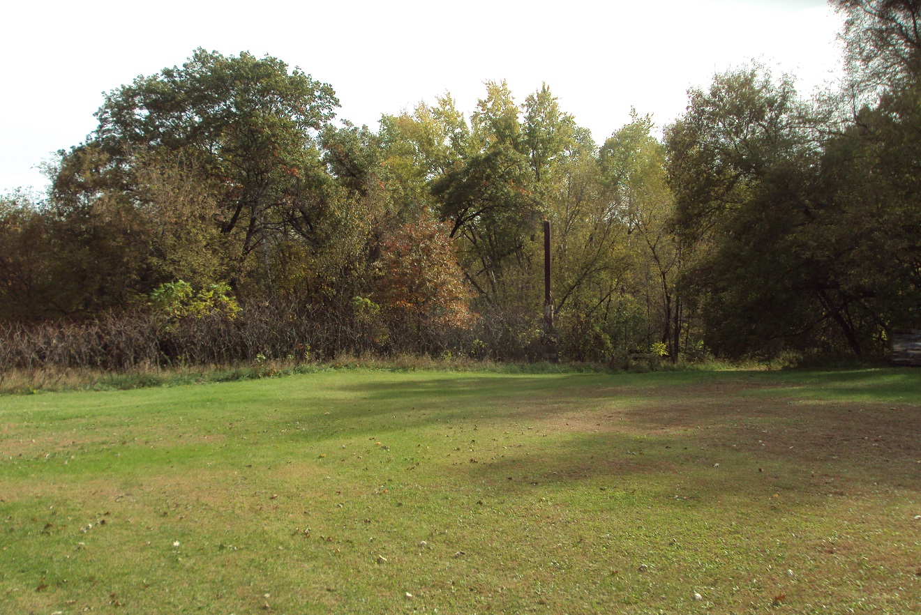
On the former Bar L golf course grounds. The bulk of the golf grounds is now grown over with trees and brush, though it's fairly easy to conceive where the holes might have been routed. The smokestack to the right and in the background (click on the photo for a larger view) is all that remains of Augie's Hayloft.
On the former Bar L golf course grounds. The bulk of the golf grounds is now grown over with trees and brush, though it’s fairly easy to conceive where the holes might have been routed. The smokestack to the right and in the background (click on the photo for a larger view) is all that remains of Auggies Hayloft.

Larowe had in the meantime become the founder of another golf course — Golden Tee Country Club, a nine-holer in Ham Lake that was incorporated in 1964. Larowe again conceived of something greater than a golf course — homes, townhomes, tennis courts and a tournament-quality golf course, according to a 2012 letter sent by Avis Peterson to Linda Coffin, who wrote a history of what started as Golden Tee and, after Larowe’s exit as owner, became Majestic Oaks Golf Club in 1971. Larowe’s vision essentially was realized, as Majestic Oaks currently features 45 holes of golf plus an events center and dinner theater.

Back to the Bar L site …

Larowe’s old property — the interior of the semi-circular area created by 297th and 293rd avenues and River Ridge Road — is now occupied primarily by the pond, wetlands and about 20 homesites. The Traveler reported that one home lies on what used to be the old third green at Bar L.

There are a few other odd details and rumors about Bar L that I researched but never could confirm or explain:

— Though Bar L has been closed for 45 years, it still is listed as an operating golf course on at least one Internet site, one that lists “youth golf” venues. Parents, don’t go dropping your kids off in Bradford Township for any daylong instructional golf clinics. You’ll be disappointed.

— A trail bisects the Bar L property and runs north-and-south behind what is now the yard of a homeowner who referred to it as “The Oxen Trail” and suggested it predates the golf course by many years. The trail is clearly visible in a 1938 aerial photo of the area and runs for at least two miles north and south of the golf course site.

— One of the River Ridge residents passed along two tidbits. First, he said he heard that former Minnesota Twins star Harmon Killebrew once was interested in buying Bar L. I made an inquiry with the Killebrew family that was not met with a response. Then I noticed in an old plat map that property just west of Bar L once was owned by an entity called Wheelock Enterprises — and Wheelock Whitney and family were prime figures in the early years of the Minnesota Twins. There is a Wheelock Enterprises based in Stillwater, but again, I was unable to connect with that business, so I have to reach the conclusion that all of this is just odd, random coincidence.

— Second, the River Ridge resident said that a creek that runs through the southern part of the site — he called it Lost Creek — was considered a dividing line between the Lakota/Dakota Sioux and Ojibwe tribes of North America. I couldn’t find any verification of that, or for that manner any refutal, and there is at least a grain of credibility to the claim. Lake Mille Lacs, 45 miles to the north, is considered a sacred body of water by the Dakota Sioux, and the Rum River, which emanates from Lake Mille Lacs, is known as “Spirit River” in the Dakota culture.

Lost Creek, incidentally, likely was the primary source of flooding on the Bar L grounds and was the stream that Larowe tapped into to build his pond next to the clubhouse.

Which brings us, finally and not coincidentally, to the waterslide.

“Behind the clubhouse,” Avis Peterson said, “he (Ray Larowe) built a sauna, and then he built a slide to go behind the sauna and into the pond. You’d go down the hill and into the cold water.”

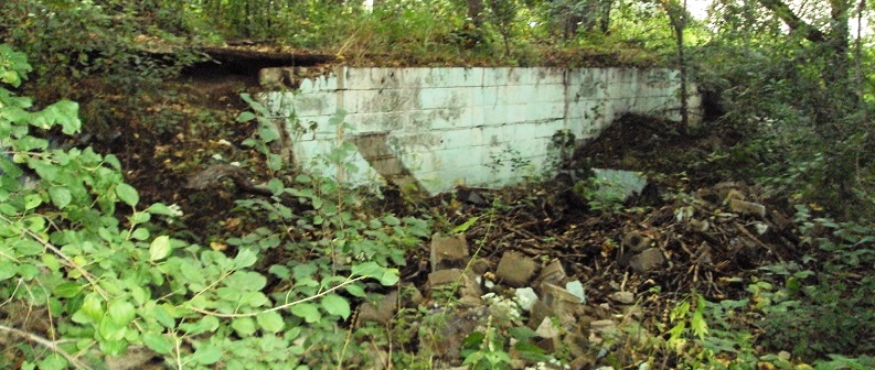
There are crumbling, concrete remains of the sauna near the house that is on the site that was the Bar L clubhouse. The old sauna is on a hillside, and the current resident uses the bank as a sliding hill in the wintertime, leading down to the pond.

The gentleman who owns the home had no clue that Ray Larowe’s Bar L revelers once slip-slided their way into Ray’s pond.

Don’t believe the waterslide story? Check out the photos below.

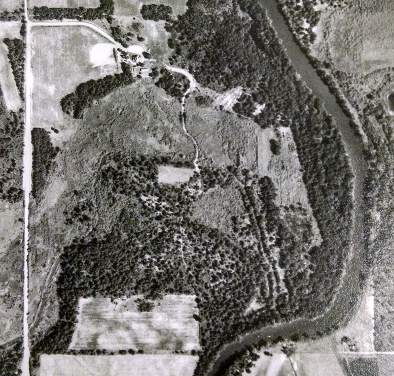
Bar L Ranch Club site, 1953 aerial photo. The bright, white area near the upper-left corner of the photo is the site of the former Johnson Sisters Rest Home. There is no golf course at this point. The Rum River runs along the right side of the photo. Courtesy John Borchert Library, University of Minnesota.
Bar L Ranch Club site, 1953 aerial photo — before the golf course and supper club existed. The bright, white area near the upper-left corner of the photo is the site of the former Johnson Sisters Rest Home. The Rum River is along the right side of the photo. Aerial photos courtesy of John Borchert Map Library, University of Minnesota.
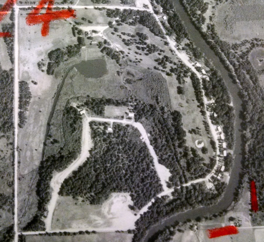
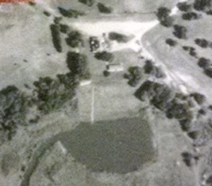
1965 photo of the same site, with the Bar L Ranch Club having been established and the golf course in the upper-right quadrant of the photo. Ray Larowe's pond below the clubhouse, and the channel he presumably dug to feed the pond, is clearly visible.
1965 photo of the same site, with the Bar L Ranch Club having been established and the golf course along the right side of the photo, near the river. Below the clubhouse lies Ray Larowe’s pond, and the channel he presumably dug to feed the pond.
In case you're skeptical about the existence of the waterslide that led from the Bar L sauna to the pond, perhaps this will convince you. Check out the thin white line below the clubhouse and leading into the pond. It's the waterslide, and the white rectangle at the top of the thin white line is the sauna.
In case you’re skeptical about the existence of the waterslide that led from the Bar L sauna to the pond, perhaps this will convince you. Check out the thin white line below the clubhouse and leading into the pond. It’s the waterslide, and the white rectangle at the top of the thin white line is the sauna.
Remains of the sauna at Bar L.

Thanks to the Isanti County Historical Society for considerable information on Bar L Ranch Club and its Isanti County lost-course predecessor, Shady Oaks (see previous post).

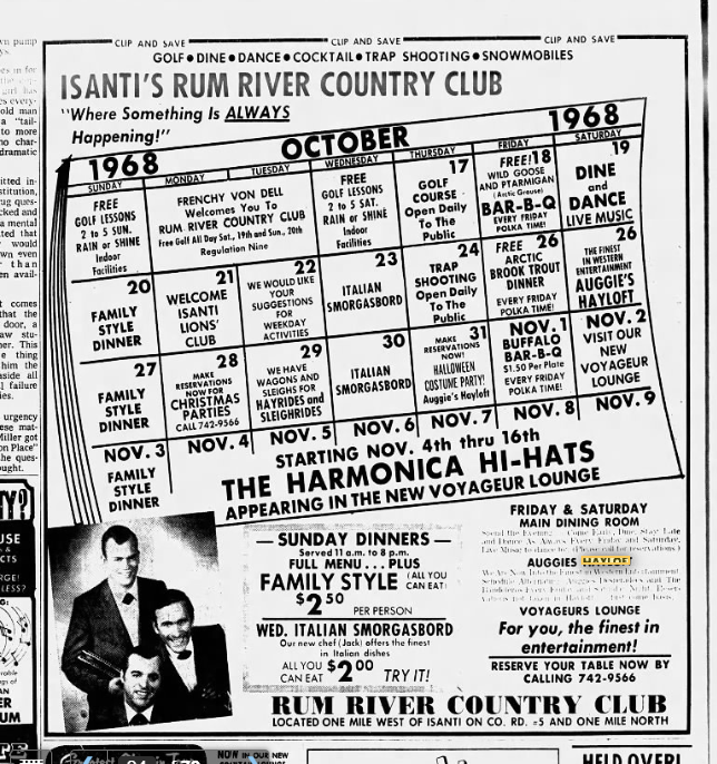
January 2020 footnote: I found a Minneapolis Tribune ad from Oct. 17, 1968, advertising Auggies Hayloft (it appears I had the spelling wrong in the original post). Here it is:


Highway 65, Part II: 85 years of golf in Cambridge

Golf’s highest-profile denizen up Minnesota Highway 65 in the Cambridge area is Purple Hawk Country Club. The club, situated 3.5 miles north of downtown Cambridge, opened on May 25, 1970, and purportedly was named after an Ojibwa warrior who was skilled at the game of lacrosse. That’s what they say, though I frankly believe that like I believe Kim Jong Il really did shoot that reputed round of 38-under par 34 with 11 aces in the 1990s at the Pyongyang Golf Complex.

Regardless, Purple Hawk is regarded highly enough to attract Twin Citians on day trips and serve as a destination for northern Minnesotans looking to play their first round of the year in springtime. Once its greens freeze over in a few weeks, it will have 46 seasons in the books.

Purple Hawk’s 1970 start date stands as close to a midpoint for golf history in the Cambridge area. There was plenty of activity before that, and there has been activity since.

A little before Purple Hawk: PH’s predecessor lay two miles to the west, within a few hundred yards of the hairpin turn in the Rum River that sends the river flowing from northward to southward. The predecessor was known as Cambridge Golf Club, though at least two early 1960s telephone directories called it Cambridge Country Club. The club — but not the course — ceased to exist when much of its membership, looking to expand its milieu from nine to 18 holes, established Purple Hawk. The Cambridge GC grounds, according to a 1993 Isanti County Traveler story, were sold in September 1968 to Ed Chies, and that course operates today as Grandy Nine.

Early 1960s ad from Cambridge-area telephone directory -- part of Minnesota History Center archives
Early 1960s ad from Cambridge-area telephone directory — part of Minnesota History Center archives

There is conflicting information as to the age of the Grandy Nine site. Though a website lists the course’s founding date as 1960, the Traveler story (a more credible source, I would think) reported that the Cambridge GC/Grandy Nine site began operation as a golf course “shortly after World War II,” with grass greens added in 1954 and clubhouse and course improvements following in the early to mid-1960s. Further confusing the issue is that Cambridge Country Club had a listing in the 1961 and ’62 phone books but not in 1960.

But unless I am mistaken, and I have been mistaken only 3,479,785 times before this (and that’s just in the past month), Cambridge Golf Club, Cambridge Country Club and Grandy Nine were the same golf course, just with different names.

Well before Purple Hawk: At last, we come to the real deal: a lost golf course.

Twisted logic? Maybe in your world, but not in mine. Lost courses rule.

This lost course, like Purple Hawk, is visible from Highway 65, albeit on the other end of town and with a fair amount of imagination required. (Don’t tell me that’s a contradiction. Just shut up and read.)

The course was called Shady Oaks, and it had a decent run considering its modest background.

Shady Oaks’ resting place can be seen among the shady oaks (duh) on the southern edge of Cambridge, in an area known as Edgewood. The golf course, the 1993 Isanti County Traveler reported, “was basically a pasture on the farm owned by Nils Carlson, Sr. … In the late 1920s and early 1930s when Nils Sr. wasn’t farming anymore and the boys (sons Nils Jr. and Oscar) were occupied in other things, it was decided to use the pasture land as a golf course.”

Shady Oaks’ first hole was a few yards west of what was Highway 65 then and now is Davenport Street Northeast. Its southern edge was nearby — what is now 309th Lane Northeast, a short street that leads to the century-plus-old Carlson farmhouse that still stands and still is owned by Carlson descendants. Its western border was on or near the BNSF Railway tracks, and its northern border was what is now 311th Avenue Northeast. (The golf course, contrary to the same issue of the Isanti County Traveler, did not venture as far north as the former site of the District 3 School, i.e. near the Main Street exit off Highway 65. Three people who remembered the golf course grounds unequivocally said the course’s northern border was basically the southern edge of the woods in Edgewood, or what is now 311th Avenue.)

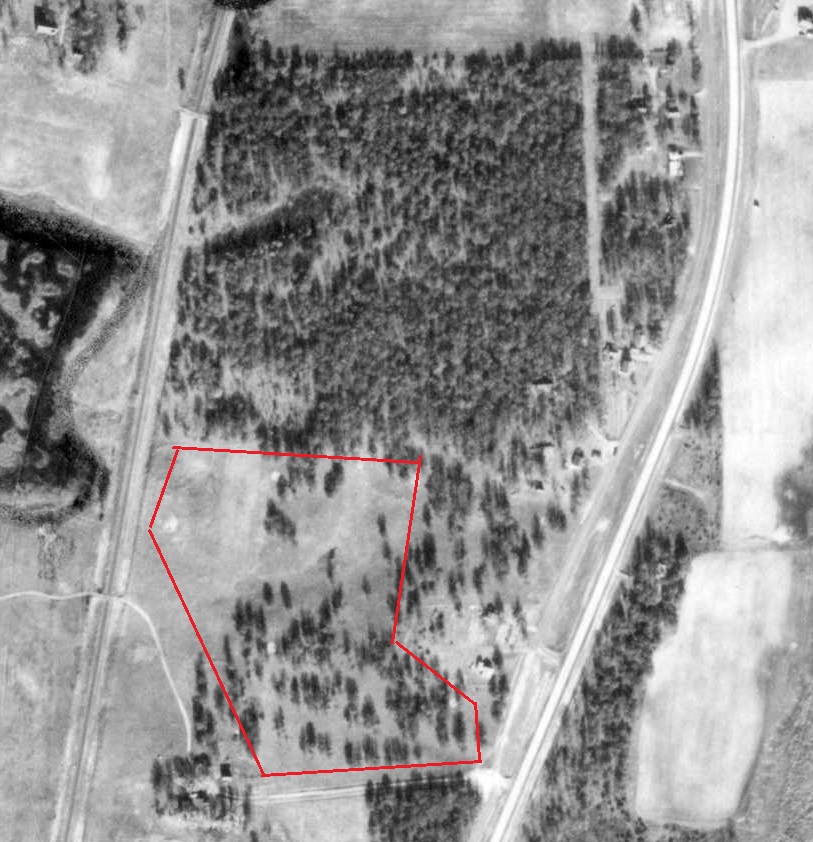
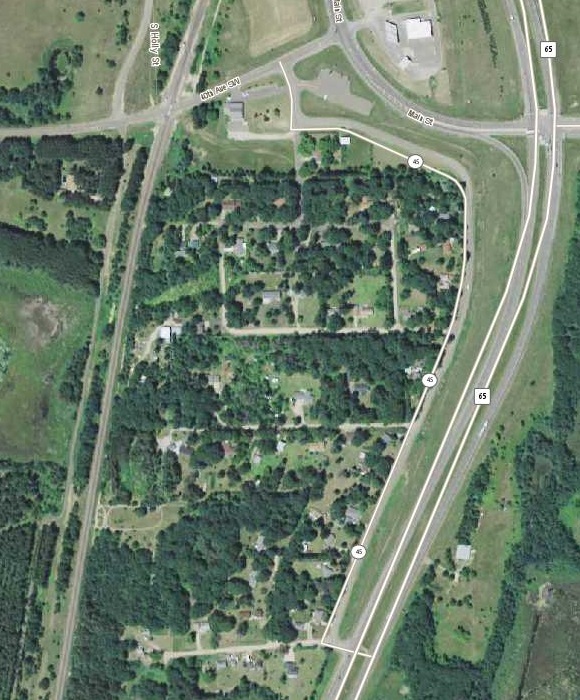
Edgewood area of Cambridge, 1953 aerial photo. This photo would have been taken a few years after Shady Oaks closed. Area inside the red border is approximate area of the golf course. A number of sites of the old greens are clearly visible as small, bright circles. Base photo courtesy of Minnesota Department of Natural Resources.
Edgewood area of Cambridge, 1953 aerial photo. This photo would have been taken a few years after Shady Oaks closed. Area inside the red border is approximate area of the golf course. A number of sites of the old sand greens are clearly visible as small, bright circles. Base photo courtesy of Minnesota Department of Natural Resources.
Edgewood area of Cambridge, 2013 photo courtesy of John R. Borchert Map Library at the University of Minnesota.

Judging from the best reconstruction I can put together — and this has been a tough acorn to crack — Shady Oaks had two clubhouses at separate times. No, wait a minute. Clubhouse really isn’t the right word. They were more like receptacles.

The first was Nils Sr.’s house — or hands, actually. “Hole No. 1, par 4,” the Isanti County Traveler reported, “golfers would tee off near the highway and drive west 226 yards toward the farm buildings where the green was located. As golfers approached the green, Nils Sr. would come out from his house and collect a dime as the admission charge for playing the course.”

Nils perhaps grew weary of this. At least two people I talked with remembered a shack near the first tee — at the corner of the old Highway 65 (now Davenport Street) and 309th Lane. Snacks, they said, were available at the shack, and golfers presumably paid their nominal greens fees there, too.

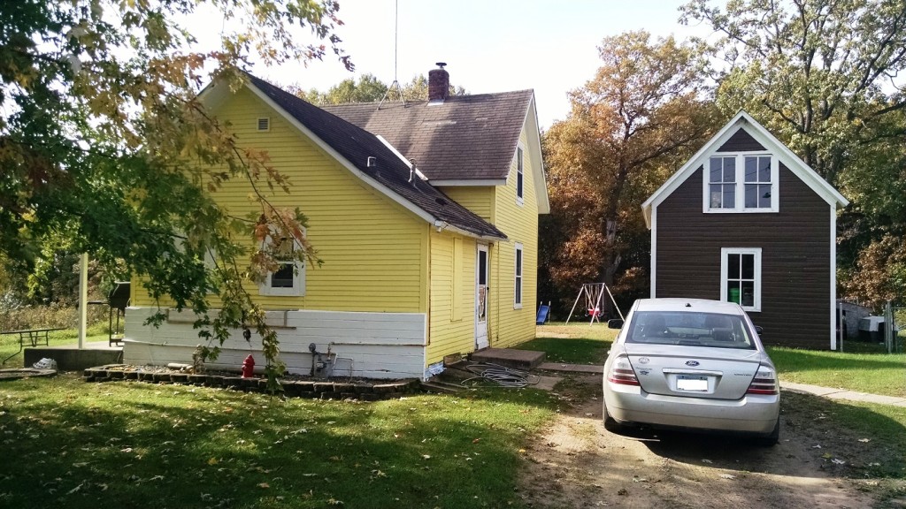
Original "clubhouse," if you will, of Shady Oaks Golf Course. More accurately, this is the former home of Nils Carlson Sr. and then his sons Nils Jr. and Oscar, who operated Shady Oaks.
Original “clubhouse,” if you will, of Shady Oaks Golf Course. More accurately, this is the former home of Nils Carlson Sr. and then his sons Nils Jr. and Oscar, who operated Shady Oaks.

After the first hole, the course turned northward. The Traveler story said so, and so did Roger Carlson of Cambridge, who lives about a mile from the old course and played it as a youth. Carlson, 85, is a retired Cambridge photography professional and son of the late Charles Carlson, whose brothers Nils Jr. and Oscar operated Shady Oaks.

Roger Carlson and I spent about a half-hour in mid-October tromping through the grounds north and east of the Carlson home, in hopes that Roger’s memories of Shady Oaks might be jogged. They weren’t, unfortunately, though Roger remembered carrying his hickory-shafted irons around the place and was fairly certain that the second hole did indeed go north. Beyond that, the combination of old growth and new growth on the old Shady Oaks grounds made it impossible for Roger to definitively identify any of the routing.

shadyoaks1

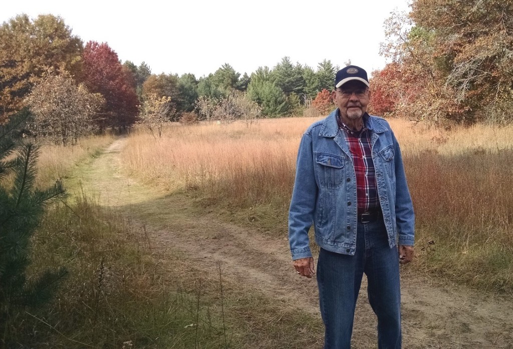
Roger Carlson of Cambridge, standing near what likely was the second green on Shady Oaks. Railroad tracks in front of green trees in the background were near the western border of the course. It’s unclear whether the land between Carlson and the tracks was part of the course, but best guess is that it was.

Like Roger Carlson, three or four other people I talked with remembered that Shady Oaks once existed there, but they retained no vivid memories of the course. Most said the course lasted until shortly after World War II; Roger Carlson said he thought it remained open until close to 1950. The Isanti County Traveler story reported that Shady Oaks was a par-29 layout with sand greens, and that fits with both the relatively small parcel of land it occupied and the old aerial photos which almost certainly show at least three or four sand-green sites within about five years of the course’s closing.

The departure of Shady Oaks would roughly coincide with the starting date of Cambridge Country Club, as reported by the Isanti County Traveler. Whether there are direct connections between those two events isn’t known, but it does establish a fairly continuous history of golf in Cambridge-Isanti area from about 1930 until the present.

Thanks to the Isanti County Historical Society for providing information on the county’s lost courses.

Next post: The lost  course in nearby Isanti.