Category Archives: Lost golf courses

Golf up Highway 65, Part III: Bar L Ranch Club (and waterslide)

Fifty years ago in rural Isanti County, there was a golf-and-entertainment establishment that had its somewhat lengthy title pretty much covered. The Bar L Ranch Club featured, all to varying degrees, bar, L, ranch and club.

I know. If you read the title of this post, you might be wondering: What about the waterslide?

As they say, wait for it …

Bar L Ranch Club was both golf course and supper club — more prominently the latter, based on a half-dozen conversations I had with people who remembered the place. The club was situated 1.7 miles northwest of downtown Isanti, in Bradford Township, with the clubhouse/restaurant/dance hall near the corner of what is now County Highway 70 and 297th Avenue Northwest. The golf course, a nine-holer with grass greens, began near the clubhouse and headed west, then south, at one point tracking within 100 yards of the west bank of the Rum River, then heading back on a return trip to the clubhouse. (Its apparent out-and-back routing isn’t significant in a golfing sense, but I can’t say I’ve seen many like it on nine-hole courses in Minnesota.)
2013 aerial photo of Isanti and area to the northwest. The former Bar L Ranch Club grounds are within the red circle. Photo courtesy of Minnesota Department of Natural Resources.

As for the “L” in Bar L, I never was told by anyone what it meant, and — journalistic blunder here — I must say I failed to ask. But my presumption is that “Bar L” was a hat tip to its owner-founder.

Ray Larowe founded Bar L Ranch Club in the mid- to late 1950s. He had a decent-sized, two-story building in place; the property it was on had served at the Johnson Sisters Rest Home (capacity: 12) from the early 1930s through the early 1950s.

Larowe, by all indications, was an idea man, a forward thinker. His idea in this case was to turn the old rest home and its grounds into a golf course and supper club, then develop the surrounding area.

“Ray began work on a nine-hole golf course and remodeled the former rest home into a restaurant,” a 1993 Isanti County Traveler story reported. “He platted a housing development along the river called River Ridge, providing access from the golf course and restaurant by building a circular road through the potential development. (That road is now known as River Ridge Road Northwest and 293rd Avenue Northwest.)

“The golf course was a par 35 regulation course open to the public. The club house expanded and it was a popular spot, offering a full dinner menu and often live entertainment. Minnie Olson, who with her husband Gil had formerly owned the Doodlebug Café in Cambridge, was one of the cooks at the club. Her pickled beef, served as an hors d’oeuvre, became widely known to buy it by the jarful to take home.”

Details about the golf course are hard to come by — at least they were for me. “It wasn’t a very elaborate course — kind of an executive course,” said Richard Guetschoff of North Branch, who estimated he played Bar L a dozen times. “Kind of a family-type course.”

“Short, smaller course,” agreed Ivan Peterson of Malmo, Minn., former son-in-law of Ray Larowe. Peterson said Larowe had never designed a golf course before starting Bar L.

Larowe’s background was in road and dirt construction, said his daughter, Avis Peterson of Mesa, Ariz. “He could look at a piece of ground and visualize what he could do with it,” Avis Peterson said.

By all indications, Larowe excavated earth and created a pond out of low-lying ground south of the clubhouse-supper club. The pond likely added aesthetic value to the property, though it doesn’t appear to have been in play for golfers. (This was a feature of import, as well, to waterslide fans — and yes, I promise I will get to that.)

The supper club component of Bar L was a popular place in the late 1950s and 1960s. Many patrons were employees at the Nike Missile Base in nearby Stanford Township, established in 1960 as a means to defend the Twin Cities during the Cold War years.

“There was a house and barn and horses and horseback riding and barn dances” at Bar L, Avis Peterson recalled.

Peterson helped with cooking and cleaning. She helped explain both the “ranch” and “bar” components of the place.

“The original chairs in the clubhouse had cowhide on the upholstery. It was Western-themed inside,” she said. “It was a dry county, so you couldn’t sell liquor. People had locker stalls with liquor in them, and they could buy setups (from Bar L). The Hawaiians was the band that played there every Saturday night for a long time.”

Eventually, a sister establishment named Augie’s Auggies Hayloft opened a couple of hundred yards east of the Bar L clubhouse. “It was a converted barn and offered refreshments and short orders when the main house wasn’t open,” the Isanti County Traveler story read. “There were also horses for trail riding for a time. Later, snowmobile races were held on winter Sundays.”

The golf course, the Traveler reported, never was particularly successful. The Traveler reported that high water in springtime flooded portions of the golf course and the River Ridge development, though one golfer told me the course didn’t have severe flooding issues.

“The final blow to the Bar-L came on February 20, 1970, with a disastrous fire,” the Traveler reported. “Losses were estimated at between $400,000 and $500,00. While there was talk of rebuilding, that never came to pass. Auggies Hayloft remained open until it too burned a year later.”
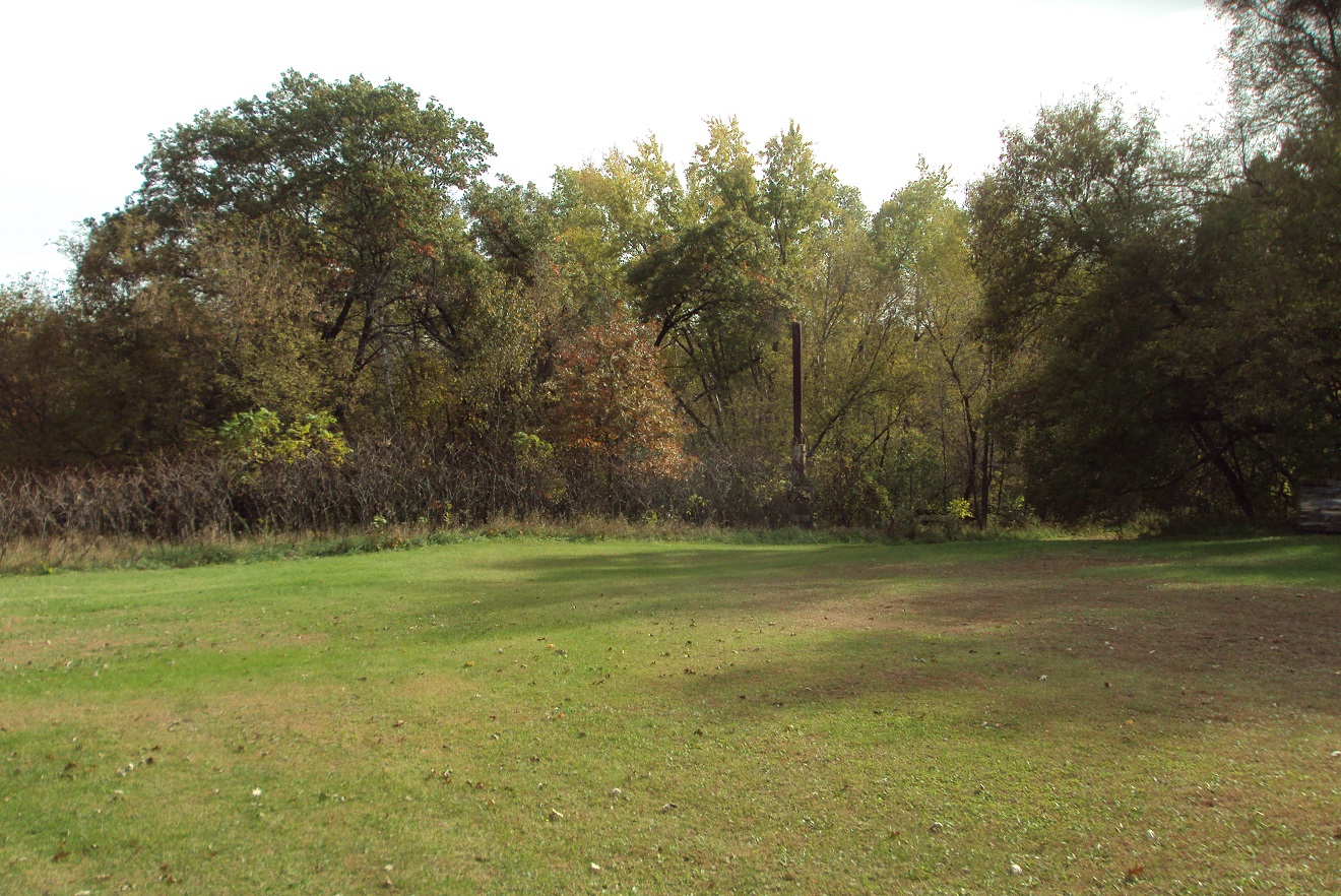
On the former Bar L golf course grounds. The bulk of the golf grounds is now grown over with trees and brush, though it's fairly easy to conceive where the holes might have been routed. The smokestack to the right and in the background (click on the photo for a larger view) is all that remains of Augie's Hayloft.
On the former Bar L golf course grounds. The bulk of the golf grounds is now grown over with trees and brush, though it’s fairly easy to conceive where the holes might have been routed. The smokestack to the right and in the background (click on the photo for a larger view) is all that remains of Auggies Hayloft.

Larowe had in the meantime become the founder of another golf course — Golden Tee Country Club, a nine-holer in Ham Lake that was incorporated in 1964. Larowe again conceived of something greater than a golf course — homes, townhomes, tennis courts and a tournament-quality golf course, according to a 2012 letter sent by Avis Peterson to Linda Coffin, who wrote a history of what started as Golden Tee and, after Larowe’s exit as owner, became Majestic Oaks Golf Club in 1971. Larowe’s vision essentially was realized, as Majestic Oaks currently features 45 holes of golf plus an events center and dinner theater.

Back to the Bar L site …

Larowe’s old property — the interior of the semi-circular area created by 297th and 293rd avenues and River Ridge Road — is now occupied primarily by the pond, wetlands and about 20 homesites. The Traveler reported that one home lies on what used to be the old third green at Bar L.

There are a few other odd details and rumors about Bar L that I researched but never could confirm or explain:

— Though Bar L has been closed for 45 years, it still is listed as an operating golf course on at least one Internet site, one that lists “youth golf” venues. Parents, don’t go dropping your kids off in Bradford Township for any daylong instructional golf clinics. You’ll be disappointed.

— A trail bisects the Bar L property and runs north-and-south behind what is now the yard of a homeowner who referred to it as “The Oxen Trail” and suggested it predates the golf course by many years. The trail is clearly visible in a 1938 aerial photo of the area and runs for at least two miles north and south of the golf course site.

— One of the River Ridge residents passed along two tidbits. First, he said he heard that former Minnesota Twins star Harmon Killebrew once was interested in buying Bar L. I made an inquiry with the Killebrew family that was not met with a response. Then I noticed in an old plat map that property just west of Bar L once was owned by an entity called Wheelock Enterprises — and Wheelock Whitney and family were prime figures in the early years of the Minnesota Twins. There is a Wheelock Enterprises based in Stillwater, but again, I was unable to connect with that business, so I have to reach the conclusion that all of this is just odd, random coincidence.

— Second, the River Ridge resident said that a creek that runs through the southern part of the site — he called it Lost Creek — was considered a dividing line between the Lakota/Dakota Sioux and Ojibwe tribes of North America. I couldn’t find any verification of that, or for that manner any refutal, and there is at least a grain of credibility to the claim. Lake Mille Lacs, 45 miles to the north, is considered a sacred body of water by the Dakota Sioux, and the Rum River, which emanates from Lake Mille Lacs, is known as “Spirit River” in the Dakota culture.

Lost Creek, incidentally, likely was the primary source of flooding on the Bar L grounds and was the stream that Larowe tapped into to build his pond next to the clubhouse.

Which brings us, finally and not coincidentally, to the waterslide.

“Behind the clubhouse,” Avis Peterson said, “he (Ray Larowe) built a sauna, and then he built a slide to go behind the sauna and into the pond. You’d go down the hill and into the cold water.”

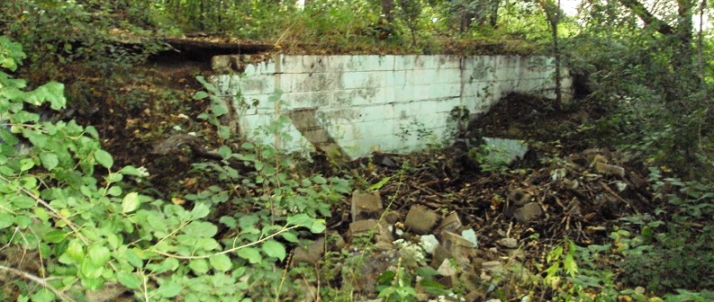
There are crumbling, concrete remains of the sauna near the house that is on the site that was the Bar L clubhouse. The old sauna is on a hillside, and the current resident uses the bank as a sliding hill in the wintertime, leading down to the pond.

The gentleman who owns the home had no clue that Ray Larowe’s Bar L revelers once slip-slided their way into Ray’s pond.

Don’t believe the waterslide story? Check out the photos below.
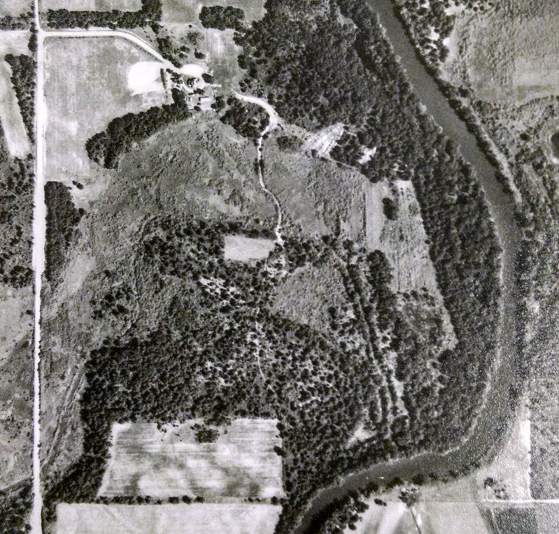
Bar L Ranch Club site, 1953 aerial photo. The bright, white area near the upper-left corner of the photo is the site of the former Johnson Sisters Rest Home. There is no golf course at this point. The Rum River runs along the right side of the photo. Courtesy John Borchert Library, University of Minnesota.
Bar L Ranch Club site, 1953 aerial photo — before the golf course and supper club existed. The bright, white area near the upper-left corner of the photo is the site of the former Johnson Sisters Rest Home. The Rum River is along the right side of the photo. Aerial photos courtesy of John Borchert Map Library, University of Minnesota.
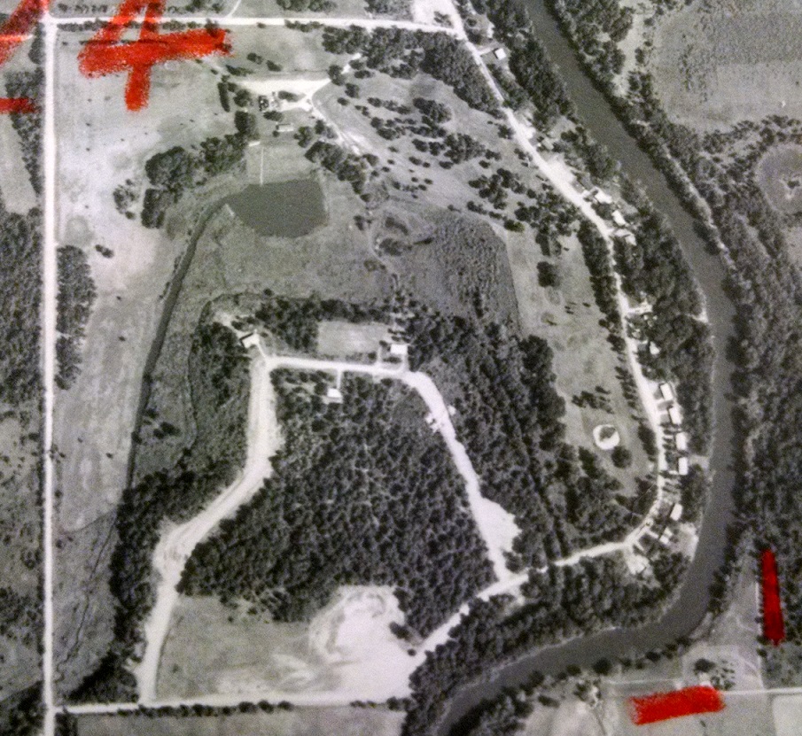
1965 photo of the same site, with the Bar L Ranch Club having been established and the golf course in the upper-right quadrant of the photo. Ray Larowe's pond below the clubhouse, and the channel he presumably dug to feed the pond, is clearly visible.
1965 photo of the same site, with the Bar L Ranch Club having been established and the golf course along the right side of the photo, near the river. Below the clubhouse lies Ray Larowe’s pond, and the channel he presumably dug to feed the pond.
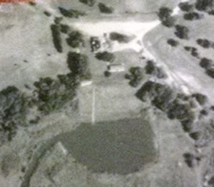
In case you're skeptical about the existence of the waterslide that led from the Bar L sauna to the pond, perhaps this will convince you. Check out the thin white line below the clubhouse and leading into the pond. It's the waterslide, and the white rectangle at the top of the thin white line is the sauna.
In case you’re skeptical about the existence of the waterslide that led from the Bar L sauna to the pond, perhaps this will convince you. Check out the thin white line below the clubhouse and leading into the pond. It’s the waterslide, and the white rectangle at the top of the thin white line is the sauna.
Remains of the sauna at Bar L.

Thanks to the Isanti County Historical Society for considerable information on Bar L Ranch Club and its Isanti County lost-course predecessor, Shady Oaks (see previous post).

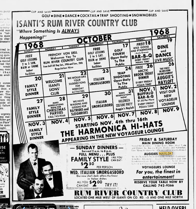
January 2020 footnote: I found a Minneapolis Tribune ad from Oct. 17, 1968, advertising Auggies Hayloft (it appears I had the spelling wrong in the original post). Here it is:
 

Highway 65, Part II: 85 years of golf in Cambridge

Golf’s highest-profile denizen up Minnesota Highway 65 in the Cambridge area is Purple Hawk Country Club. The club, situated 3.5 miles north of downtown Cambridge, opened on May 25, 1970, and purportedly was named after an Ojibwa warrior who was skilled at the game of lacrosse. That’s what they say, though I frankly believe that like I believe Kim Jong Il really did shoot that reputed round of 38-under par 34 with 11 aces in the 1990s at the Pyongyang Golf Complex.

Regardless, Purple Hawk is regarded highly enough to attract Twin Citians on day trips and serve as a destination for northern Minnesotans looking to play their first round of the year in springtime. Once its greens freeze over in a few weeks, it will have 46 seasons in the books.

Purple Hawk’s 1970 start date stands as close to a midpoint for golf history in the Cambridge area. There was plenty of activity before that, and there has been activity since.

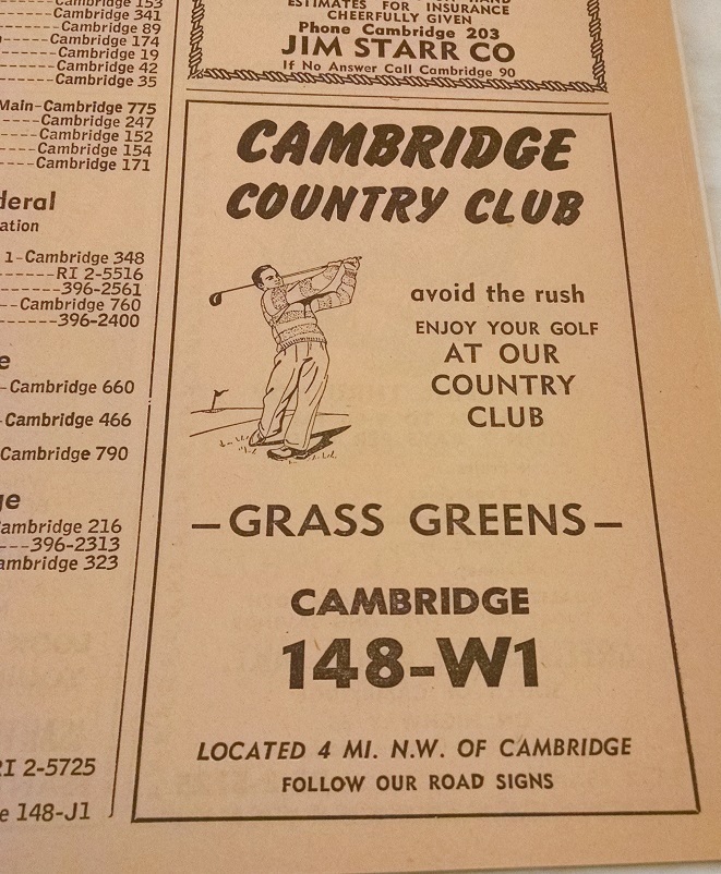
A little before Purple Hawk: PH’s predecessor lay two miles to the west, within a few hundred yards of the hairpin turn in the Rum River that sends the river flowing from northward to southward. The predecessor was known as Cambridge Golf Club, though at least two early 1960s telephone directories called it Cambridge Country Club. The club — but not the course — ceased to exist when much of its membership, looking to expand its milieu from nine to 18 holes, established Purple Hawk. The Cambridge GC grounds, according to a 1993 Isanti County Traveler story, were sold in September 1968 to Ed Chies, and that course operates today as Grandy Nine.

Early 1960s ad from Cambridge-area telephone directory -- part of Minnesota History Center archives
Early 1960s ad from Cambridge-area telephone directory — part of Minnesota History Center archives

There is conflicting information as to the age of the Grandy Nine site. Though a website lists the course’s founding date as 1960, the Traveler story (a more credible source, I would think) reported that the Cambridge GC/Grandy Nine site began operation as a golf course “shortly after World War II,” with grass greens added in 1954 and clubhouse and course improvements following in the early to mid-1960s. Further confusing the issue is that Cambridge Country Club had a listing in the 1961 and ’62 phone books but not in 1960.

But unless I am mistaken, and I have been mistaken only 3,479,785 times before this (and that’s just in the past month), Cambridge Golf Club, Cambridge Country Club and Grandy Nine were the same golf course, just with different names.

Well before Purple Hawk: At last, we come to the real deal: a lost golf course.

Twisted logic? Maybe in your world, but not in mine. Lost courses rule.

This lost course, like Purple Hawk, is visible from Highway 65, albeit on the other end of town and with a fair amount of imagination required. (Don’t tell me that’s a contradiction. Just shut up and read.)

The course was called Shady Oaks, and it had a decent run considering its modest background.

Shady Oaks’ resting place can be seen among the shady oaks (duh) on the southern edge of Cambridge, in an area known as Edgewood. The golf course, the 1993 Isanti County Traveler reported, “was basically a pasture on the farm owned by Nils Carlson, Sr. … In the late 1920s and early 1930s when Nils Sr. wasn’t farming anymore and the boys (sons Nils Jr. and Oscar) were occupied in other things, it was decided to use the pasture land as a golf course.”

Shady Oaks’ first hole was a few yards west of what was Highway 65 then and now is Davenport Street Northeast. Its southern edge was nearby — what is now 309th Lane Northeast, a short street that leads to the century-plus-old Carlson farmhouse that still stands and still is owned by Carlson descendants. Its western border was on or near the BNSF Railway tracks, and its northern border was what is now 311th Avenue Northeast. (The golf course, contrary to the same issue of the Isanti County Traveler, did not venture as far north as the former site of the District 3 School, i.e. near the Main Street exit off Highway 65. Three people who remembered the golf course grounds unequivocally said the course’s northern border was basically the southern edge of the woods in Edgewood, or what is now 311th Avenue.)

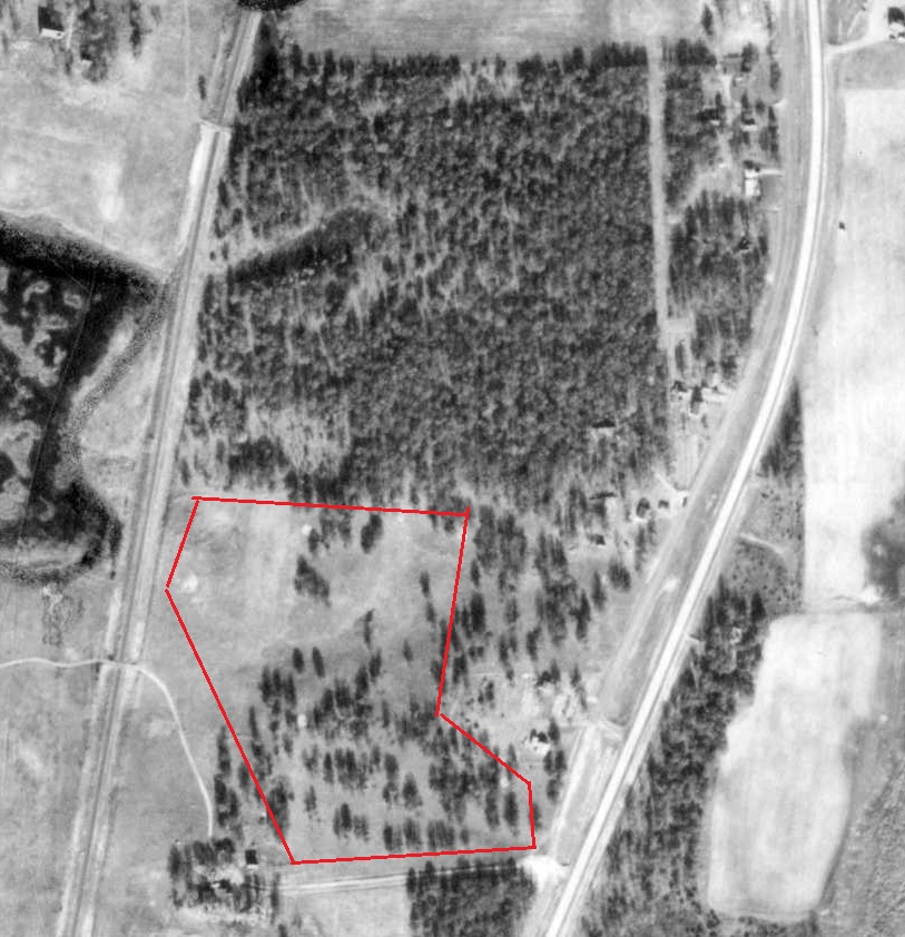
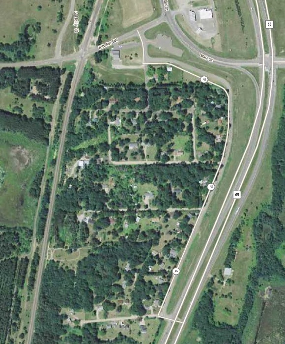
Edgewood area of Cambridge, 1953 aerial photo. This photo would have been taken a few years after Shady Oaks closed. Area inside the red border is approximate area of the golf course. A number of sites of the old greens are clearly visible as small, bright circles. Base photo courtesy of Minnesota Department of Natural Resources.
Edgewood area of Cambridge, 1953 aerial photo. This photo would have been taken a few years after Shady Oaks closed. Area inside the red border is approximate area of the golf course. A number of sites of the old sand greens are clearly visible as small, bright circles. Base photo courtesy of Minnesota Department of Natural Resources.
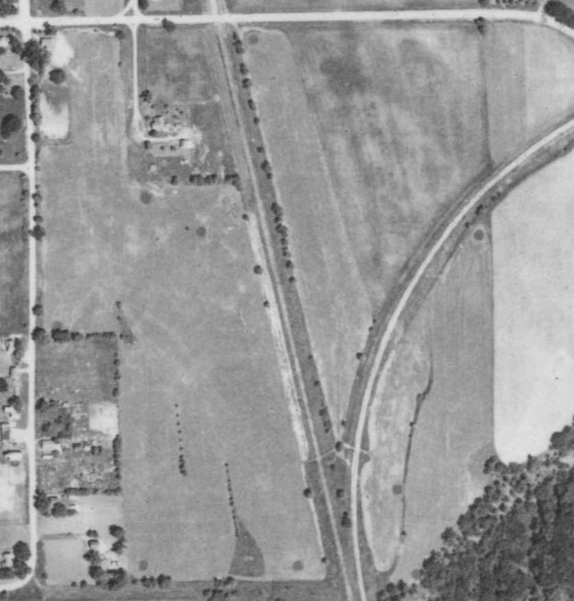
Edgewood area of Cambridge, 2013 photo courtesy of John R. Borchert Map Library at the University of Minnesota.

Judging from the best reconstruction I can put together — and this has been a tough acorn to crack — Shady Oaks had two clubhouses at separate times. No, wait a minute. Clubhouse really isn’t the right word. They were more like receptacles.

The first was Nils Sr.’s house — or hands, actually. “Hole No. 1, par 4,” the Isanti County Traveler reported, “golfers would tee off near the highway and drive west 226 yards toward the farm buildings where the green was located. As golfers approached the green, Nils Sr. would come out from his house and collect a dime as the admission charge for playing the course.”

Nils perhaps grew weary of this. At least two people I talked with remembered a shack near the first tee — at the corner of the old Highway 65 (now Davenport Street) and 309th Lane. Snacks, they said, were available at the shack, and golfers presumably paid their nominal greens fees there, too.

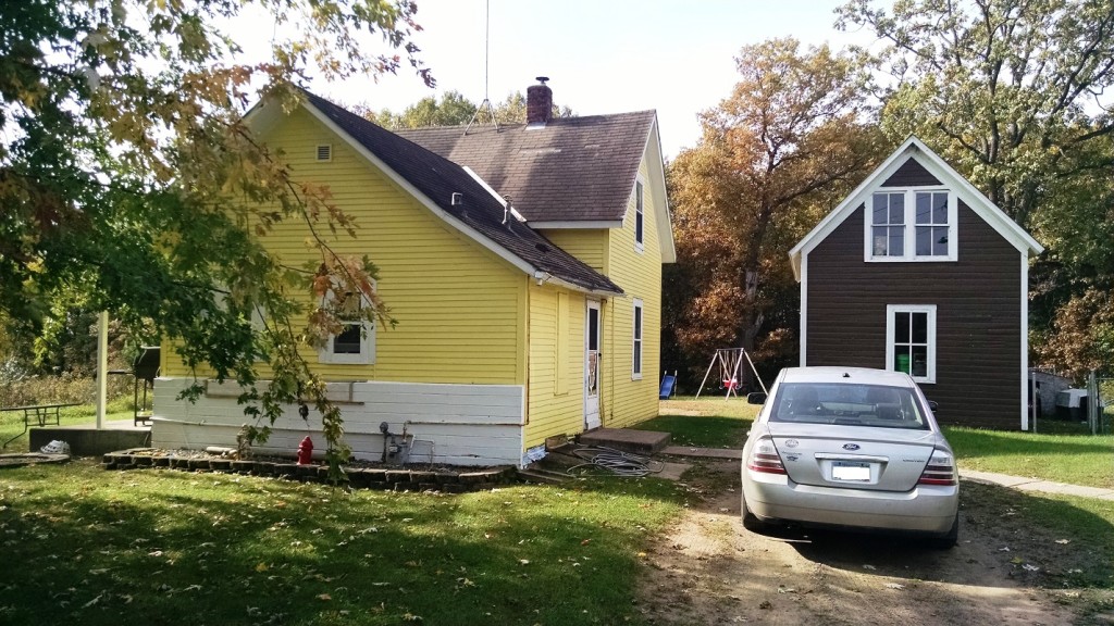
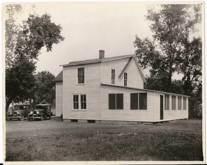
Original "clubhouse," if you will, of Shady Oaks Golf Course. More accurately, this is the former home of Nils Carlson Sr. and then his sons Nils Jr. and Oscar, who operated Shady Oaks.
Original “clubhouse,” if you will, of Shady Oaks Golf Course. More accurately, this is the former home of Nils Carlson Sr. and then his sons Nils Jr. and Oscar, who operated Shady Oaks.

After the first hole, the course turned northward. The Traveler story said so, and so did Roger Carlson of Cambridge, who lives about a mile from the old course and played it as a youth. Carlson, 85, is a retired Cambridge photography professional and son of the late Charles Carlson, whose brothers Nils Jr. and Oscar operated Shady Oaks.

Roger Carlson and I spent about a half-hour in mid-October tromping through the grounds north and east of the Carlson home, in hopes that Roger’s memories of Shady Oaks might be jogged. They weren’t, unfortunately, though Roger remembered carrying his hickory-shafted irons around the place and was fairly certain that the second hole did indeed go north. Beyond that, the combination of old growth and new growth on the old Shady Oaks grounds made it impossible for Roger to definitively identify any of the routing.

shadyoaks1

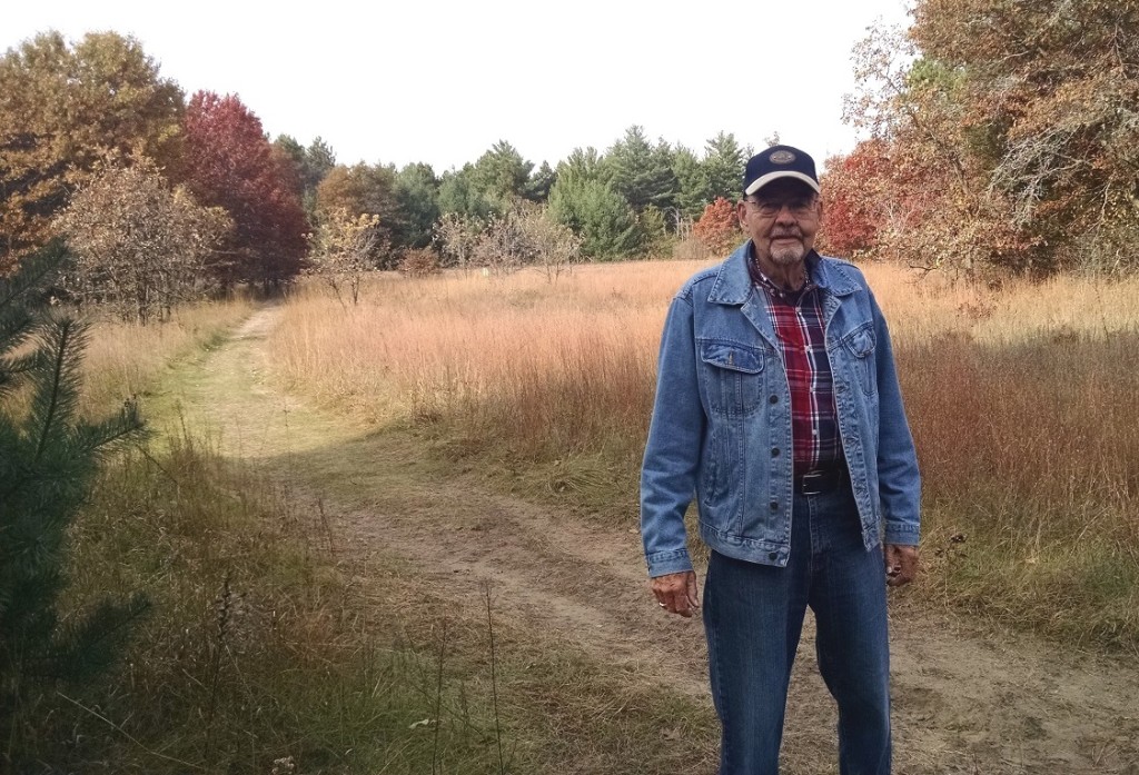
Roger Carlson of Cambridge, standing near what likely was the second green on Shady Oaks. Railroad tracks in front of green trees in the background were near the western border of the course. It’s unclear whether the land between Carlson and the tracks was part of the course, but best guess is that it was.

Like Roger Carlson, three or four other people I talked with remembered that Shady Oaks once existed there, but they retained no vivid memories of the course. Most said the course lasted until shortly after World War II; Roger Carlson said he thought it remained open until close to 1950. The Isanti County Traveler story reported that Shady Oaks was a par-29 layout with sand greens, and that fits with both the relatively small parcel of land it occupied and the old aerial photos which almost certainly show at least three or four sand-green sites within about five years of the course’s closing.

The departure of Shady Oaks would roughly coincide with the starting date of Cambridge Country Club, as reported by the Isanti County Traveler. Whether there are direct connections between those two events isn’t known, but it does establish a fairly continuous history of golf in Cambridge-Isanti area from about 1930 until the present.

Thanks to the Isanti County Historical Society for providing information on the county’s lost courses.

Next post: The lost  course in nearby Isanti.


Valley View: The Hastings bridge

DSC06669

In eight days, school will be back in session at John F. Kennedy Elementary in Hastings, and the golf course will again be treated with reckless disregard and utter impunity.

First-graders will run screaming across the greens. Third-graders will jump and stomp and kick at the fairways as if they weren’t even there. Recess monitors will look away, as if nothing untoward were happening. Custodians, in the ultimate show of indifference, will toss garbage all over the George Nelson Historical Monument.

If they only knew …

… yeah, they would just keep doing it.

Understandable. Hey, all the kids see is a schoolyard. Play on.

A few others — very few anymore — also see an old golf course on the Kennedy grounds. Decades ago, a course known as Valley View — it went by other names later in life — occupied what is now the schoolyard, along with part of the current Smead Manufacturing site and undeveloped land to the south and east.

As a golf course site, this tract isn’t particularly notable. There are few elevation changes, no water and no overly distinguishable features.  As a bridge, however, the site carries some significance.

And in Hastings, bridges (think Spiral Bridge, 1895-1951; “Big Blue” High Bridge, 1951-2013; and four-laner, 2013-present) are a big deal.

Valley View spanned all or parts of 31 golf seasons in Hastings and bridged a gap between a mostly unknown era of golf in the city, going all the way back to 1924, and the present day.

Oh, yeah. About that monument …

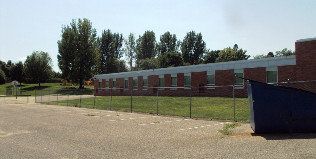
George Nelson, 84, and his friend Bill McNamara, 81, both Hastings residents and former golfers at the Valley View site, rode along one warm August afternoon as I went to visit the place. I turned south from 10th Street East onto Tyler Street. We hung a quick left into the main Kennedy Elementary parking lot and proceeded directly and purposefully across the first fairway, which, yes, makes me not one whit better than the kids who scamper across other sections of the old golf course.

We veered right, into the school’s east parking lot, and Nelson spotted the monument.

“I got a hole in one there,” he said. “Right there.”

“Right there,” at a corner of the east parking lot and on the exact site of the old No. 2 green at Valley View (and I mean exact; you can verify for yourself if you want to take the half-hour to compare old aerial photos to current ones), is a large, steel marker, paying tribute to the ace Nelson recorded 66 years ago while representing Hastings in a high school golf match.

The George Nelson Historic Monument … is a Dumpster.

The George Nelson Historical Dumpster -- or, put perhaps a bit more elegantly, the site of Nelson's 1949 hole in one at the original Hastings Country Club.
The George Nelson Historical Monument — or, put perhaps a bit more elegantly, the site, on the right, of Nelson’s 1949 hole in one on the second hole at the original Hastings Country Club.

The Dumpster was, of course, not there in 1949 when Nelson pulled a 6-ion from his bag, teed off from a slight rise by where the Kennedy playground now stands, aimed north, landed the ball just short of the green because, he said, that was the only way you could successfully play holes with sand greens, and watched it hop and roll into the hole.

(Aside: I wonder if Nelson is the only person alive to have posted two holes in one on lost Minnesota golf courses. Probably not, but give him credit: In 1951, he used a 2-wood to ace the sixth hole at the original — and now lost — site of Faribault Golf and Country Club. It was the first hole in one in 12 years at the course, which relocated 1956 to a site farther north.)

“We had so much fun out here,” Nelson said to McNamara, which was easy for him to say considering he once had the distinct pleasure of penciling in a “1” on his scorecard.

Nelson and McNamara spent the better part of an hour showing me around the grounds, pointing out where every hole was, 1 through 9, and reminiscing. They were, in effect, preserving the bridge.

———————

Hastings Gazette, July 25, 1924. Headline: Golf Course Assured For Fans Of City.

“Arrangements whereby the sporting element of Hastings will soon be able to gratify their desires for outdoor recreation, were revealed here this week in the announcement that the use of a natural golf course on the Nick Conzemius farm a mile west of the city has been secured by local enthusiasts of the sport.

“The proposed course, starting at the western boundary line of the city proper, extends for fully a mile in a westerly direction and abounds in hazards that should test the bility (sic) of golfers in this vicinity to their hearts’ content it is stated by those who have examined the proffered grounds.”

(Modern-day translation of overwrought prose: Fore!)

This original Hastings golf club, which was given no formal name in the newspaper story, had an initial membership of 25; membership fee was $1. The course consisted of nine holes. Best guess is that this location was near what is now Conzemius Park and Hastings Middle School.

Five years later, the club moved east, according to an entry in The Hastings Archives, by Richard B. Darsow. “1929: The Valley View Golf Course, formerly on the Nick Conzemius Farm, was moved and laid out on the Fred C. Gillitt farm, corner of Tenth and Tyler Streets.”

Most likely, the course became known as Valley View upon the move, not before it. And though Darsow linked Valley View and the Conzemius course, no connection is mentioned in any of five newspaper stories about Valley View’s opening that were forwarded to me by the Dakota County Historical Society and by Cindy Smith, curator of the Pioneer Room in Hastings’ City Hall.

Whomever first wrote about Valley View for the Hastings Gazette veritably swooned over the place, which wasn’t unusual for community newspaper writers of the day. I don’t know, maybe there was a set of shiny, new hickory-shafted MacGregors in it for the author.

“There are few golf courses in the country that excel the Valley View grounds in natural beauty or commanding location,” the Gazette reported on July 26, 1929, a month before the course officially opened. From the first green, the newspaper continued, “the golfer commands a magnificent view of both the Mississippi and Vermillion valley and the distant hills of Wisconsin, some of which are perhaps 10 miles away.” (The view is today obscured by building construction and tree canopies.)

Bluster aside, the Valley View site had staying power. The golf course lasted through 1936, when the club reorganized under the name Hastings Golf Club. It lasted through 1939, when 20 members re-formed under the name Hastings Country Club. It lasted through 1944, during a period when many other Minnesota courses were closing, thanks in part to a group of “war widows,” as the Gazette called them, who pitched in to help maintain the course. It lasted through 1947, when in another reorganization the club’s golfers bought the course from the Gillitt family and incorporated under the name Hastings Country Club (one 1947 newspaper clip refers to a renaming from Hastings Golf Club to Hastings Country Club at that point, but multiple clips through the 1940s refer to the club as Hastings Country Club. The incorporation, however, was a key rite of passage to Hastings CC in its present form). And the golf course lasted through 1949, when club members voted 24-12 not to sell the land to an interested private party.

But in 1957, feeling squeezed by residential growth and looking for room to perhaps expand to 18 holes, members began exploring potential new sites. They found one just over a mile to the southwest. On Sept. 2, 1958, the club purchased the John P. Zweber farm, and on May 1, 1961, Hastings Country Club opened with nine holes off Westview Drive, just a few blocks south of the old Conzemius Farm site. A second nine opened in 1966. The course has generally been held in high regard, and it has hosted many Minnesota Golf Association championship events.

If the Conzemius site is Hastings Lost Golf Course Version 1.0 and the Valley View site is Version 2.0, the current site is, let’s say, Version 2.01. Hastings CC has endured financial troubles in recent years and, after an announcement last fall that the club was ending operations and going up for sale, the course briefly lay dormant this spring before reopening for public play on May 13 and continuing through the present. I made multiple inquiries about its status, but none was answered, and so to the best of my knowledge Hastings Country Club remains for sale, its fate hanging in the balance.

Hastings Country Club, 2015

Meanwhile, the Valley View site is a lost course. Gone, but 55 years later, not entirely forgotten.

——————

At the southeast corner of 10th and Tyler stands the Community Education building for Hastings Schools. This  is the site of the former clubhouse for Valley View/Hastings Golf Club/Hastings Country Club. The clubhouse originally was a two-story home owned by Gillitt, judging by the 1929 Gazette story on Valley View. A 30- by 55-foot addition was completed in 1955.

Valley View clubhouse, photo dated Sept. 3, 1929 (photo property of Joe Bissen)

Just to the east, near the corner of 10th and Bailey, was Valley View’s first tee. The opening hole headed south, across land on which Kennedy Elementary was built (meaning kids now whimsically study science where golfers once carefully studied their approach shots), with the green near a corner of the Kennedy grounds, up a small hill and near the school’s playground.

McNamara grew up across 10th Street from the first tee, having moved there as a
12-year-old in 1946. “My aunt Martha Yanz got me started playing with her, and so a life of frustration was born!” he wrote in an email after our visit to the site.

Nos. 2 through 5 ran back and forth, parallel to one another, covering land on the south side of the current Kennedy grounds, including its ballfields. The green for the par-5 third hole was near the corner of 15th and Bailey; the fifth hole ran alongside a railroad spur line now operated by Canadian Pacific. The Veterans Home Bikeway/Mississippi River Regional Trail also runs alongside. “Five was a really good hole,” Nelson said. “Long and challenging, but a good hole.”

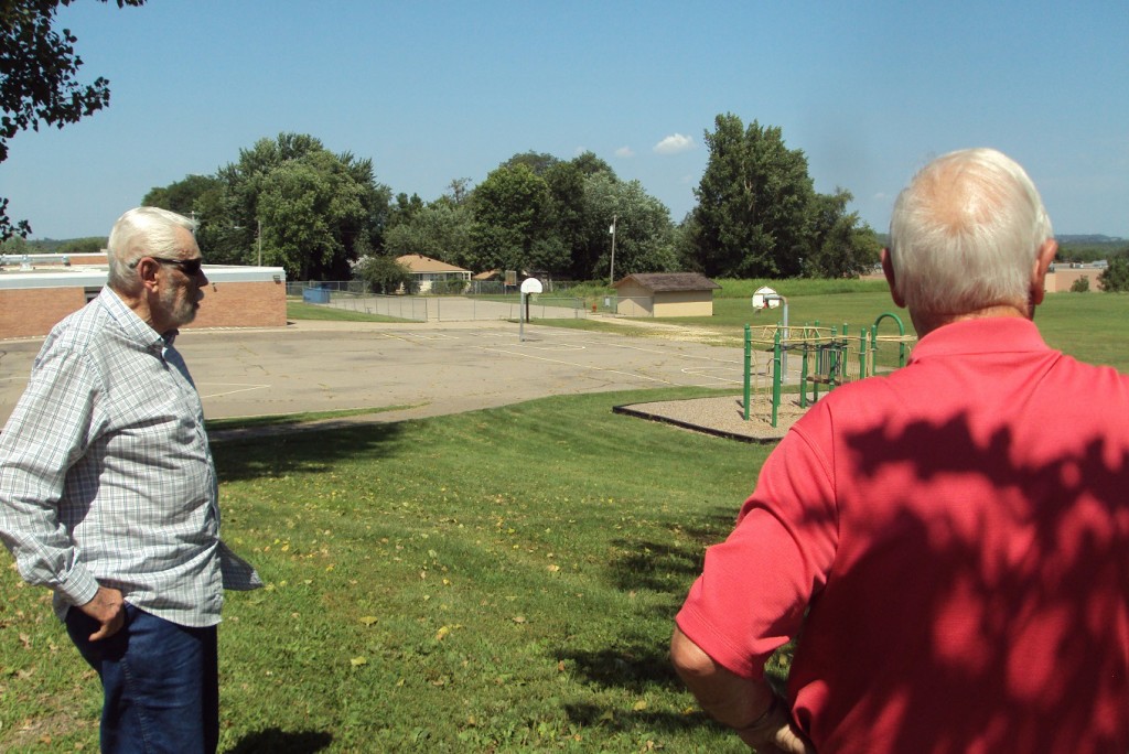
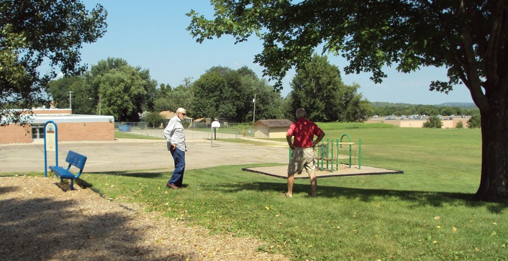
George Nelson, left, and Bill McNamara stand near the site of the tee box on the old second hole at Valley View/Hastings GC/Hastings CC. In the background are the Mississippi River bluffs on the Wisconsin side.
George Nelson, left, and Bill McNamara stand near the site of the tee box on the old second hole at Valley View/Hastings GC/Hastings CC. In the background are bluffs on the Wisconsin side of the Mississippi River.

Nos. 6 through 9 were on the east side of the railroad tracks. The sixth was a par 3 with a drop-off on the right; golfers near the sixth green and seventh tee could descend to the Vermillion River springs for a drink of water. The seventh, a short par 4, played north, near what is now a large Public Works hangar, and the eighth, an even shorter par 4, went south. As with any proper closing hole, the ninth returned home. Well, sort of. It started along the east side of the railroad tracks and headed north, parallel with the tracks, covering part of what now would be the Smead back parking lot, driveway and west side of the building. The green was maybe 25 yards from 10th Street and just a few feet from what is now the Smead driveway. From the ninth green to the clubhouse for post-round refreshments, a walk of more than 220 yards was required.

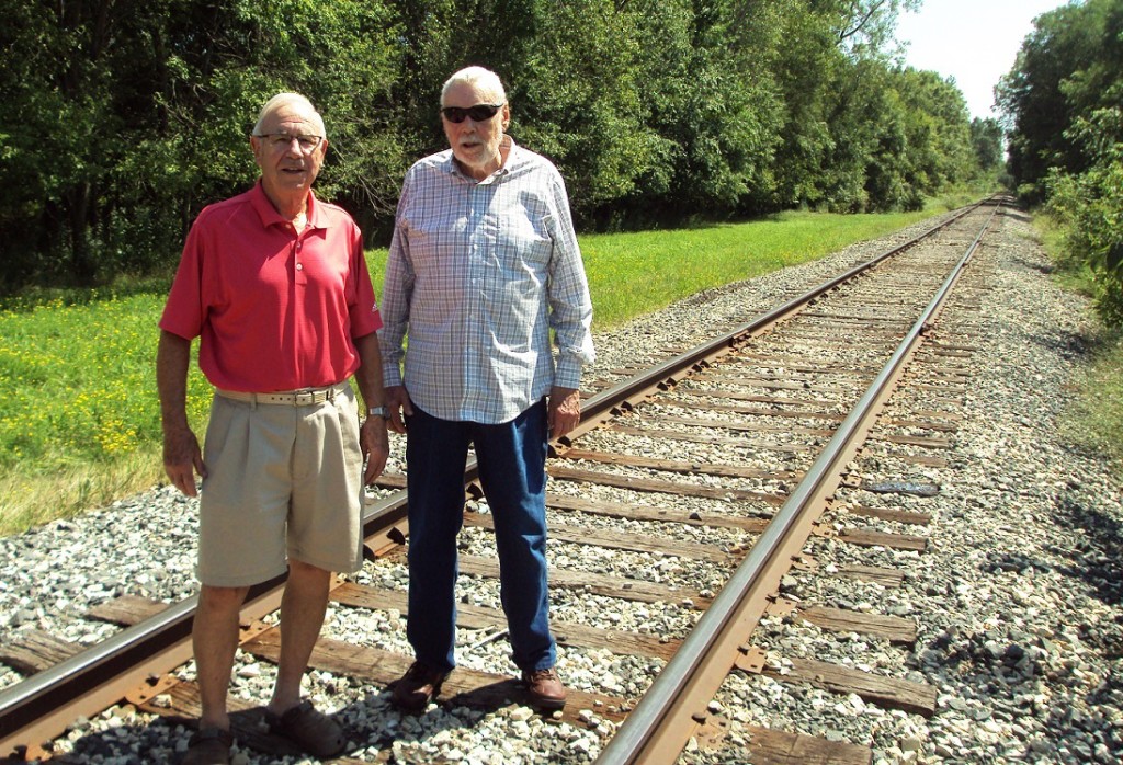
McNamara, left, and Nelson stand on the railroad tracks that divided the five western opening holes at Valley View from its four eastern closing holes.
Bill McNamara, left, and George Nelson stand on the railroad tracks that divided the five western opening holes at Valley View from its four eastern closing holes.

Nelson, who played the course almost daily, he said, remained a Hastings Country Club member when the new course opened in 1961. He is no longer a member there. McNamara did not make the transition to the current Hastings CC site, though he still plays area courses with a group of retirees.

“Living so close,” McNamara wrote in his email, “we kids made the course our own.  Golf and ballgames in the summer, skating and sliding on the hills in the winter. My dad cut grass and did maintenance in his spare time, and even did a little golfing.”

Of the course, he wrote: “A short distance, by today’s standards, nine holes, with SAND GREENS, small, hard, oiled sand, flat as a pancake. No water hazards or sand traps, unless you count the greens!

“… It was our course, and we loved it.”

Aerial photo, Hastings Golf Club (the Valley View site), 1940. Photo courtesy of University of Minnesota's John Borchert Library.
Aerial photo, Hastings Country Club (the Valley View site), 1940. The corner of 10th and Tyler streets is at the upper-left corner of the photo; the Vermillion River is at the bottom-right corner. Photo courtesy of John R. Borchert Map Library at the University of Minnesota.

Author’s note: Finding every one of Minnesota’s lost golf courses has proved to be as implausible as winning the Grand Slam. I knew that would be the case when I started researching and writing about them in earnest three years ago, but still …

This is one in a series of posts that catch up with lost golf courses I missed in “Fore! Gone.” The best way to order the book now is through Amazon.com (from the seller named fivestarsales; that’s me) or to contact me directly. 

Thanks for reading.

jb


Rush City Country Club II: Want to see a redesign?

In about 1940, by his recollection, Don Johnson clambered up the windmill on his family farm in northern Chisago County and snapped an aerial photograph of Rush City Country Club.

Well, semi-aerial.

The click of the shutter revealed part of the grounds of the now-lost golf course, which can be seen on a post elsewhere on this website (sorry; I can never get the linking function to work properly). One would be hard-pressed to call it an aerial photo, however, since it was taken at approximately the height Wilbur and Orv reached on some of their early Kitty Hawk forays.

Now Johnson has done himself one better.

Well, two.

Johnson, a Lindstrom resident who was responsible for 95 percent of the information in my first post about Rush City Country Club, this week relayed more information on the golf course founded in 1932 by his father, Art, and uncle Bill on their father’s farm a mile east of Rush City. Most notably, they featured a first in my five-plus years of researching
Minnesota’s lost golf courses: a routing of a lost course overlaid onto a vintage aerial
photo.

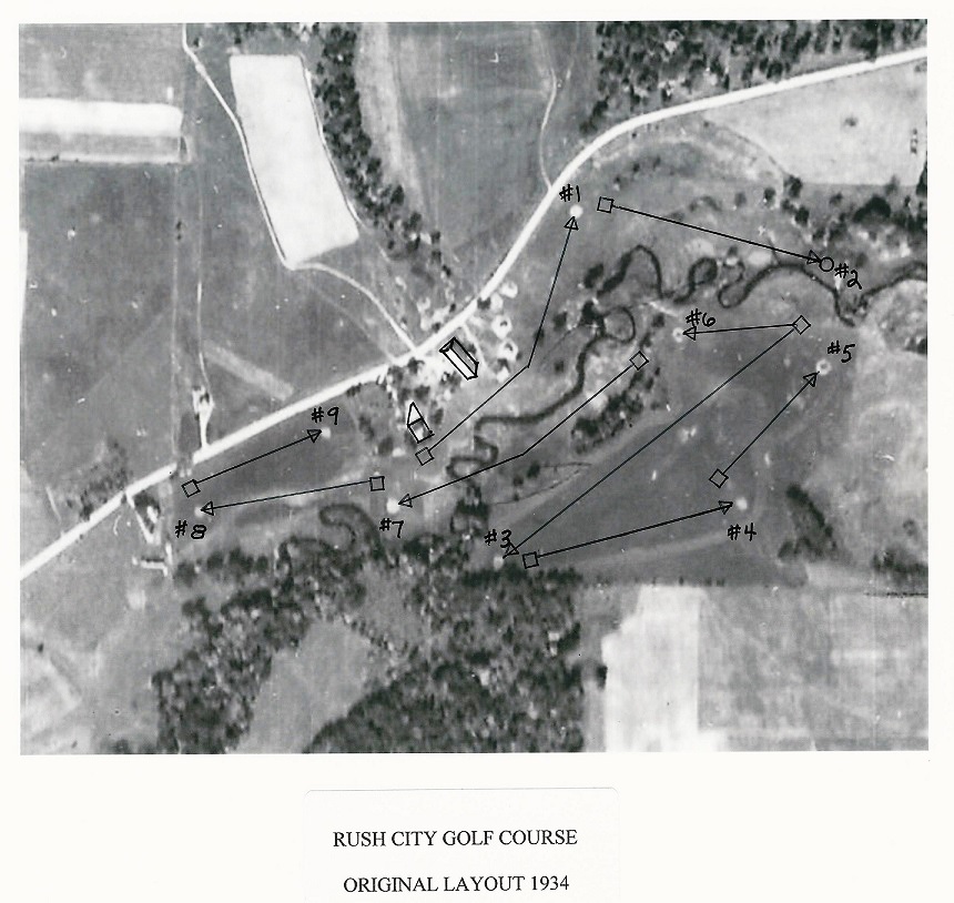
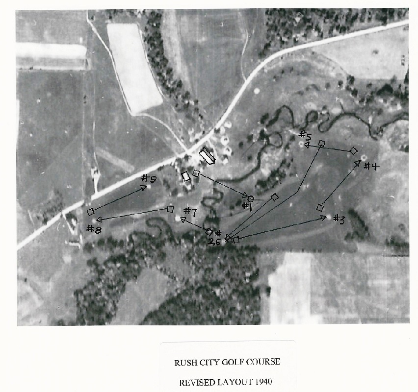
Cutting to the chase, here are Johnson’s reconstructions, first of the original Rush City CC
layout, then of the layout after it was redesigned in the late 1930s because of water issues in a low-lying area:

rushcity-1 rushcity-2

 Click on the photos for closer, better looks. North is “up” on each. Highway 25 is the white line running northeast, bordering the Johnson farm and the golf course. The current Rush City Regional Airport landing strip is approximately where the large, light rectangular patch is, north of Highway 25. As with all aerial-photo views of lost courses with sand greens, the greens are particularly notable as very light, almost perfectly round circles. Base photos courtesy of Minnesota Department of Natural Resources.

rushcity-cardThough it might be folly to make
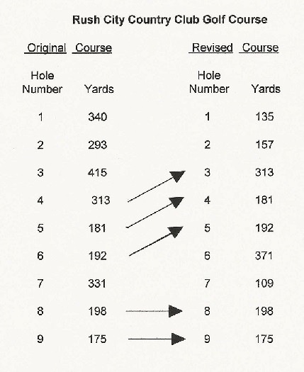
judgments off old aerials, what strikes me in these photos is how solid the original routing of Rush City Country Club appears to have been. Pete Carlson, who did the original design (he also designed Moose Lake Golf Club, 50 miles north of Rush City), used Rush Creek particularly well, designing at least three holes, and maybe up to five, using either side of the creek as a strategic element. The second and seventh holes appeared particularly well-designed, and I’ll bet pars on the latter were hard to come by. Given that the course was only 2,438 yards long, and that there likely was no more land available, the original layout appears well-conceived and challenging without offering any noticeably blatant “funky” holes. Only one nitpick: The par-threes were pretty similar in length: 181, 192, 198 and 175 yards.

Wish I could say the same about the revised layout, though the loss of the land that holes No. 1 and 2 were on surely destroyed any opportunity to match the original. The course was shortened by 607 yards and played to a par of only 29, with only three holes longer than 300 yards. Even more notably, holes No. 2 and 6 now shared the same green. “If you saw players approaching playing No. 6,” Johnson said, “you would hold your tee shot off No. 2.  Never heard of a problem.”

The course survived until about 1954, Johnson reported, though never regaining the
popularity it enjoyed in the 1930s and early 1940s. I can’t help but think the forced revision of the course into tighter quarters had something to do with that.

In addition to the aerial reconstructions, Johnson, 87, passed along more memories:

“The golf course was developed and maintained with an Allis Chalmers Model U tractor purchased about 1933. This was the first farm tractor in the area on rubber tires. It might have been purchased with the golf course in mind, but Art and Bill Johnson also did custom threshing in the area, which required traveling many miles. The threshing machine also was on rubber for speedy travel at 12 mph.

“Allis Chalmers first added rubber tires to their tractor in 1933. They advertised by
displaying their tractor at the Minnesota State Fair with Barney Oldfield, a well-known race car driver, driving around the race track at 64 mph.

“A pull-behind road grader was acquired to level the greens during construction. The greens were oiled sand which would wash during rainstorms if not very level. The sand was hand screened and oiled with used motor oil. The greens were much softer than grass greens on other courses. …

“The bridges across Rush Creek were built using logs felled along the water. One log felled in the spring was so full of sap it would hardly float. The bridges were covered with
two-inch oak planks. I couldn’t drive a spike without bending it until my father said, ‘Don’t force it, just let the hammer do the work.’ Amazing, but no more bent spikes. …

“Golf clubs of that day had wooden shafts. My first set of clubs were broken discards which were glued together and the shafts wrapped with black linen thread. My first steel-shaft irons were acquired about 142 a $1.65 each. …

“When the clubhouse was operating as a dance hall, I was paid 25 cents a week to pick up empty bottles and keep the beer cooler filled. Sometimes as I walked behind the bar I would sample a bit of tap beer. A dice game called ‘Fourteen’ was played, customer against the bartender, and winners were paid one dollar in merchandise tokens or ‘chips,’ as they were called. These tokens were 25-cent brass-embossed with the Rush City
Country Club name.”

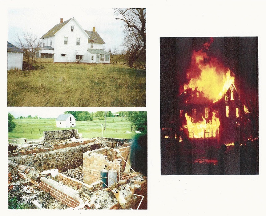
Johnson also passed along three photos of the building that served variously as farmhouse, clubhouse and dance hall. It was destroyed, he noted, in 1991 with a controlled burn by several fire departments.

rushcity-house

Calling Clearwater Country Club. Hello? Hello???

(Note: Since this original post was filed, a couple of updates have presented themselves. Read this post first, then see the updates here🙂

—————-

Think of everything Minnesota golf course owners have had to put up with through the years.

Tractor broke down. Hired help quit. Bear pooped on the fifth green. Cart path washed out. Well ran dry. Tree fell on the 12th fairway. Poa annua everywhere. Toilets overflowed. *%#^@ cutworms.

Flora’s on the party line again.

Yeah, that last one probably wasn’t so common — except at Clearwater Country Club, a modest little nine-holer that once occupied a spit of land off the south shore of Clearwater Lake, a mile and a half north of the central Minnesota city of Annandale.

Owen Prevost was the last owner of Clearwater Country Club, having acquired the place in the early 1960s. In addition to working a full-time job at Univac in Minneapolis while
double-bunking his six kids above the pro shop, Prevost had to put up with the
interruption of potential commerce whenever Annandale’s telephone service was at its
insufferable worst.

Prevost’s daughter, Sharon Judge, picks up the story from here.

“Back then (1963-1964), the pro shop business telephone was part of a ‘party line’ shared by four or five other houses on the road, including Flora and Lyman Ransom on their farm,” Judge recently related in an email. “Clearwater Country Club’s number was 7799, and calls were placed by actual operators.

“The party line posed a significant problem for our business,  because anyone wanting to make a tee time, or sign up for men’s day, or women’s day, or wanting to make a delivery, etc., had to compete with Flora Ransom, the farmer’s wife, who spent all of her time using and gossiping by phone. Flora was a very kind, but winded, person.”

Clearwater Country Club  had a nice run of at least 2 1/2 decades, telephonic interlopers notwithstanding. The beginning and concluding details of the course’s history are
unfortunately missing here, as none of the dozen or so people I contacted or tried
to contact either knew or offered precise starting and ending dates. Judge, in her
otherwise wonderfully detailed email, filled in many blanks in the middle. Here is a partial reconstruction:

Clearwater CC opened before 1942, most likely. A postcard dated June 22, 1942, and sent from Minneapolis to Rockford, Ill., confirms that notion. The postcard, pictured below and bought by yours truly off eBay, is captioned “Boat Landing at Golf Course, Clearwater Lake, Annandale, Minn.” The golf course is not clearly visible in the postcard (nor is Flora Ransom), but it seems likely the postcard showed part of its former grounds. (I never was told by anyone that there might have been another golf course on Clearwater Lake at any time).

clearwater2

clearwater1An early owner of Clearwater CC might have been the Swyter family, though admittedly that is purely speculative on my part. A March 2015 obituary for Berniece Swyter of Paynesville, Minn., published in the St. Cloud Times, includes the sentence “Berniece and George (Swyter) operated a golf course and campground on Clearwater Lake in
Annandale, MN.” I made inquiries with the Swyter family but was unable to confirm that the golf course mentioned in the obituary was Clearwater CC.

In 1950 or thereabouts, Hal Carnes bought the golf course, according to an entry on a blog produced by an Ovaska family of Los Alamos, N.M. The blog’s author posted a photo of Hal Carnes and wrote that “Grandpa Hal was an excellent golfer and they (Hal and his wife,
Janet) bought the Clearwater Country Club in 1950(?) and my mom used to drive the golf cart and sell drinks.” Hal Carnes, the blog post says, had previously lived in St. Paul and
Baudette.

My attempts to contact members of the Ovaska family were unsuccessful.

Clearwater Country Club was noted, for better or worse, for its sand greens, a feature not uncommon in Minnesota the 1920s through 1940s. However, while most of Minnesota’s sand-green courses either shut down by the 1940s or converted to grass greens,
Clearwater remained sand-bound until its demise in the 1960s.

The Ovaska blog and Sharon Judge’s email both suggested Clearwater Country Club was the last wholly sand-greens course in Minnesota. It likely was one of the last, but I’m
almost certain it was not the last. To my knowledge, that distinction belongs to
Whitewater Valley Golf Course in Whitewater State Park near St. Charles, which shut down in 1975. (The Whitewater course is featured in “Fore! Gone.” and pictured on the book’s cover.)

A few Annandale-area residents remember playing Clearwater Country Club. Ed Kaz, a
former Annandale hardware store owner, recalled that the sand greens were difficult to negotiate. Retired schoolteacher Dave Greve said much the same and noted that the course was relatively short, likely not a par 36. Jim Gustason, a Minneapolis native who now lives in Rogers and maintains a home on the north shore of Clearwater Lake that his parents once owned, remembered playing Clearwater CC as early as 1950. He and a friend would troll from one side of the lake to the other, play the golf course, then scoop
wayward golf balls out of the lake.

Bruce Prevost, son of former course owner Owen Prevost and brother of Sharon Judge,
recalled that the Prevosts operated a candy store and rented boats on the premises.
And, he said, “My mom was known for her snapping-turtle soup on men’s night.” Bruce Prevost speculated that Clearwater CC shut down in 1966 or 1967.

But it was Judge, who in an odd coincidence now lives in Annandale, Va., who offered the most vivid memories of Clearwater Country Club. “I have fond memories of that place in a John Irving ‘Hotel New Hampshire’ kind of way,” she wrote in her email.

The memories are little short of priceless.

“My dad … sold the course because he didn’t have the money, or the desire to go into debt by replacing the sand with grass greens (estimated at that time to cost around $3,000 per green to convert),” Judge wrote. “The clubhouse faced Highway 24 just before the road curves to go toward Pleasant Lake. It was bought by Ron Freeman. There was a circular driveway and parking area for golfers.

“While my father worked at Univac in Minneapolis during the week, our mom and my sister Gail and I ran the pro shop. (She was in eighth and ninth grade, while I was in fourth and fifth grade.) My mom, Myra Prevost, cooked the dinners for Thursday men’s league, while Dad, Owen, the pro, hosted and played. Thursday night men’s league  always ended with a few guys smoking cigars and playing poker in the pro shop late at night.

“My job as a kid was sometimes manning the pro shop, loading soda pop in the cooler, and as I got older, I was able to help oil the sand greens and moved the sweepers around them (carpet squares on rope pulls), and mow fairways, until I got the tractor and the mowers behind it stuck in the water hazard and partially tore up the seventh fairway. My dad realized I wasn’t quite old enough to have the skill set yet for that job!

“… The pro shop had an L-shaped countertop and display cases for balls and tees for sale, and we sold soda and chuckwagons and other sandwiches you could heat in the first
microwave oven.

“… The club’s first fairway was parallel to Highway 24. The first tee box was to the right of the house (with the road to the back).

“… My sister Donna worked at the course summers while she was in college. … She lived in the second little pro shop, which was a cabin down by Clearwater Lake. Golfers could stop halfway round the course, drink a pop or eat a sandwich, or buy cigarettes. … This
little pro shop also served as the place that managed the resort my parents also ran,
Clearwater Resort, which had campsites, two or three cabins for rent, trailer sites, and
picnic areas, as well as boat and pontoon rentals, and a beach/swimming area.

“The golf course also had a driving range, left of the creek and trees that ran along side the pro shop residence. It was a big, open field that ran from the Highway 24 down to
Clearwater Lake.  My sister Gail and I retrieved the golf balls by walking around with Brown’s Ice Cream gallon buckets and tin cans attached to old club shafts to scoop up balls (while trying to lookout for garter snakes and field mice) — my least favorite job. But we got paid for it. The golf course and the resort was a family affair.

“Dad’s dream was to open another golf course (on Cedar Lake). He never got the approval from the county he needed. So to feed his interest in course design, he helped Elmer (Schmidt) design his course, Whispering Pines (just southeast of downtown Annandale).

“Dad, Owen Prevost,  loved the game of golf. We know he’s up in heaven still playing!”

Clearwater Country Club, 1963 aerial photo. Clearwater Lake is at the top of the photo; Wright County Highway 24 is the straight-line road near the bottom. The Clearwater CC clubhouse and its circular driveway can be seen near the bottom-left corner. Photo courtesy of Minnesota Department of Natural Resources.

Clearwater Country Club, 1963 aerial photo. The south shore of Clearwater Lake is at the top of the photo; Wright County Highway 24 is the straight-line road near the bottom; it curves
toward Annandale at the bottom-left corner. The Clearwater CC clubhouse and its circular driveway can be seen near the bottom-left corner. Photo courtesy of Minnesota Department of Natural Resources.

Author’s note: What was I thinking? Finding every one of Minnesota’s lost golf courses has proved to be as implausible as winning the Grand Slam. I knew that would be the case when I started researching and writing about them in earnest three years ago, but still …

This is the second entry in a series of posts that catch up with lost golf courses I missed in “Fore! Gone.” Next up (probably): Valley View, Hastings.

Thanks for reading.

jb