Category Archives: Lost golf courses

One I missed: Rush City Country Club

rushtoken7

July 27, 2015

“Well, should we take a look?”

Don Johnson had popped the question.

Johnson and I were spending a late afternoon exploring.  We had driven into northern  Chisago County and pulled off the road. We were starting at an open field when he up and said the six magic words:

“Well, should we take a look?”

Um, yeah, Don. We should take a look. I mean, after all, it’s a lost golf course. Why
wouldn’t we take a look? Why wouldn’t anyone?

Fine, so traipsing through long-empty fields with rarely much to really see isn’t everyone’s cup o’ frappucino. Nevertheless, I had wanted to check out the place, and I had wanted Johnson to check it out with me, never mind the handful of mitigating circumstances.

Such as:

Bumps and brambles. This was rolling turf, overgrown with grass, weeds and thistles,
shin-high to knee-high. No, this wouldn’t exactly be an expedition up the sheer face of
El Capitan, but it wouldn’t be a walk in the park, either. Tumble-and-fall potential: maybe 10 percent.

Also: The temperature was 90. Humidity was up there, too.

And: Johnson was 87. As in years of age.

“Eighty-seven and a half,” he had gently corrected me a bit earlier.

Not to mention: Carl Heinrich’s advice.

OK, I just mentioned it.

A month earlier, Heinrich, who owns property just east of where Johnson and I were standing, had suggested in a phone conversation that exploring the premises, especially the wooded area surrounding nearby Rush Creek, might not be prudent. Something
concerning large mammals with sharp incisors and powerful paws.

Not that I cared. Not that decency prevailed, either, prompting me to suggest, say, this
rejoinder to Johnson:

“Sure, Don, let’s go look around, but just FYI, I’ve been told there might be bears close by, perhaps eager to consume our major organs and leave our rotting entrails over by the
second green.”

No, I shut up. I wanted to explore the 60-year-old resting place of Rush City Country Club as much as Johnson did.

We forged ahead.

——————
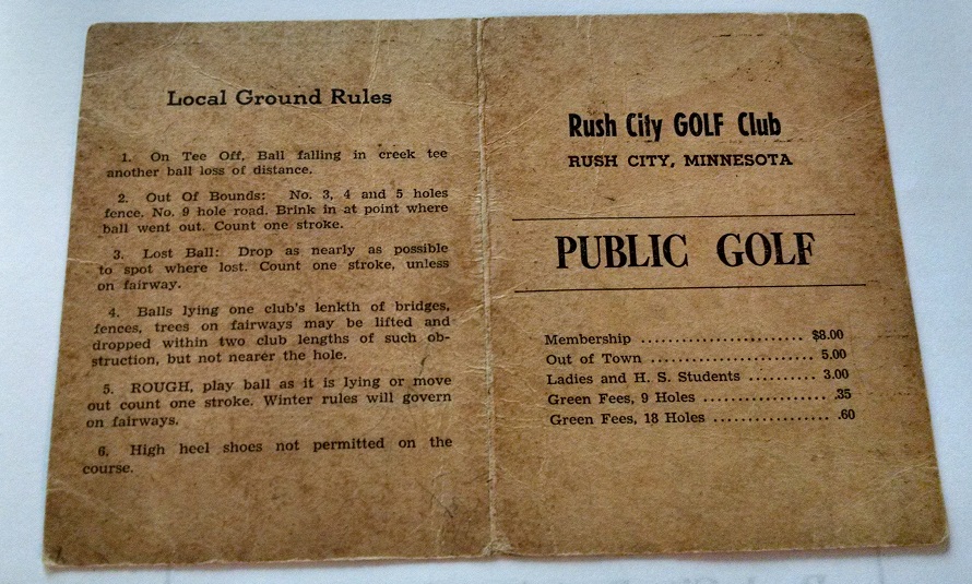
rush5rush6“The Rush City Golf Course was
developed in 1932-33 by Arthur ‘Art’ and William ‘Bill’ Johnson on the J.P. Johnson farm east of Rush City,” reads the first sentence in “Rush City Golf Course,” a
detailed, illustrated booklet
written by Art Johnson’s son Don — the same Don Johnson who was exploring the abandoned course with me.

“The design and construction of the golf course,” the booklet
continues, “was assisted by Pete  Carlson, who developed and
operated the golf course on Sand Lake near Moose Lake MN. The (Rush City) course was first opened for play in 1934.”

To be more specific, Rush City Country Club (or Golf Course, or Golf Club; it was referred to all three ways) was situated one mile east-northeast of
downtown Rush City, off Chisago County Highway 55. Across the road to the north in
modern times lies a soybean field and then the southern edge of the landing strip for Rush City Regional Airport. The golf course lay just south of the highway. Bisecting it during its playing days was Rush Creek, a serpentine stream that flows out of Rush Lake, west of Rush City and Interstate 35, and ultimately empties into the St. Croix River.

If anyone knows the lay of the land, Johnson does. He grew up on the property, slept and ate and studied in the abode that also served as the golf clubhouse. He played Rush City CC as a youth and helped the family manage the farm and golf course before graduating from Rush City High as the class salutatorian in 1945. He attended the University of
Minnesota and went on to work in the Twin Cities as a mechanical engineer for Honeywell.

Johnson, who is retired and now lives in Lindstrom, later developed an interest in his Chisago County and western Wisconsin roots, became a genealogy expert and history buff, and wrote the Rush City Golf Course booklet a decade ago. It is the definitive history of the lost course.

A few more passages:

“The golf course was first developed by tiling and draining land along Rush Creek, which was already beginning to dry up in the early 1930s. The course of Rush Creek was altered to fill and straighten one of the horseshoe bends. Three holes followed the course of the creek. As originally designed and built, the golf course was a par 36. The greens were oiled sand, as were most of the country courses at that time.

“Frequent stories in the Rush City Post tell of various golf tournaments being held, pitting the locals against teams from Braham, Cambridge and North Branch starting in 1934.”
(A round of 40, recorded by Huck Merriott in 1934, is the lowest score mentioned in the
handful of newspaper clippings and ads offered by Johnson.)

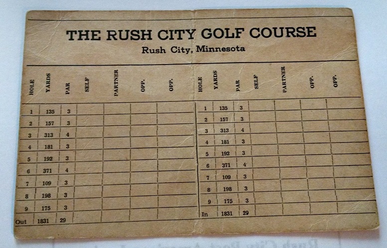
“… As the ground along Rush Creek became wetter near the end of the 1930s, the golf course had to be altered and shortened two different times until it became only a par 29. Thereafter, only two holes, #1 and #7, crossed the creek, and none played along Rush Creek.” (A scorecard from the redesigned and shorter version of the course lists only two holes longer than 300 yards.)

rushoverhead

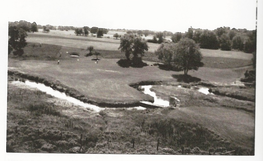
This image, scanned from Don Johnson’s “Rush City Golf Course” booklet, shows the first hole at Rush City Country Club, circa 1940. The hole was a 135-yard par 3, crossing Rush Creek. The sand green is visible to the left of two smaller trees toward the top-left of the photo. Johnson took the photo after climbing the windmill on the family farm.

” … During the winter of 1934-35 the clubhouse was remodeled and in the spring of 1935 was opened for dances several nights a week in addition to golf. … From 1935 until about 1943 Saturday night dances were held at the club house with beer, set-ups and
hamburgers being sold. A 5¢ slot machine was also operated in the club house but was
always moved out of sight into the ladies rest room when notification was received that the sheriff was coming for a visit.

” … The golf course continued to operate until about 1954, although never regaining the popularity and tournaments of the 1930s and early 1940s after the end of WWII.”

Johnson’s newspaper clippings featured ads: “Herman Sandquist and his orchestra will play at the club” … “Hamm’s and Glueck’s Beer on draught” … “Shot-gun Turkey Shoot … Use your own gun and ammunition.”

————

rush3

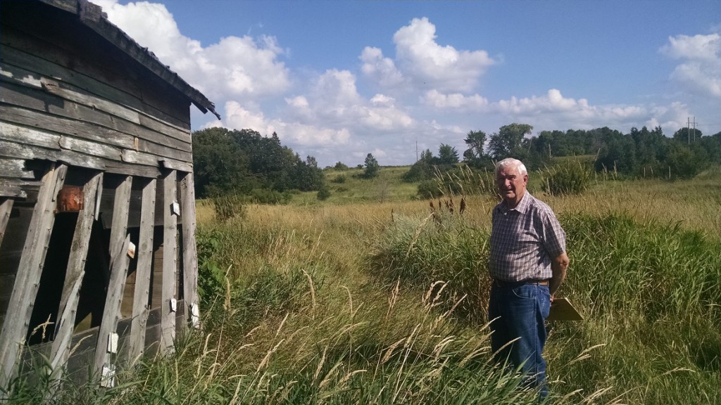
Johnson and I tromped into the field. We approached the only standing building in sight — although “standing” hardly seems the operative word. An old granary, tilted so badly you’d swear you could knock it over with a properly placed whisper, leaned out toward the golf grounds, standing sentry, as it did 75 years earlier, near the corner of what was a dogleg on the first hole of the course’s original design.

That opening hole would be replaced in Rush City CC’s later, wetter years by a par 3 of 135 yards that crossed Rush Creek. The hole today would be considered the antithesis of a proper golf hole — instead of a grass green with a sand bunker beyond, it had a sand green with a grass bunker beyond. (In the photo above, the former green site is visible at the clearing near the horizon.)

Old No. 1 was memorable for Johnson. “There was a kid, I was in first grade and he was in second grade,” Johnson told me a couple of weeks earlier in a phone conversation. “We played the first hole, and he beat me. He got the first hole in 12 shots, and I did it in 13.

“The thing is, we went on and went to school together and played sports together, and I never could beat him at anything.”

You could blame the equipment, Don, and no one would think the worse of you.

“I learned to play golf using the backside of my dad’s left-handed putter,” Johnson said.

Moving on, we came upon old concrete blocks 60rush1 yards south of the granary. They were part of the foundation of Johnson’s childhood home — in other words, the old Rush City CC
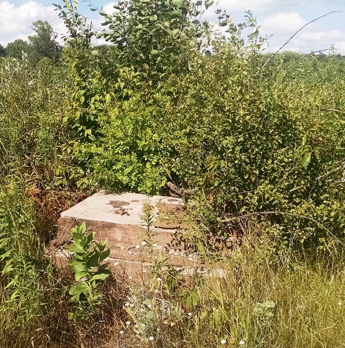
clubhouse. Nothing remains of the building except the
foundation and part of an exit on the building’s west side. A patch of day lilies planted by two of Johnson’s aunts in the mid-1930s still blooms alongside the foundation. The two-story house was burned down in about 1990, Johnson said, in
order to ensure a clear path for craft flying in and out of the
nearby airport.

Johnson explained that the bulk of the golf course once lay mostly to the east and south of this spot, part of it on low ground near the creek and more of it on higher ground across the creek.

Though Johnson is the pre-eminent authority on Rush City Country Club, then and now, Heinrich offered a couple of recollections as well.

“When I bought that land,” Heinrich said, “I found so many golf balls. I gave a 10-pound sack of them to some kid as payment for working for me.”

Also, he recalled, “I had this hired hand; he’d see golfers go out and chop at the grass. If we had boiled eggs for breakfast, he’d put them out there, and the golfers, they’d go out swinging away and looking for the balls — and they’d be eggshells.”

rush4

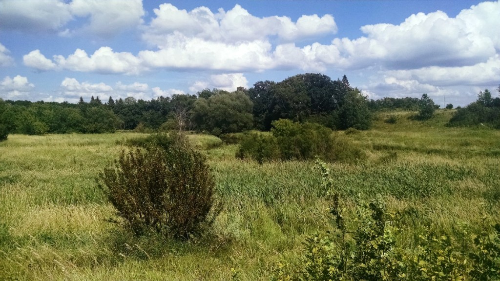
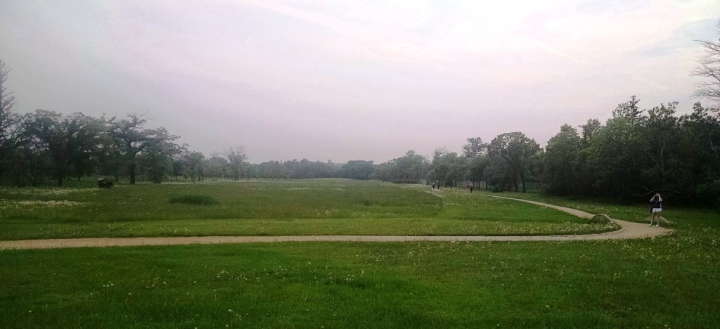
From a slight rise near the former first tee of Rush City CC, Rush Creek is visible below,
winding eastward. (No bears in sight.)

 Author’s note: What was I thinking? Finding every one of Minnesota’s lost golf courses has proved to be as implausible as winning the Grand Slam. I knew that would be the case when I started researching and writing about them in earnest three years ago, but still …

This is the first in a series of posts that catch up with lost golf courses I missed in “Fore! Gone.” Next up: Clearwater Country Club, Annandale.

Thanks for reading.

jb

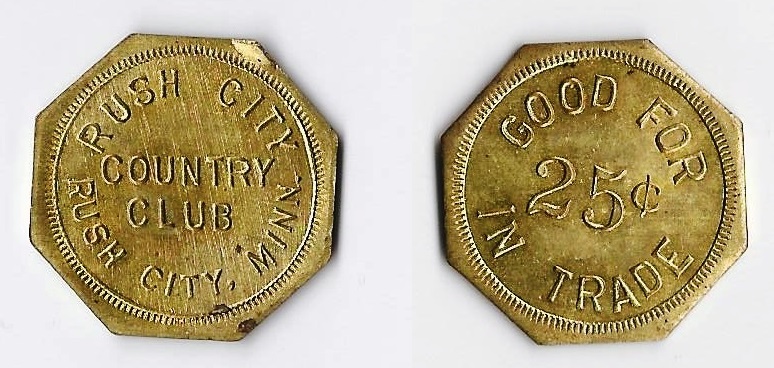
Author’s note II: The old Rush City Country Club token pictured at the top of this post was generously given to me by Don Johnson. Much appreciated, sir.
Lost, north of the border

southwood1

Four-hundred forty-six miles from home — in another country, in fact — and I stumble upon a lost golf course. Seriously, I almost literally stumble across it.

You know what they say about truth, fiction and strangeness …

Taking a break from my casual pursuit of more Minnesota lost golf courses, I was transported last week along I-94, I-29 and then Manitoba 75 — across Minnesota, up the topographical flat-top haircut otherwise known as northwestern North Dakota and into the land of bilingual road signs otherwise known as Canada. (“What the hell does ARRÊT mean? Damned if I know; I’ll just keep driving.”)

No, I’m not planning to write a book about the lost golf courses of Canada. How much time do you think I have on my hands?

But Canada — more specifically, Winnipeg — had been beckoning for the better part of a year, since the day the Women’s World Cup schedule was finalized. Yes, I have turned into a soccer geek, a transformation for which I will not apologize, and my daughter and I were not about to miss a once-in-a-lifetime opportunity to watch the U.S. Women’s National Team open its quest for a world championship.

I will spare everyone the gory details of whether the U.S. can escape unscathed from the Group of Death or whether right back Ali Krieger is fit to cut off the Swedes, much less the speedy Nigerians, from gaining the corner on the American defense. You don’t want to know about that, right? RIGHT?

OK, then, I’ll focus on golf.

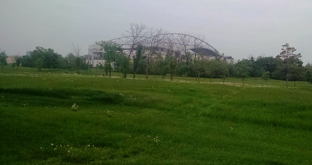
Anyway, shortly after arriving in the World Cup host city, we had been told by a Winnipegger of a way to park free and take a short walk to Investors Group Field, the sparkling new home of the Winnipeg Blue Bombers football team (Minnesota connection: Bud Grant coached the Blue Bombers from 1957-66 and led them to four Grey Cup titles). Just north of the stadium was a large area of green space, posted as property of the University of Manitoba. We skirted the green space on the walk to the stadium, and then, after the Americans’ rousing (adjective courtesy of biased U.S. fan) 3-1 victory over Australia, we decided to take a shortcut through more of the green space on the walk back to our parking lot.

southwood2

Walking on a gravel path and emerging from a line of trees, I looked a few feet to the right and noticed a small area, maybe 100 by 200 feet, that was slightly elevated. Turning to the left, a large field opened before us, the grass and weeds having grown about a foot high. The field was framed by a thin line of trees on the left and another line of trees on the right.

“Whoa,” I said. “That looks like an old golf course.”

I seriously did not want to say that. The experience of having visited almost 30 lost-course sites in Minnesota taught me to be skeptical. Many of the Minnesota sites I have walked upon look like golf courses but in fact are just open space or farmland or woodland — not lost golf courses.

But even my daughter, who had been on lost-courses forays with me, allowed that, yes, this piece of Canadian sod did indeed look like an old golf course. There were other pathways through the grounds, some of them featuring small, arched, concrete bridges. I pointed out that, about 350 yards or so up what looked like the fairway, there was a patch of different-colored grass, browner than the rest. It reminded me of the site of the lost Whitewater Valley Golf Course in southeastern Minnesota, where the old greensites feature non-native grasses that, when grown over after the course closed, look distinctly different from the rest of the grass.

Tee box. Fairway. Rough. Treelines. Cart paths. Green.

“That REALLY looks like an old golf course,” I said, and my daughter could not disagree.

We walked a bit further and struck up a conversation with a Kenyan family that had relocated in Winnipeg a year and a half earlier. (“How do you like Winnipeg?” I asked. “TOO COLD!” the father replied emphatically.) We talked about the soccer game and other things, and then I decided to risk making a fool of myself, though that isn’t something — and you can ask my daughter this — I hadn’t done a thousand times before.

“Do you know whether there was a golf course here?”

“Yes, there was,” the man said.

Aha! My eyes hadn’t betrayed me. It was a lost golf course. Seems I can’t escape them even if I want to.

Back in the States, I learned more about my “discovery.”

This was not just any lost course. The tract of land north of Investors Group Field, now owned by the University of Manitoba, was the longtime home of Southwood Golf & Country Club, a significant and historic Canadian golf club.

From what I can gather, and without being willing to sacrifice the entirety of my remaining vacation trying to sort out overlapping and sometimes-contradictory information on the Interweb, here are a few tidbits about Southwood, its predecessors and its present state:

— The club dates to 1894, which makes it practically prehistoric in North American golf terms. Its original incarnation was known as either Norwood Golf Club or, according to the website Golf Manitoba, “the Winnipeg Golf Club with a nine hole golf course located in Norwood.” As far as I can tell, Norwood is a neighborhood in Winnipeg, perhaps a mile or two north of the original Southwood grounds.

— “A few years later, in the early 1900’s,” notes the Southwood Golf & Country Club website, “the Winnipeg Hunt Club was established. … With the demise of the hunt, in 1918, seven golf holes were built and the Club became known as the Winnipeg Hunt Golf Club. The popularity of golf was quickly taking hold in Manitoba and in 1919, an amalgamation was proposed between the committees of the Norwood Golf Club and the Winnipeg Hunt Golf Club.

“Additional land was acquired from the Agricultural College (site of the University of Manitoba) and the proposal was made and accepted to form the Southwood Golf Club in 1919.”

— Norwood/Winnipeg GC, then nine holes, was Winnipeg’s first golf course, according to Golf Manitoba. And, notes the Southwood website, “As a descendant of the Winnipeg Golf Club (a.k.a. Norwood Golf Club), established in 1894, the Royal Canadian Golf Association recognizes Southwood as the oldest 18-hole golf course in Manitoba.”

— Talk about architectural chops; Southwood has them. “The original course,” reads Southwood’s website, “was designed by Willlie Park, Junior from Musselburgh, Scotland, winner of the British Open in 1887 and 1889. The course was re-designed in later years by Stanley Thompson and was the acclaimed architect’s first 18-hole design in Canada.” (More Minnesota connections: Park routed Minneapolis Golf Club in St. Louis Park in late fall 1916; Thompson designed North Oaks Golf Club in 1950-51.)

— In 2008, the University of Manitoba purchased “the Southwood Golf Course,” according to a university web page, “and acquired the lands in November of 2011.” Since then, as is typical with Minnesota lost courses, Winnipeggers have engaged in a vigorous public debate over the ultimate fate of the Southwood grounds. The university would like to develop much of the 120-acre site as mixed-use housing and retail.

— Though the Southwood plot qualifies as a lost course, Southwood Golf & Country Club is not dead. The club moved to a site five miles (‘scuse me — 8 kilometers in Canadaspeak) south and reopened in 2011. From the club’s website: “Poised graciously alongside the meandering LaSalle River and Trappist Monastery Provincial Heritage Park, the 18-hole course was designed by renowned Canadian Architect Thomas McBroom to the highest standards. The spectacular natural and historic surroundings provide a perfect setting. Tree groves, river valley and historic ruins have been left largely untouched, while natural contours of the land are maximized to create distinct landmarks, shadows, hills and ridges. An additional 9 holes are planned for the future.”

— Southwood hosted the Manitoba Open 11 times. Among past champions of the tournament are two-time PGA Tour winner Dave Barr and — two more Minnesota connections — Ev Stuart of Duluth in 1956 and Dayton Olson of Minneapolis in 1963.

So, that’s the story of the “newest” lost golf course I have visited. Now, would you like me to tell you about impending new developments in Winnipeg, i.e. why Team USA will thrash Sweden 4-1 on Friday in its second group game?

Didn’t think so.

southwood3

Lost golf courses, on the air: Talking with a Twin

On the morning of May 2, I had the pleasure of talking about lost golf courses and “Fore! Gone.” on KTWN-FM, better known as Go 96.3, also known as the Minnesota Twins flagship radio station. Rod Simons, host of a Sunday morning sports show on KTWN, kindly invited me to talk about lost golf courses and my book with him and former Minnesota Twins catcher Tim Laudner, who not so coincidentally happens to be a low single-digit handicap golfer who knows a fair share about the history of the game in the state.
Click on the arrow below to listen in:

Westwood-C-small
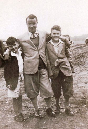
We talked about Westwood Hills in St. Louis Park, where Sam Snead Gene Sarazen visited with a couple of McNulty boys, sons of the club’s owner and manager (photo courtesy Jim McNulty) …
???????????????????????????????
… and we talked about Joyner’s in Brooklyn Park, the course Laudner grew up on. This is part of all that’s left of Joyner’s.

Heron Lake: Lost course, found scorecard

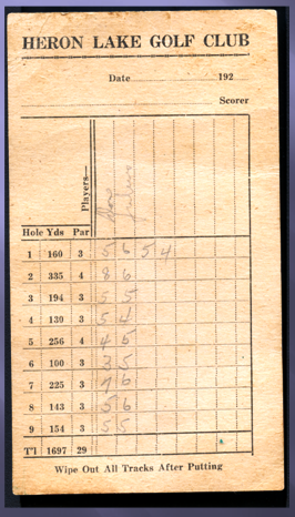
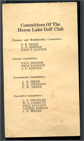
Check out the old-time golf scorecard …

heronlake heronlake2

The card is from Heron Lake Golf Club, a lost golf course in Heron Lake, a small town in Jackson County, southwestern Minnesota. The club was organized in July 1925, with the course presumably opened at that time or shortly after. The golf course, on the north side of town and occupying land that includes the current Laker Field baseball park, survived until at least 1934.

In a sense, there is nothing spectacular about the scorecard nor what it reveals. Heron Lake Golf Club likely was a typical small-town Minnesota course of the 1920s and ’30s: nine holes, par 29, total of 1,697 yards, with seven par-3s and two par-4s. The longest hole was the 335-yard second, the shortest the 130-yard fourth. The course had sand greens, also typical of small-town Minnesota courses of that era.

But if the scorecard isn’t spectacular, it is at the least old. And for area residents, some of the names of the committee members listed on the card most likely will resonate. The first person on the list, H.B. Triem, designed the golf course, as well as a now-defunct course in Lakefield that opened the next year.

The image was passed along by Michael Kirchmeier, director of the Jackson County Historical Society in Lakefield. Mike was a great help to me in researching southwestern Minnesota courses, 10 of which are covered in Chapter 42 of “Fore! Gone.”, titled “Silos and Flagsticks.” You can find out more about some of these courses by visiting the historical society (or, of course, reading the book).

Anyone interested in reproducing the image should please contact Kirchmeier first.

Bryn Mawr Golf Club: location, location, location

BrynMawr-A-small

When it comes to ponderous reads, nothing in “Fore! Gone.” rivals Chapter 29, titled “Minneapolis Mystery.” (Hey, I didn’t say the whole book was a dull read. There are 43 other chapters, and at least three or four of them contain a witticism.)

Anyway, I recently found out Chapter 29 needn’t have read like something out of “The Noun Phrase in Ancient Greek: A Functional Analysis of the Order and Articulation of NP Constituent in Herodotus.” (Apparently, there  really is such a book.)

“Minneapolis Mystery” was my seven-page attempt at pinning down the former location of the lost Bryn Mawr Golf Club, a long-gone but historically significant golf course that was founded in 1898 and, after its two incarnations shut down, spawned Minikahda Golf Club and then Interlachen Country Club. Though others had written about Bryn Mawr, most of the references to the golf course’s precise location were vague at best.

So, figuring people might like to know exactly where Bryn Mawr GC was, I launched a labyrinthine expedition in print, citing addresses, property records, plat maps, blog entries, elevation charts and newspaper clips — pretty much everything but ancient sundial readings — in an attempt to disclose, within a city block or two, where the old golf-course grounds lay.

My reasonably educated guess read thusly: “… the Bryn Mawr course started near the Oliver Avenue clubhouse, briefly crossed Cedar Lake Road, then swept up the hill to the southwest, across Penn Avenue, to the hilltop, and played back toward the clubhouse in the area now occupied by Mount View Avenue.”

brynmawrlaurel-small

So stood the printed word, for almost a year.

And then, along came Joe Gladke.

Gladke is one of Minnesota’s most well-informed golf history buffs. He has spent many hours researching the history of the game in the state and has scads (yeah, scads. It isn’t a quantifiably precise term, but scads are scads, OK?) of newspaper clippings and other documentation at his behest.

An email I had sent to some Minnesota golf history buffs on a subject  marginally Bryn Mawr-related made its way to Gladke, and he responded with an email attachment and message that featured the phrase, “Have you seen this map before?”

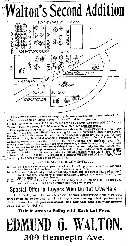
Well, ahem, no, I hadn’t. I opened the attachment and took a look. Voila. Gladke unraveled the Bryn Mawr mystery with a one-minute deployment of his scanner and a half-dozen mouse clicks. Here it is: a clip from the Minneapolis Tribune of Feb. 19, 1899, showing the exact location of what was Bryn Mawr Golf Club. Props to Joe Gladke.

brynmawrupright-page-001

To add a bit of perspective, those of you who know the Bryn Mawr neighborhood might be familiar with the Cuppa Java coffee shop at the corner of Cedar Lake Road and Penn Avenue and the handful of business nearby.  Those business are all on or very near the area of the map above marked by the word “Bryn” in the “Bryn Mawr Golf Club” label.

There you have it. From a personal standpoint, the map has evoked equal parts sheepishness and satisfaction. Sheepishness that, with all the hours I spent searching online and otherwise, and using what I thought was every conceivable permutation in those searches, I never came across this map, which really shouldn’t have been hard to find. Satisfaction in the map’s verification of the old Bryn Mawr Golf Club grounds.  To borrow from a phrase once used postgame by Denny Green, “The Bryn Mawr course is where I thought it was!

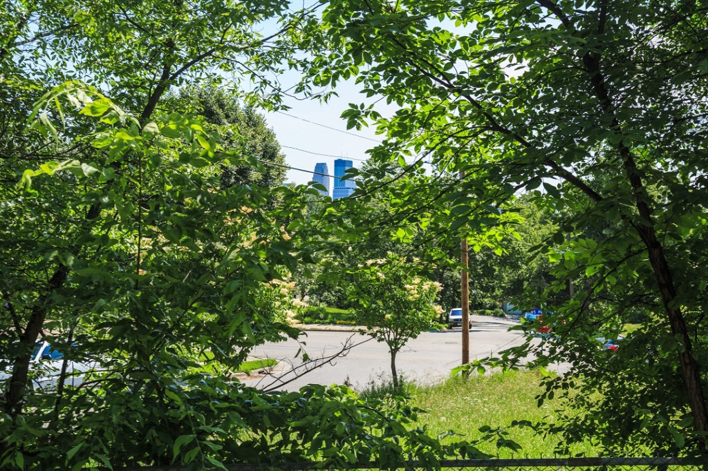
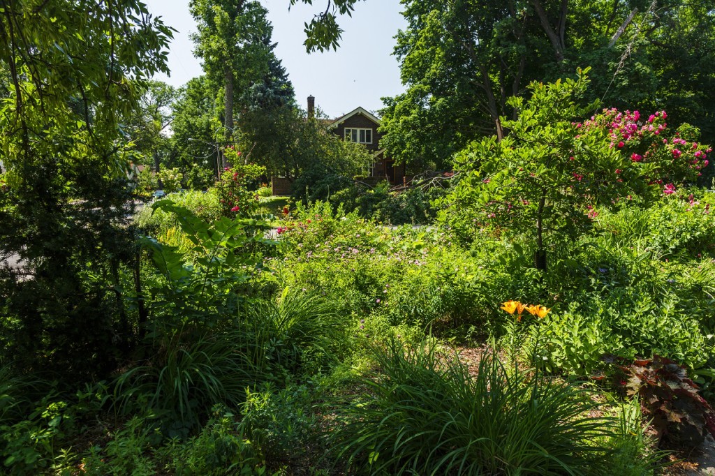
(About the photos in this post: both were taken by the preternaturally talented Peter Wong. The top photo was taken from near the intersection of Mount View Avenue and Penn Avenue, almost certainly on the grounds of the old Bryn Mawr course and looking eastward toward downtown Minneapolis. The bottom photo shows the Laurel Triangle, a small triangle of flowers and foliage at the intersection of Laurel and Oliver avenues and Cedar Lake Road, very close to the location of the second Bryn Mawr GC clubhouse on Oliver Avenue. If you have an interest in remarkable golf-course photos, I encourage you to make a visit to the photographer’s website, PeterWongPhotography.com. Happy Thanksgiving.)