Elk River Golf Club, Part II: This-a-way? Or that-a-way?

Here it is, in black and white:


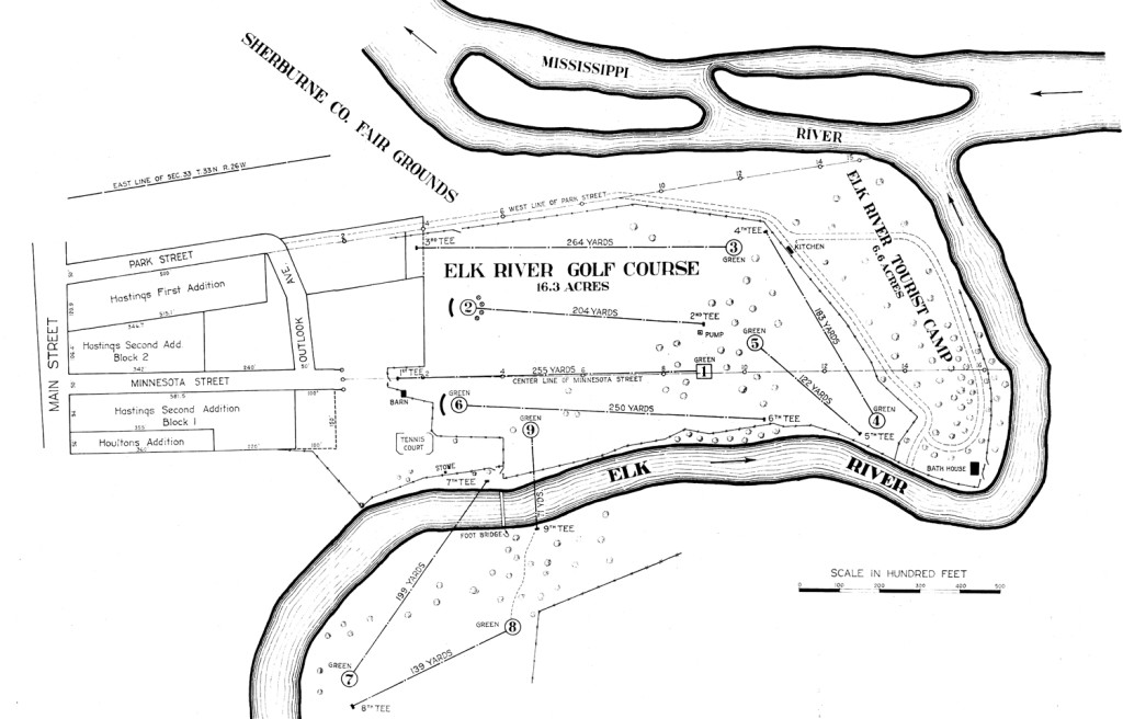
Map of the grounds of Elk River Golf Club and Bailey's Point. Imagine it rotated 90 degrees clockwise to make it geographically correct. South is to the right, west at the bottom, etc. (Courtesy of City of Elk River and Joni Astrup, Elk River Star News)

What is it? Map of a golf course, now abandoned. The map is neatly and professionally produced, holes ordered and marked with yardage annotated, nearby streets and grounds designated, finely detailed right down to the word “pump” at midcourse.

Who would argue with it?

Sorry. I feel like arguing.

This map of “Elk River Golf Course” — every other reference I’ve seen to the place, which operated in southeastern Sherburne County from 1924-42, is to Elk River Golf Club, but that’s not what I’m here to argue about — has been in reasonably common circulation in and around town, for those who are interested in such a thing. It appears 100 percent, surefire, incontrovertibly credible.

Appears.

In my previous post on Elk River Golf Club, I published a scan of the map. That post also includes a prominent asterisk (if you saw the post and missed the asterisk, someone must have poked your eyes out when you got to that paragraph). Well, as I composed that post, I was all set to hit the “publish” button, sans asterisk, when I decided to phone a longtime Elk River resident just to verify the source of an old ERGC photograph.

Charlie Brown answered his phone, and opened up one big, slippery can of worms.

Thanks, Charlie.

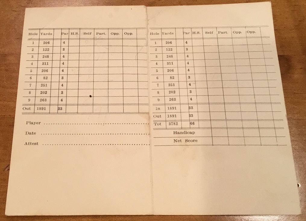
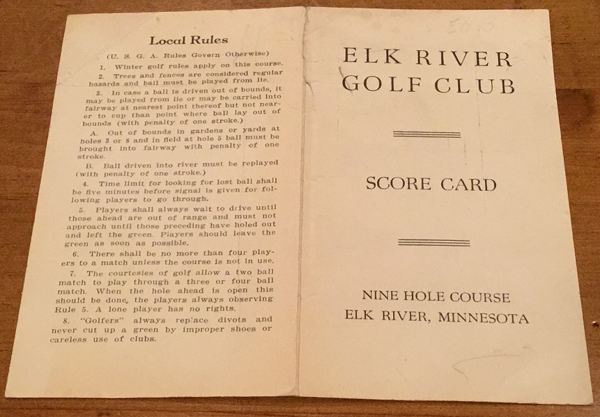
Brown, who lives less than a hundred yards from the old Elk River Golf Club site, on what is now Bailey Point Nature Preserve, near the confluence of the Mississippi and Elk rivers, not only confirmed the source of the photos, he passed along an old scorecard from the golf course:

ElkRiverCard1

ElkRiverCard2

Cool. I loved it. I always enjoy publishing tangible evidence of lost golf courses, such as old scorecards. This one looked to me to be from the 1920s or ’30s, strictly guessing.

Then I looked closer at the scorecard. And the map. And then the scorecard again. And the map. Repeat, a few dozen times, scratching head.

The map and the scorecard were mismatched.

On the map, hole No. 1 was 255 yards. On the scorecard, it was 206 yards. No. 2 on the map was 204 yards, On the scorecard, 122. No. 3 map, 250. Scorecard, 248. (OK, that was close.) No. 4 map, 183. Scorecard, 311. The mismatches continued through all nine holes, map and scorecard. Many of the yardages were highly similar, and one was identical — the 122 yards of the fifth hole on the map matched the 122 yards of the second hole of the scorecard — but still, there also were significant variations.

An explanation seemed simple and logical — and no, it had nothing to do with possible seismic shifting in southern Sherburne County 80 years ago having moved the earth here and there and everywhere. At some point, the folks running Elk River Golf Club must have re-routed the course, changing the order in which the holes were played, perhaps re-measuring yardages. It wasn’t, and isn’t, an uncommon practice in golf-course design.

Wait just a minute, Gerardus Mercator. (He was a famous mapmaker. I had to look it up, but now you know something about cartography.) Explaining away the difference between Elk River Golf Club, map version, and ERGC, scorecard version, was easy enough if you just say “It was re-routed,” but much more complicated upon looking closely.

After comparing yardages this way and that, looking at the routing on the map, and trying to imagine possible re-routings, I ran my thoughts past Brown. He agreed that a re-routing, or at least a remeasuring or changing of a couple of holes, was almost certain. We traded at least a dozen emails on possibilities, and then I ran our thoughts past the person who knew more about the property than anyone — Elk River resident Steve Shoemaker, who had had his boots on the ground there for more than a year, using a metal detector to dig up cups from the sand greens that remained buried on the property more than 70 years after the golf course had closed.

I felt sheepish about it, because Shoemaker’s discovery had been so remarkable, and he had identified each cup he dug up based on the map, and I felt a bit like I was throwing cold water upon everything. But I wanted to be historically accurate, and thankfully, Shoemaker bought in. I traded a few dozen more messages with both Brown and Shoemaker, and we came to form this consensus:

That map of Elk River Golf Club depicted a course routing that almost certainly never was used.

Without going into minute detail about how we reached this conclusion, the short story is that we believe that the scorecard represented the actual routing and sequence of holes from the course’s inception as a nine-hole layout in 1926 through most of the course’s life span, except for periods in which three holes lying mostly across the Elk River were shut down and the course was a six-holer. And we believe that the map probably was drawn up very late during Elk River Golf Club’s existence, probably within a year either side of 1940, as the club dealt with financial difficulties and consistent flooding on the grounds.

And we believe that the map most likely was just a proposal of a re-routing that never came to be.

For what it’s worth, it’s almost certain that the golf course didn’t start at the north end of the grounds, as shown on the map, but rather near the southeast corner, near the end of a road that ran to the former Elk River Tourist Camp. The routing, in general terms, then took golfers west and then north, then across the Elk River for three holes, including an 82-yard par 3 that crossed the river, concluding with three long-ish holes on the north, central and eastern parts of Bailey’s Point.
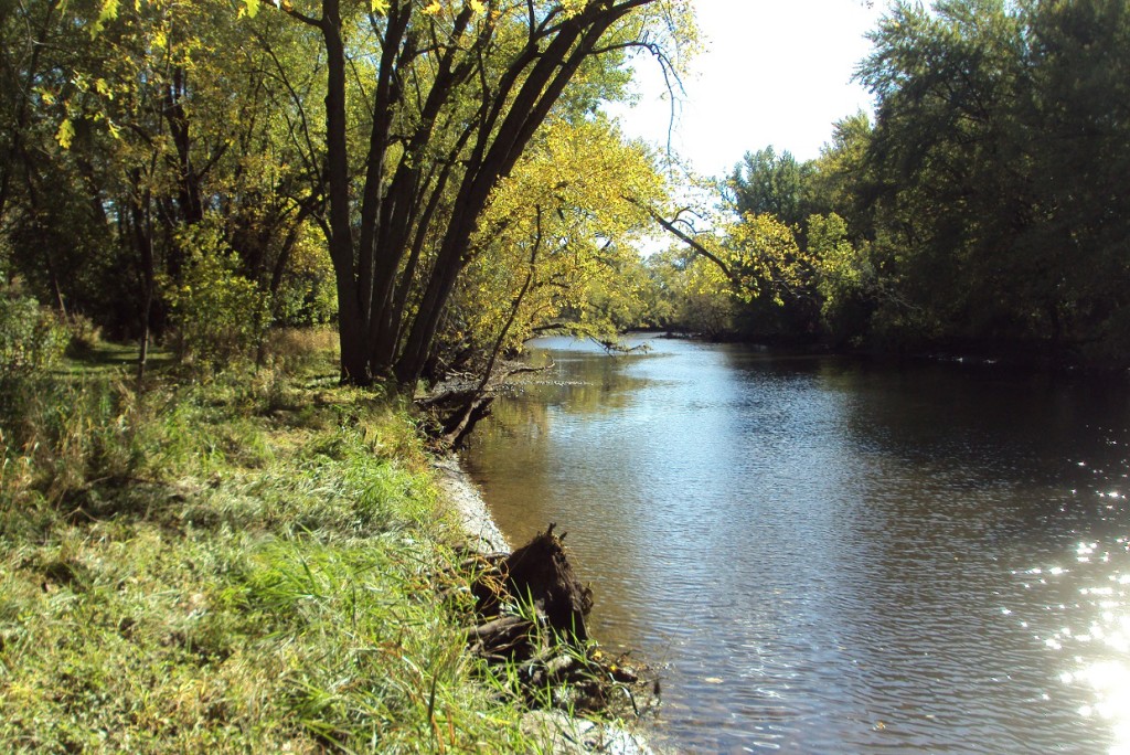
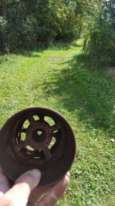
Current photo of the edge of what was the fourth hole on Elk River Golf Club, which ran parallel to the Elk River.
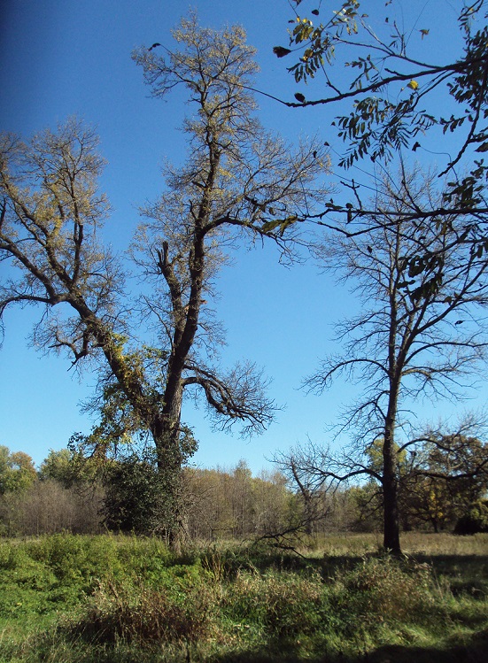
Near the old third and seventh holes at ERGC, now part of Bailey Point Nature Preserve.

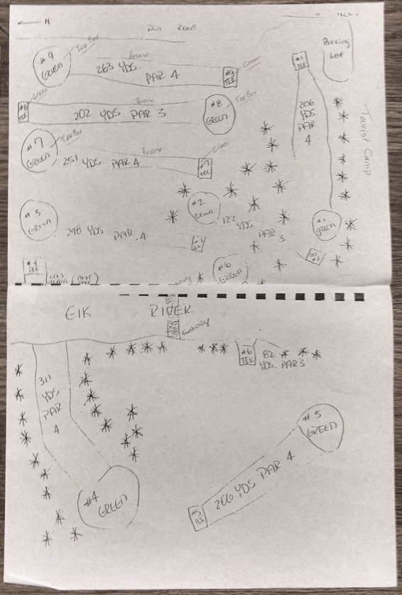
After Brown, Shoemaker and I traded dozens of suspicions on the routing, Brown then came up with a document all but confirming that the “scorecard” routing was indeed used at least at some point. Brown passed along a second map, hand-drawn and shown below, that he had received via Elk River’s Tod Roskaft (click on it for a closer look).

ergcmap-drawn

Maybe this was just a long, convoluted exercise in picking at nits, but it did have at least one concrete (or more accurately, metal) benefit: Through the old aerial photos of the grounds and the hand-drawn map, Shoemaker altered his search for the cup from hole No. 4 (labeled hole No. 7 on the more formal map), taking into account that the yardage on the scorecard, 311 yards, was significantly greater than the yardage on the formal map, 199 yards, probably representative of plans the club made, but probably never implemented, in about 1940 to shorten the hole from a par 4 to a par 3. Shoemaker extended his search deeper into what are now relatively thick woods, and voila:
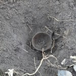
ergc4thcupThat’s the old fourth cup from Elk River Golf Club, discovered in early November by Shoemaker on the portion of the old golf-club grounds that lay west of the Elk River. It had been a challenge for Shoemaker to find the cup, but the notion that the layout corresponded with the scorecard/hand-drawn map and not with the formal map set him on the correct path. He now is missing only two of the nine cups from ERGC, and assuming they still are out there and buried beneath, I have little doubt he’ll turn them up in time.

Efforts to find someone still living who might remember the routing of Elk River Golf Club have, sadly been fruitless to this point. Anyone who fits the description would almost certainly be in their 90s. If you know of anyone who knows and would like to talk about it, I’d love to pursue.

Also for what it’s worth, the quest to determine whether the ERGC layout ever corresponded with the formal map required some digging — not the kind Shoemaker does — into whens and wheres of the golf club’s history, which evolved into the following timeline:

ELK RIVER GOLF CLUB TIMELINE

Sources in parentheses

1924: Golf course founded on Bailey point (Brook Sullivan booklet), presumably with six holes. Improvements were underway at the adjacent Elk River Tourist Camp, south of the golf course at the confluence of the Elk and Mississippi rivers (Charlie Brown).

1925: Alternate opening year of six-hole course, as implied in 1926 Sherburne County Star News story.

1926: Course expanded to nine holes (Star News), with three additional holes wholly or partially across the Elk River to the west, on a plot known as the Houlton farm.

1927: Course apparently had reverted to its original layout, as Robert Hastings and Joe Flaherty tied for low score of 26 in the Fourth of July picnic event “for the six hole course” (Star News).

1928: “The local club now numbers about 25 members.” (Star News)

1938: Heavy rains in late March May caused severe flooding along the rivers, raising them to their highest levels in 23 years (Brown; Elk River library). Footbridge leading to the ERGC grounds “across the river” was washed out. A June 9 story in the Star News notes the washed-out footbridge and flooded course. The fourth, fifth and sixth holes, lying wholly or partially across the Elk River, were not in play during 1938 (Brown).

1939: “A  lengthy  discussion regarding the cost of repairing the bridge and getting the holes on the other side of the river in shape.” (Minutes from ERGC meeting, via Brown, via Tod Roskaft)

1942: Course reverts to its six-hole routing, as club decides to take the grounds across the Elk River out of operation (Star News).

1943: Golf grounds “completely flooded” (Star News, April 8.) Also flooded was the “Wilson tourist camp,” as labeled by the Star News, which by then had been closed for nearly two years.

1943 and beyond: No further mention of Elk River Golf Club is found in searching through various years of Star News archives, into the 1950s.

1960: A new Elk River Golf Club is established in the northwestern part of the city. It continues to operate today.

Note: Charlie Brown entries based on research he conducted at Elk River’s Great River Regional Library.
Elk River Golf Club, 1924-42: Can you dig it?

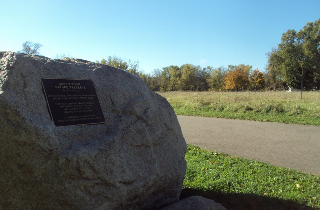
At the trailhead of Bailey Point Nature Preserve in Elk River, site of the former Elk River Golf Club.

Now, for something entirely different: A lost-and-found golf course.

Lost: In the first half of the 20th century, Elk River Golf Club lay on a peninsula near the confluence of the Mississippi and Elk rivers, a few blocks southwest of downtown in the central Minnesota city of Elk River. The club hosted golfers for just short of two decades before being abandoned.

“NINE HOLE GOLF COURSE LAID OUT,” read a front-page headline in the April 29, 1926, Sherburne County Star News, published in Elk River. The accompanying story explained that the course was to be expanded beyond the six-hole “practice” layout set out the year before “on the Hastings flat, south of L.D. Bailey’s residence,” and that in the eyes of the course architect, “it will be a fascinating one from the view of the golf enthusiast.” (Another source, which will be cited in a subsequent post, set the opening date of the course, as a six-hole layout, as 1924.)

“Beginning with 1930,” reads an entry in a booklet written by Brook Sullivan and held at the Great River Regional Library in Elk River, “the Elk River Golf Club had a very busy schedule hosting many tournaments and other social events.” After the annual Fourth of July tournament, Sullivan wrote, “A Bridge tournament was held for the ladies at two p.m. and so were other atheletic (sic) events such as tennis, croquet, relay racing, and archery.”

In 1932, Sullivan wrote, 16-year-old Elk River golfing prodigy Richard Longfellow won the club’s Championship Cup, by a 4-and-3 decision. In 1935, the annual family membership fee was $15.

Pinning down a date of the course’s demise is more problematic. Most of the evidence points toward the likelihood that Elk River Golf Club lasted into the early 1940s.

Drawing on the conjecture of one longtime Elk River golf expert who thought that the course might have been abandoned in 1942, I went to the Minnesota History Center, loaded up the 1942 reel of the Sherburne County Star News on microfilm, and found this in the April 23 issue:

“(A meeting will be held) next Wednesday to determine whether or not it will be possible to maintain the local course this year.” Two weeks later, the newspaper reported that the club had agreed to operate as a six-hole course, taking out of operation the two holes that lay across a footbridge over the Elk River, west of an area known as Bailey’s Point.

At least two people I talked with indicated that Elk River Golf Club probably faded away shortly after that. That theory is supported by an April 1943 newspaper report that the golf grounds had been “completely flooded,” along with the adjacent tourist camp, and the fact that in perusing Star News editions from 1944 through 1946, as well as in the early 1950s, no further mention of local golf was found.

Found: ERGC is being rediscovered, quite literally.

On Sept. 30, I received a Facebook message from Elk River resident Steve Shoemaker. He was familiar (and how) with Bailey’s Point and told me about the lost golf course.

“There were 7 holes on the main side of the Elk River, and 2 holes on the other side that were accessed by a pedestrian bridge,” Shoemaker wrote. “I have a couple of old pictures showing people playing the course.”

Followed by the kicker: “I have recovered 5 of the cups (hole #8 just yesterday).”

Gold. Shoemaker’s discovery was gold to me. As of that date, I had identified 133 lost golf courses in Minnesota, had visited 34 sites of courses abandoned before the year 2000, and the only recognizable remnants I knew of were one old green site (Westwood Hills, St. Louis Park), two old tee boxes (Matoska, Gem Lake; Riverside, Duluth) and two or three remaining features from the abandoned construction of the never-opened Royalhaven course in Hugo. A few people had told me about old golf balls they had discovered on lost-course sites, and a farmer in Tracy had dug up one cup in his corn-and-soybean fields. But more than half the cups from a lost course’s greens? Shoemaker’s discovery was stunning.

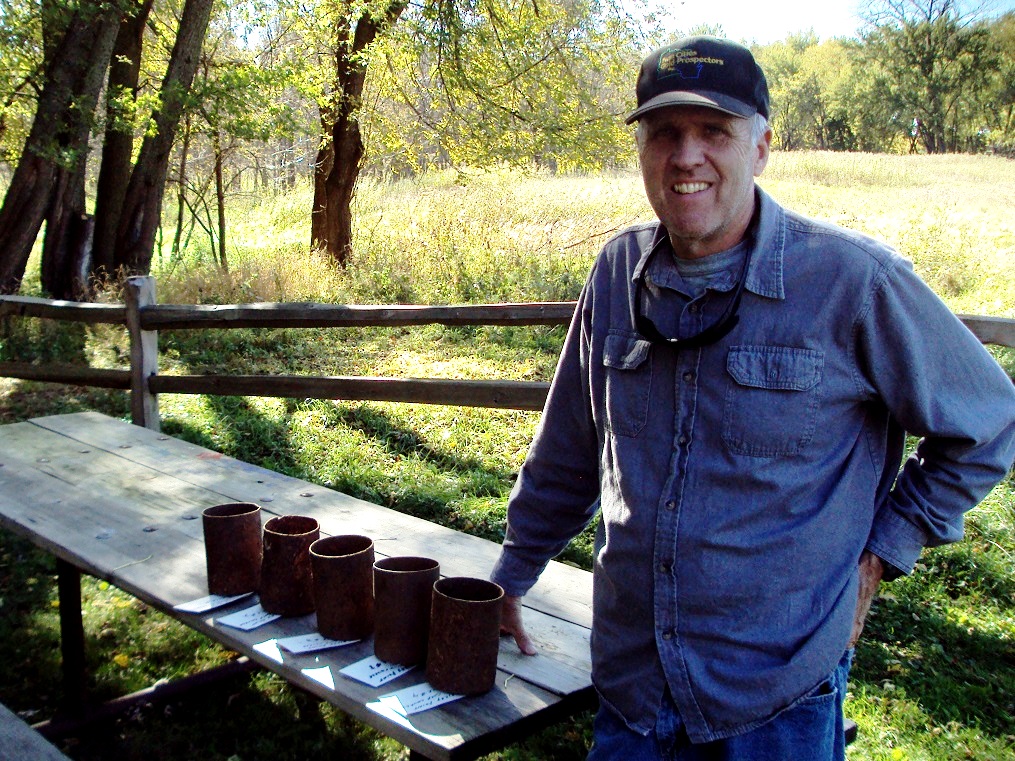
Steve Shoemaker of Elk River displays five of the cups he has unearthed from the grounds of the old Elk River Golf Club site, now part of Bailey Point Nature Preserve.

Speaking of gold … Shoemaker, it turns out, is a distinctive individual. Retired from the U.S. Army after 40 years’ service, 10 as a military policeman and 30 as a helicopter pilot, his current avocation is treasure-seeking. He is a member of numerous gold-prospecting organizations, including the Gold Prospectors Association of America, and keeps his precious-metal-hunting feet wet by exploring lake and river beds, including the Elk and the Mississippi.

With the aid of a powerful metal detector, Shoemaker has harvested gold nuggets from Arizona and Alaska. He has dug up early-1900s Barber and Indian Head coins from the grounds of the former Elk River Tourist Camp, on the southernmost portion of Bailey’s Point. At Sackets Harbor, on Lake Ontario in upstate New York, the site of a noted battle in the War of 1812, he found spent musket balls. They had been discharged by U.S. forces firing upon British soldiers trying to advance upon them while they waded through water. Shoemaker noted that some of the musket balls were damaged, which he said could have happened only by having struck British troops.

Enough history. Enough numismatics. Back to the lost golf course.

Shoemaker and I met in early September at Bailey Point Nature Preserve. He had agreed to show me the lay of the land. As a reference point, he was using an old map of the golf-course layout, showing locations of nine greens plus nearby landmarks: streets, the tourist camp, the old Sherburne County Fairgrounds to the northeast of the course and a former tennis court near the course’s northern border. We walked the general route of the seven Bailey’s Point holes, and Shoemaker paused near the old sixth tee, as designated on the map, to relate how two dogs, according to what he had been told, were buried nearby. (Besides that, there was only other known dogleg on the course — the first hole that crossed the Elk River.)

One day in 2015, while Shoemaker searched for collectibles on Bailey’s Point, his metal detector alerted him. Shoemaker dug down a few inches and hit a chunk of metal.

“I thought, ‘What the hell is this thing?’ ” Shoemaker said. “At first, I thought it might be from an old oil filter or something. Then I stopped and realized, ‘I know what it is.’ ”

Shoemaker remembered that he was on the site of an old golf course, and as he excavated, he realized his find was a cup from the old Elk River Golf Club. That spawned a quest to find cups from all nine of the old holes. As of our first meeting, he had unearthed cups from, by his evaluation, Nos. 1, 2, 3, 6 and 8.

Map of the grounds of Elk River Golf Club and Bailey's Point. Imagine it rotated 90 degrees clockwise to make it geographically correct. South is to the right, west at the bottom, etc. (Courtesy of City of Elk River and Joni Astrup, Elk River Star News)
Map of the grounds of Elk River Golf Club and Bailey’s Point*. It may be best visualized rotated 90 degrees clockwise to make it geographically correct, with the Elk River Tourist Camp to the south. (Courtesy of City of Elk River and Joni Astrup, Elk River Star News)

*Largest asterisk I can find

(Next post will explain the asterisk. Yes, that’s a tease to get you to go to the next post, which should be up in a day or two.)

Shoemaker contacted me again on Oct. 7, writing, “Hole #4 found ! Searching all over for it where it should have been. Found it laying next to a large tree. I think i may have found it a couple of years ago, but just thought it was a big chunk of iron, and laid it next to this big tree so it would be out of the way !!!”

Courtesy of Steve Shoemaker

Shoemaker has since dug up one more cup, improving his treasure trove — you might not view it that way, but I do — of iron chunks to seven. If and when he wraps up his quest, he indicated that he might donate the cups for historical preservation.

(Closing note to self: Do not attempt, Shoemaker-style, to retrieve any old cups from the site of, say, Rich Acres Golf Course in Richfield, now the site of Runway 17/35 at Minneapolis -St. Paul International Airport. Would be dangerous and frowned upon by the Federal Aviation Administration.)

ERGC bits and pieces — The lost golf course, from what I could gather, has little or no connection to the current Elk River Golf Club, established in 1960 northwest of downtown.

— A longtime Elk River resident, 87-year-old Ron Ebner, whose family has owned and operated a bait shop since 1949, said he didn’t remember the golf course. But he did remember boating near the mouth of the Elk River, “and I pulled the boxes the minnows were in. We always pulled up golf balls out of the river.”

— The course featured sand greens. As with all sand greens, they show up in both on-the-scene and aerial photos as very bright, often-perfect circles.

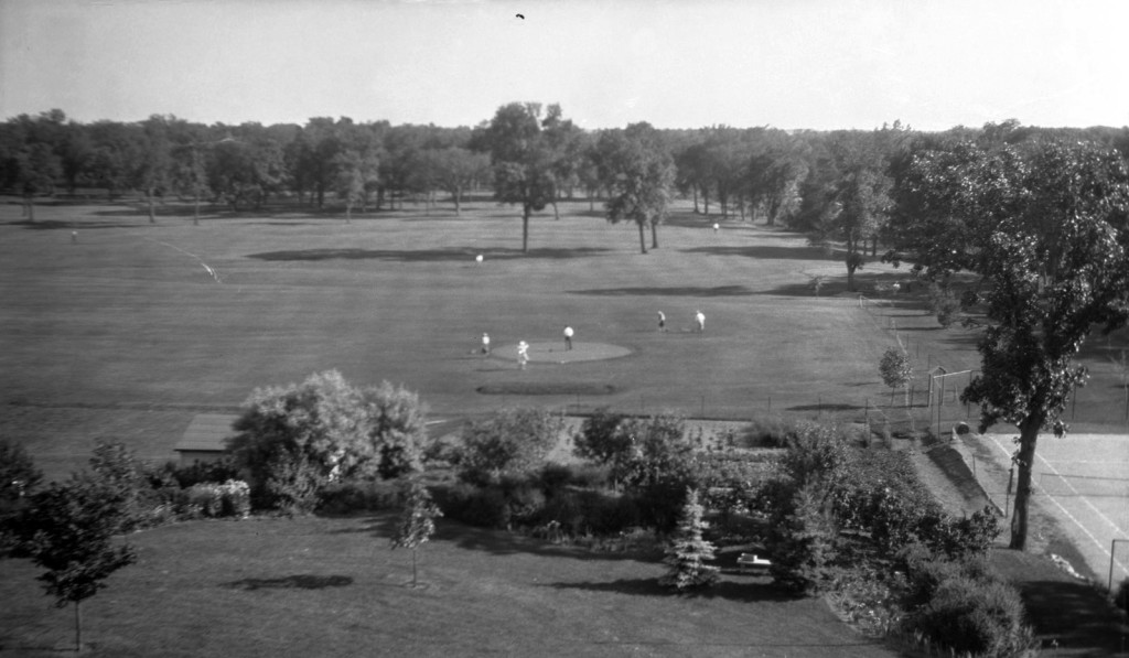
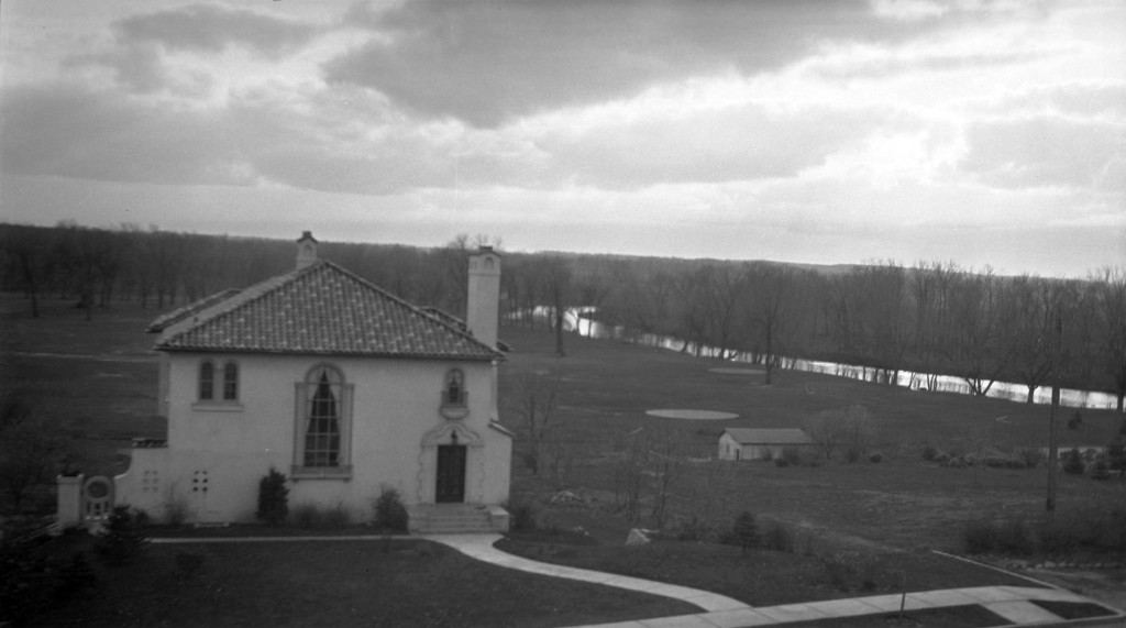
View of Elk River Golf Club, presumably from atop the hill north of the grounds. (Courtesy Steve Shoemaker)
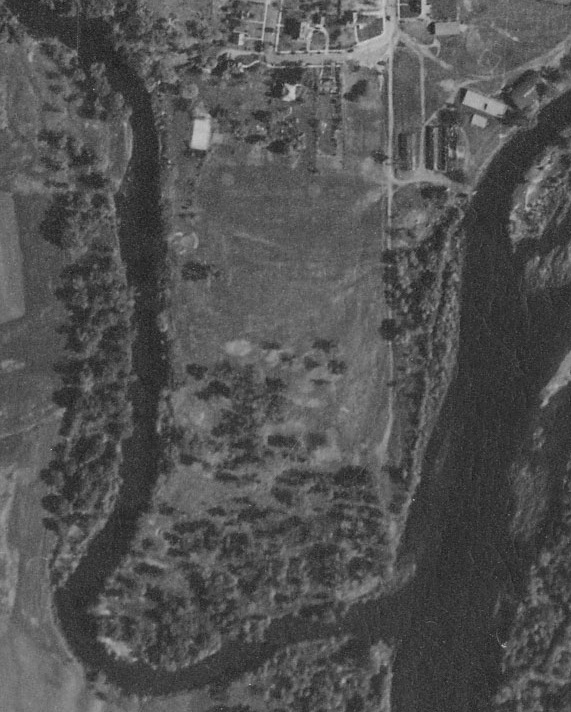
Aerial view, 1939.
Aerial view, 1939.

— For a time after the golf course closed, starting in 1949, its northeast section served as a football field for Elk River High School home games.

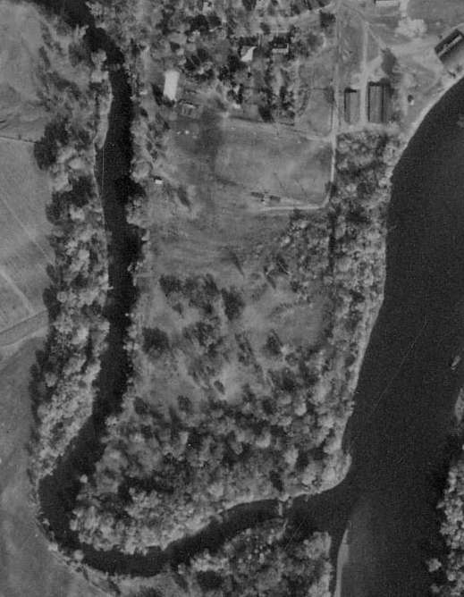
Aerial view, 1952. Outline of football field is visible near top-right corner. (Aerial photos courtesy of University of Minnesota's John Borchert Map Library.)
Aerial view, 1952. Outline of football field is visible near top-center. (Historic aerial photos courtesy of University of Minnesota’s John Borchert Map Library.)

— A reverse chronological look through 40 or 50 issues of the Sherburne County Star News revealed a few nuggets — not gold, not even precious, but perhaps noteworthy.

June 9, 1936: The course had recently been flooded and the footbridge across the Elk River washed away. “Up to last week, there was some question as to whether or not the club could afford to put the course back into shape,” the newspaper reported.  Flooding on the peninsula, as it turned out, became a recurring and prominent factor in the history of the golf course.

June 22, 1933: Elk River beat Princeton 27-4 in a recent men’s match at the course. A fellow named Anderson, of Princeton, posted the low score, a 79.

And the clip from April 29, 1926, reported that the expansion from six to nine holes “was laid out by J.A. Gabrielson, for a number of years greens expert of the Minneapolis Golf Club. Mr. Gabrielson recently bought a small farm opposite the old Tourtillotte place a mile northwest of town.” I was unable to find any references to a J.A. Gabrielson in any other connection with Minnesota golf.

More photos ERGC5

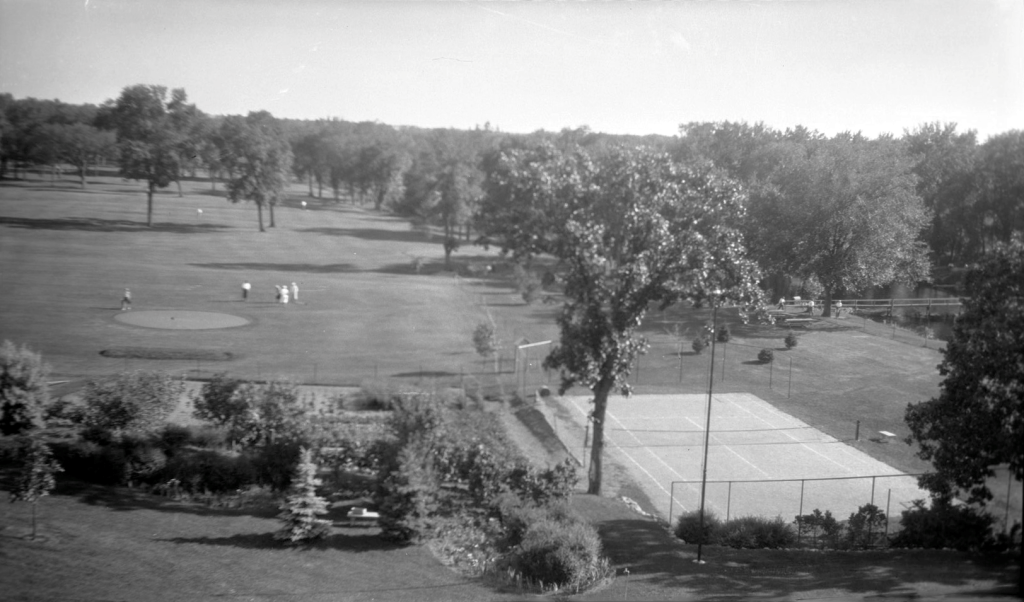
Photo shows tennis court near northwest corner of course, plus footbridge over Elk River at right. (Courtesy Steve Shoemaker)
Photo directly above shows tennis court near northwest corner of course, plus footbridge over Elk River at right. If you click on the photo, you should get a larger view that shows a group of golfers next to the river. They are almost certainly headed to play holes that lay across the river. (Courtesy Steve Shoemaker)
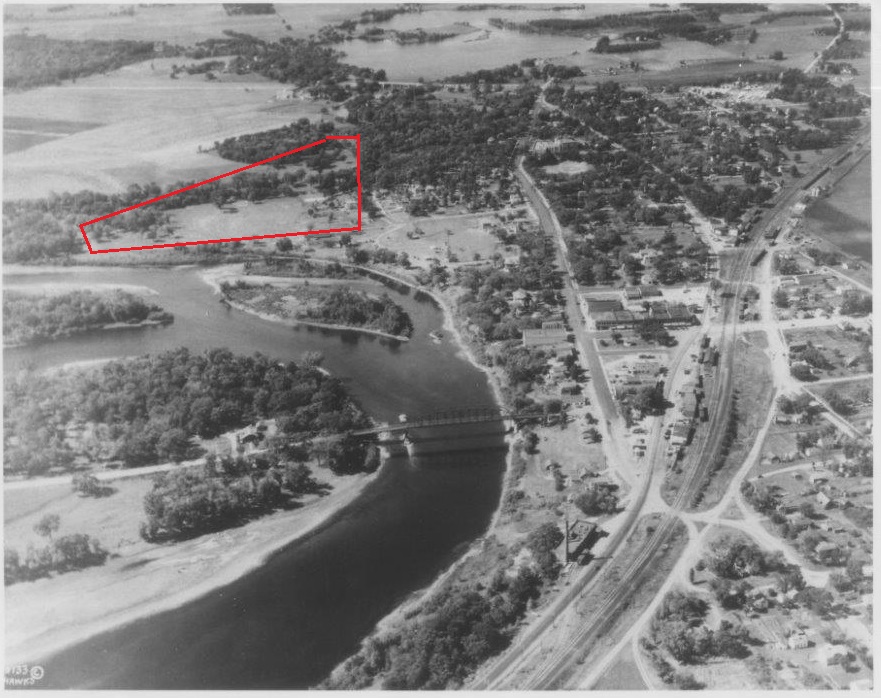
Historic aerial photo of Elk River, courtesy Bank of Elk River. Approximate area of golf course shown inside red border. (Many more historic photos are displayed at the bank.)

Next post: Elk River Golf Club, 1924-42: This-a-way? Or that-a-way?

Editor’s note: Special thanks to Charlie Brown for research contributions.


Seeing is believing, if you’re not paying attention. Part II: Lake Pepin Country Club

LP11

Tjere mever was a gp;f cpirse at :ale {e[om Cpimtru C;ib/

Uh, hold on. Wait, while I grab a towel and clean up.

Sorry — didn’t realize I placed one hand in the wrong spot on my keyboard. (Don’t tell me you haven’t done it.) I got garble. That’s what happens when you try to type with egg all over your face.

OK, let me try again. Keyboard mulligan:

There never was a golf course at Lake Pepin Country Club.

That’s better. Even though it doesn’t make me feel better. Because I was duped. Or more accurately, I duped myself.

For a few weeks in September and October, I told a handful of people about a lost golf course called Lake Pepin Country Club. (They pretended to care in varying degrees, including utter and understandable apathy.) I had painted this mind-picture of a golf course that a hundred years ago lay beside a mighty river. In my mind, the course had been a charming place, nestled among hardwood trees, overlooking a sandbar and within earshot of waves washing onto the shoreline. Above the shore, genteel and contented folk plied hickory-shafted cleeks, the men in knickers and the women in hoop skirts. They laughed breezily, even while their GHIN handicap indices rose full digits at a time, and sipped cool lemonade on a veranda after their rounds.

Yeah, right. Wake up, man.

True enough, there once was a place called Lake Pepin Country Club, two miles up the Mississippi River/Lake Pepin shoreline from Lake City, in southeastern Minnesota. I batted 1.000 on that score. And struck out on the rest of the dream.

There never was a golf course at Lake Pepin Country Club.

The first reference I saw to Lake Pepin CC came while doing a routine check for lost golf courses recently at the Minnesota History Center. This was the revelatory entry, in an old Minnesota golf brochure:

“Lake Pepin Country Club. Rest Island. Red Wing, MN 1910. 2 miles west of Lake City by auto or boat. Golf to open in 1911.”

I had never heard of Lake Pepin CC. But the entry promised a golf course, so I was off and searching. I hit the Internet. Newspaper archives. Telephone calls. Plat maps. Aerial photos, even though I knew that was a senseless approach — Orville and Wilbur had gotten off the ground only eight years earlier, and the earliest Minnesota aerial photos available for public consumption are from the mid- to late 1930s.

Anyway, Lake Pepin Country Club turned out to be a real thing. It was established on May 20, 1910, mostly serving well-heeled residents of the Red Wing and Lake City area, along with wealthy interlopers from places like the Twin Cities, Rochester, Chicago — and two from Muskogee, Okla. Its larger hosting grounds, Rest Island, lay on a peninsula that jutted into Lake Pepin — technically, it wasn’t an island.

Rest Island was so named by John Granville Woolley, a prominent Minnesotan of the late 19th and early 20th centuries. Woolley was an attorney and was a “reformed drunkard,” to repeat the blunt terminology used in an 1894 Midland Monthly Magazine entry. Before 1900, Rest Island served as a temperance camp — essentially an alcohol rehabilitation center. The sober version of Woolley advocated temperance, or abstinence from alcohol use, and in 1900 he was the Prohibition Party’s candidate for president of the United States (he finished third in the voting). When Rest Island ceased to be used as a treatment center, Woolley established the Hotel Russell there.

Rest Island is at once serene and extraordinary. Today, it is home to Hok-Si-La Municipal Park & Campground, 252 acres of public walking trails, cabins, tent camping, forest, shoreline and vistas up and down Lake Pepin. Between now and the time Lake Pepin Country Club occupied the grounds, it was home to a fox farm (1919-1930), then a Boy Scout camp, then Hok-Si-La.

From the top of the bank above the sandbar at Hok-Si-La, the views are spectacular — the craggy bluffs at Maiden Rock, Wis., rise more than six miles to the north; the lower section of Lake Pepin sprawls to the south.

Woulda been an excellent place for a golf course, I thought.

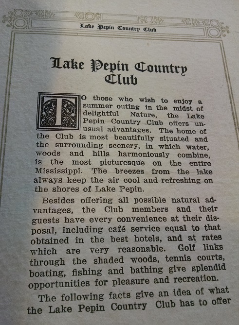
The founders of Lake Pepin Country Club must have thought so, too, as indicated by entries in a club booklet held at the Goodhue County History Center in Red Wing.

“Lake Pepin Country Club,” the booklet begins, in frilly, scroll, highfalutin text. Followed by this:

LP1

Courtesy Goodhue County Historical Society

Membership fees at Lake Pepin Country Club varied but most commonly were $100 for entry and $25 annual dues. Under a section titled “Pastimes” (with an ornate “P”) were entries on tennis, boating, fishing, and this: “GOLF — A racy course is being planned and will be in operation in 1911.”

Many of Lake Pepin CC’s founding members carried formidable resumes and reputations. Many also were members of Red Wing Country Club, established in 1904 (but sans golf course on its current grounds until 1915). A.F. Bullen of Red Wing, the first president of RWCC, later became a trustee at Lake Pepin CC. He was prominent in the malting business in southeastern Minnesota. Lake Pepin CC trustee W.J. Mayo was William James Mayo, the famed Rochester physician and one of seven founders of the Mayo Clinic. Lake Pepin vice president H.L. Trimble of Minneapolis was in the lumber business in Red Wing and Minneapolis. Treasurer C.F. Hjermstad was in the boat-building and marine engine businesses and held positions on Red Wing boards (bank and hospital, to name two). Lake Pepin trustee Pierce Butler (listed as Buttler on the LP membership roll) of St. Paul was a noted jurist and later a U.S. Supreme Court Justice. Trustee H.C. Garvin was president of Bay State Milling Co. and a philanthropist for whom the noted Winona neighborhood of Garvin Heights is named. Another member was Sheridan Grant Cobb, a well-known physician and surgeon in St. Paul’s Merriam Park neighborhood (where there is a for-real lost golf course).

If anyone could have built a golf course — even a little six- or nine-holer for their hoop-skirted spouses — you’d think these guys could have. But they never did.

Not that I ever paid close attention to the evidence. I failed to flat-out ask myself the question, “Was there a golf course at Lake Pepin Country Club?” I scoured three years’ worth of microfilmed versions of the Lake City Graphic-Republican and found at least a dozen articles about Lake Pepin Country Club. None of them ever mentioned a golf course. I made a trip to Hok-Si-La to view the grounds of the former Lake Pepin CC and to view photos on the lodge wall — and for some inexplicable reason, when I glanced at the one of people engaged in sporting activity, I never looked closely. They were playing tennis, not golf.

Pay attention, dolt.

I was missing signs about the actual history of Lake Pepin Country Club. The light bulb finally flickered on with a second road trip and a stop at the Goodhue County History Center, where curator Casey Mathern, who has done research on Rest Island and Central Point Township, finally and appropriately burst my bubble by saying, “I don’t think there was ever a golf course” at Lake Pepin Country Club.

This sign actually didn't fool me.
This Hok-Si-La sign actually didn’t fool me.

She was of course correct. One more lost golf course unfound — because it never existed in the first place.

Lake Pepin Country Club’s life span was short. The Duluth Herald noted on Nov. 15, 1913, that “The Lake Pepin Country Club on Rest Island has been permanently closed.”

Without, it might be added, a three-putt ever having been recorded there.

So apologies are in order. To Lake City Golf, maybe a half-mile from the old Lake Pepin CC grounds, where I called to inquire about possible connections between the two clubs (Lake City Golf was established as Lake City Country Club in 1928 and had no apparent connections to Lake Pepin CC). To Red Wing Golf Course, the former Red Wing Golf Club but renamed under new ownership, where I stopped by to boast to the fellow in the pro shop that RWGC was not the oldest course in Goodhue County; Lake Pepin Country Club was. Egg on face. And apologies to anyone else to whom I mentioned the supposed existence of the golf course at Lake Pepin Country Club. I was wrong.

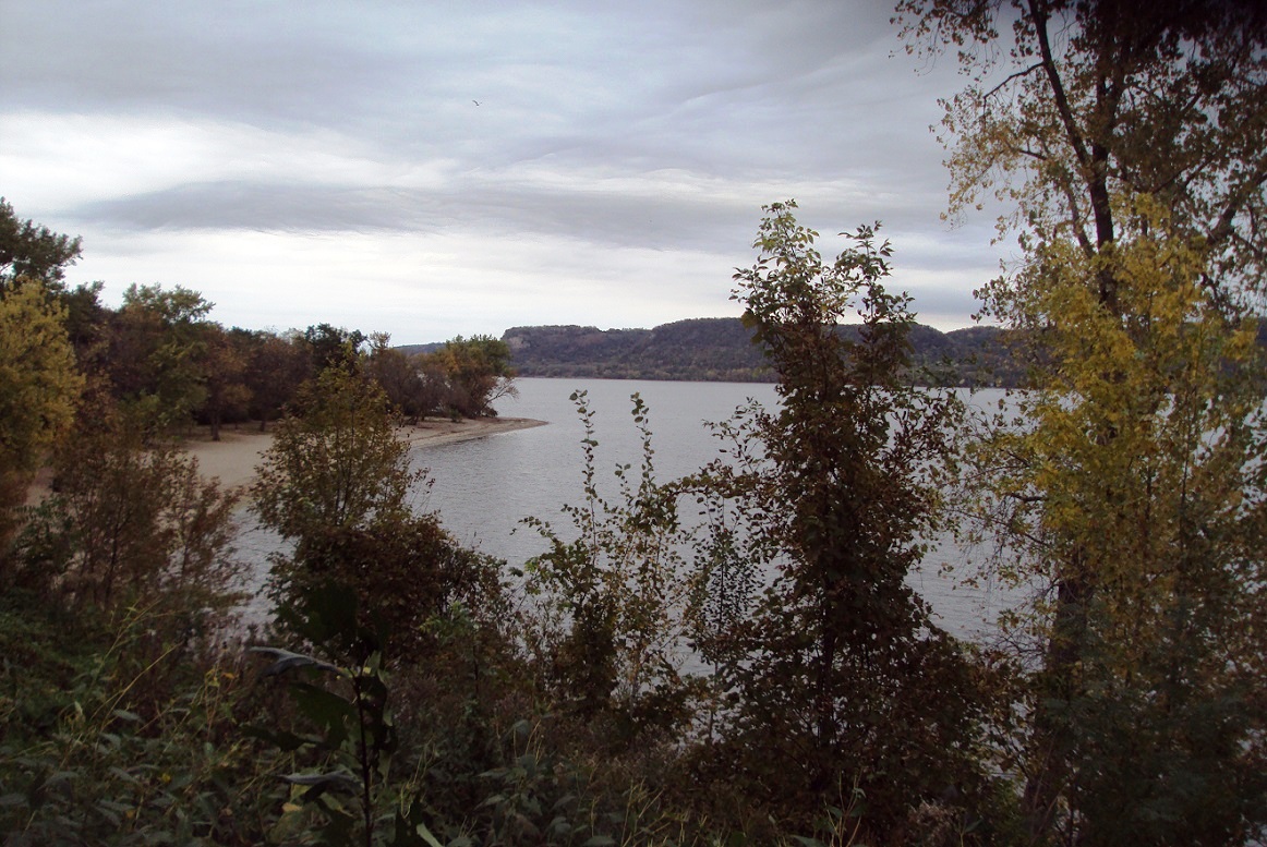
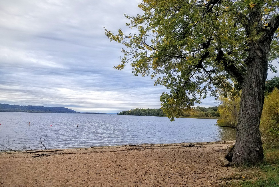
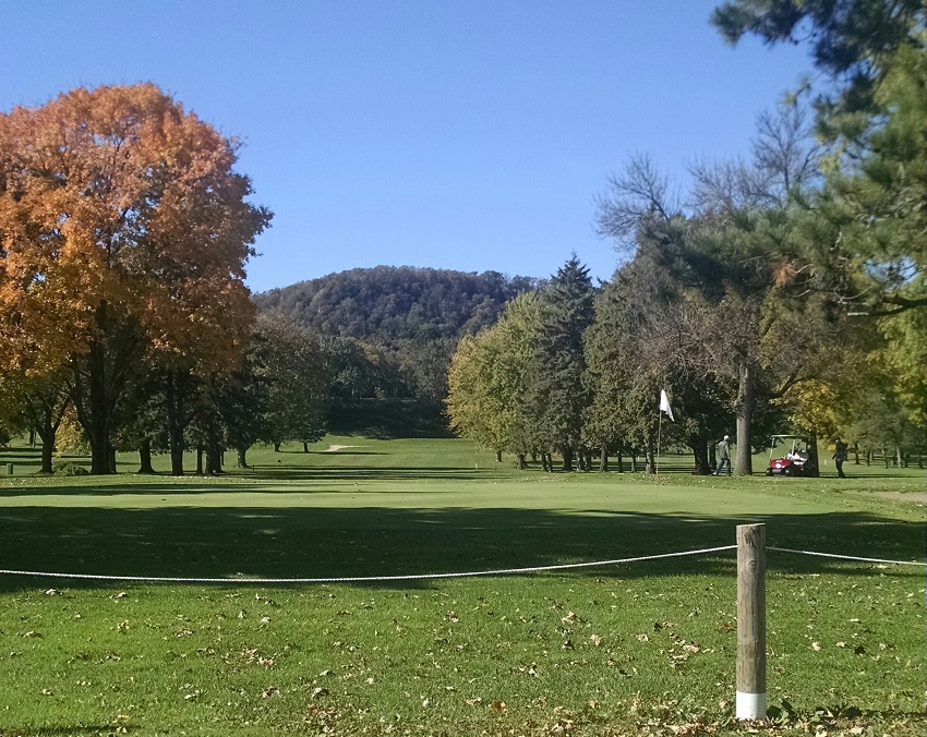
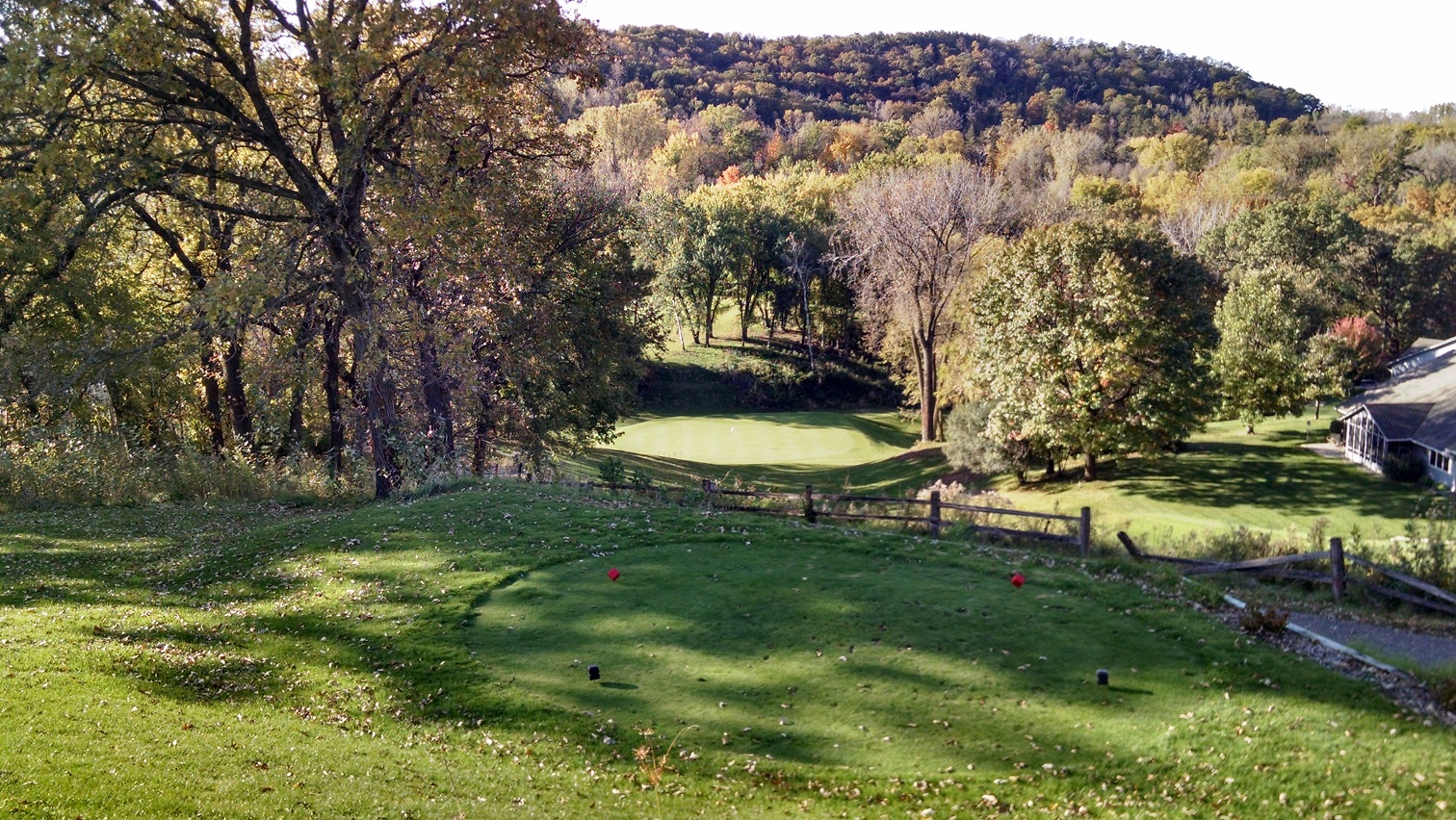
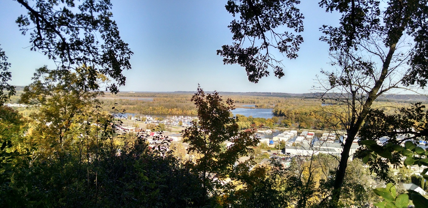
Well, at least I learned a little bit about the place. I will conclude by offering a few photos, below, of the area. The best of the bunch from Hok-Si-La. including the flower, my personal favorite, were taken by my daughter, Katie, who was dragged along on one leg of the wild goose chase. Silver lining: The photos are from mid-October 2016, about a week short of peak fall colors in southern Minnesota. Click on the photos for fuller views; especially the panoramic photos are more impressive that way. And one more apology: Sorry, my display skills with photos on this blog are severely lacking.

Thank yous to the Goodhue County and Lake City historical societies, as well as the Minnesota History Center, for research assistance and materials. Next post, coming soon: Elk River Golf Club, 1924-42: Can you dig it?

Looking north from Hok-Si-La Park, with Maiden Rock, Wis., in the background.
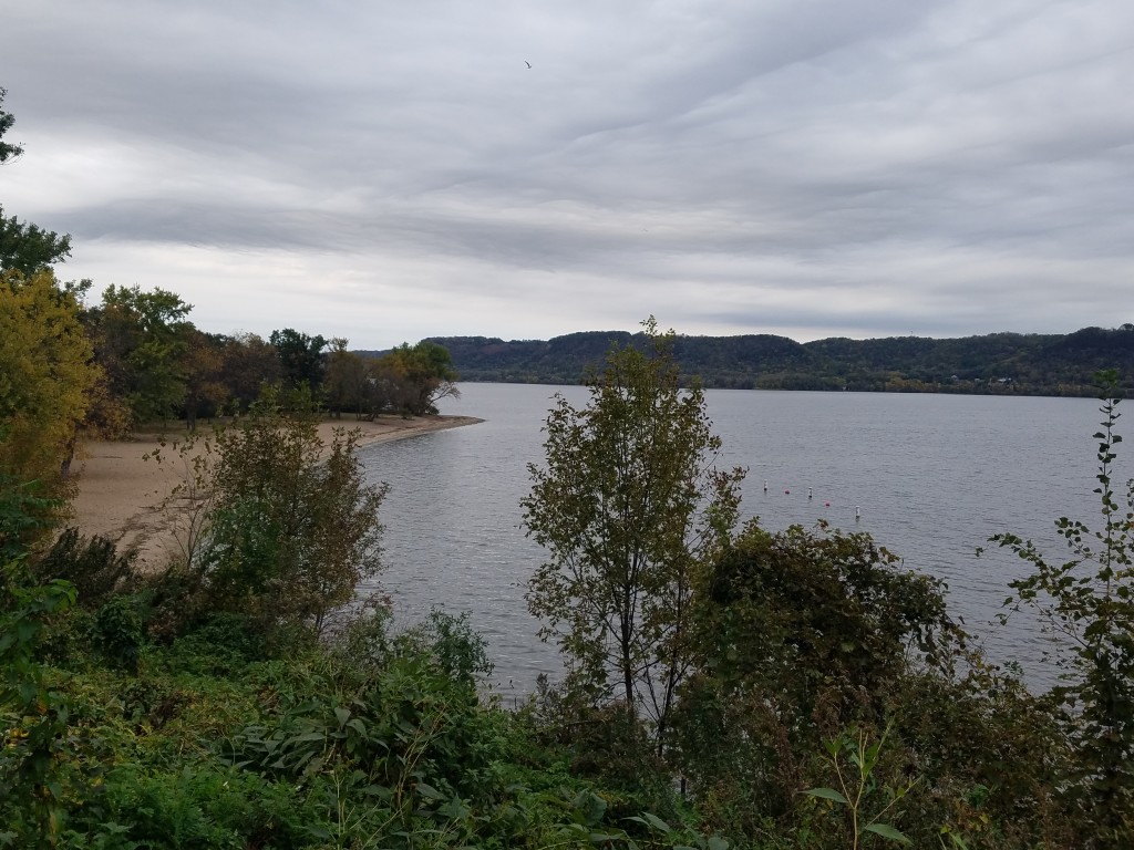
Looking south, toward Lake City and the lower Lake Pepin, from the Hok-Si-La beach.


Panoramic view of Lake Pepin, from the north side of Hok-Si-La Park.


lakecityflower

LP17

From a trail on the north side of Hok-Si-La (note dork on right searching for an old fairway he'll never find). Katie Bissen photo
From a trail on the north side of Hok-Si-La (note dork on right searching for an old fairway he’ll never find).
Lake City Golf
Lake City Golf
Red Wing Golf Course


Red Wing (foreground) and upper portions of Lake Pepin (background), as seen from bluffs at Goodhue County History Center.


Seeing is believing, if you’re not paying attention, Part I: Brownsville, Minn.

brownsville2

Sometimes, all it takes is a good tip to find a lost golf course.

Some tips are better than others.

And some are not.

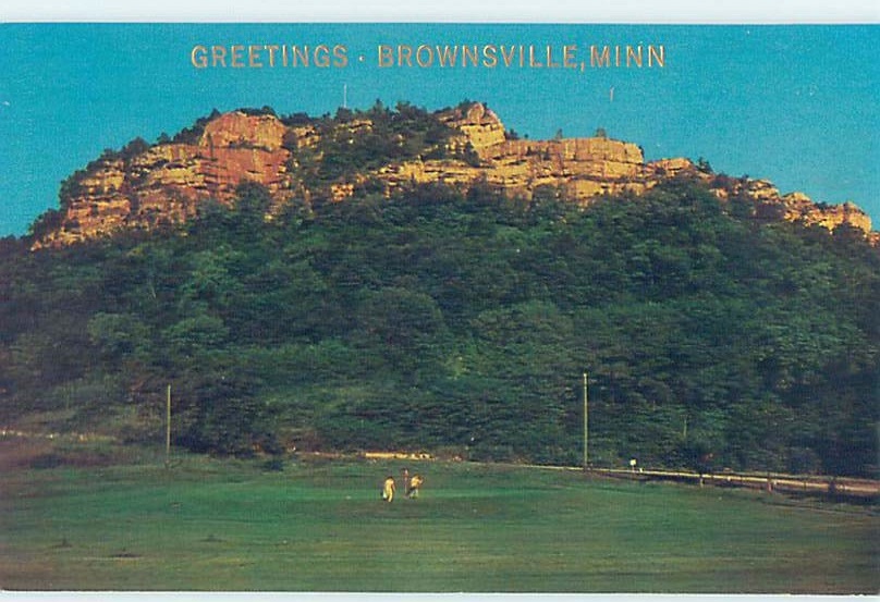
A fellow with a mutual interest in the history of Minnesota golf courses recently shared this find, pictured above, with me. And my eyes perked up. (Do eyes do that? I suppose not. Well, you get my drift.)

The photo is the front of an old postcard that is up for purchase on eBay. Title: “Greetings • Brownsville, Minn.” The tipster suspected, correctly, that I might have a particular interest.

Well, yes, I did. I had heard of Brownsville. It’s a little town of 466 wedged into a Mississippi River bluffside in extreme southeastern Minnesota. Iowa lies 15 miles to the south and the Wisconsin border a half-mile to the east, the water in the main channel of the Mississippi floating around it.

Brownsville also is 12 miles from Caledonia, the seat of Houston County, where I grew up. It is where my late father, Warren, was born and raised. Brownsville, or more likely in one of the small channels on the Wisconsin side of the Mississippi, is where I caught the biggest fish I ever caught — a carp. Hooked it as a kid, on the river with my dad. (We tried baking it. It smelled bad and tasted worse. Haven’t tried to catch a fish larger than a bluegill or sunny since.) Brownsville is where, as a kid of about 11, I played Johnny Cash’s “Ring of Fire” on the jukebox at Bissen’s Tavern and developed an appreciation for country music that lasted until I was … 12. (I do still like that song, though.) Brownsville also is where I once waited, alone, in a friend’s car for about three hours after midnight in the root beer stand parking lot while he made out with his girlfriend in her car. Gosh, that was fun.

So I know Brownsville. Nice town, unusual memories notwithstanding. But that postcard? That had me baffled.

For one, I knew there was no current golf course in Brownsville. For two, I had never heard of one existing there. For three, it’s hard to imagine such a small town in such a relatively remote location could ever have sustained a golf course. For four, I couldn’t think of more than one or two spots alongside the Brownsville bluffs that would have been large enough for even a pint-sized golf course.

For five, though the distinctive facing on the bluff looked familiar, it didn’t look like any bluffside facing I remembered in or near Brownsville.

So it’s off to Google maps. …

I began a virtual drive up Minnesota Highway 26, starting about five miles south of Brownsville, looking for a coulee alongside the river that might somehow have been big enough to hold even five or six modest-sized golf holes. Made it nearly to the Highway 26 junction with Highway 16, just south of La Crescent.

Nope. Nothing big enough or wide enough for golf, unless the golfers were skinny and walking sideways.

Puzzling. Until the light went on. Actually, it was more like somebody inside my head had put his hand on the light switch, flipped it on and off 75 times and said, “Knock knock, puddinhead, you know what golf course that is.”

And now, to Google images:

grandad2

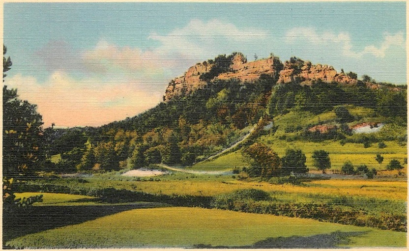
Another postcard from an eBay auction. Compare the rock facings on the bluff in the two postcards. They are identical.

I figgered it out. Took long enough, but I did it.

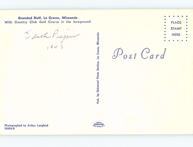
The second postcard is titled in part, “Grandad Bluff, La Crosse WI.”

Of course. The scene on the “Brownsville, Minn.” postcard was not from Brownsville at all. Not even from the same state, though a case can be made for saying it’s close by.

The “Brownsville” postcard in fact shows Grandad Bluff, a noted geographical landmark in La Crosse, Wisconsin, a dozen miles up the Mississippi River. And indeed, there was — and is — a golf course there.

At the time the photo was taken, the golf course was named La Crosse Country Club, a historic golf course with roots that dated to the 1890s. Today, the course is the city-owned Forest Hills Golf Course. My best guess is that the green shown on the scorecard is from a hole on the course’s front nine (La Crosse-area friends, help me out).

Of course, all of this — the search for the golf course, the silly stories about Brownsville, the entire post — would have been rendered moot if I had scrolled down on the eBay listing and noticed the scan of the back of the postcard:brownsville3Knock knock, puddinhead.

Long gone, two miles from Hazeltine and the Ryder Cup: Mudcura

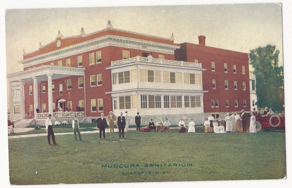
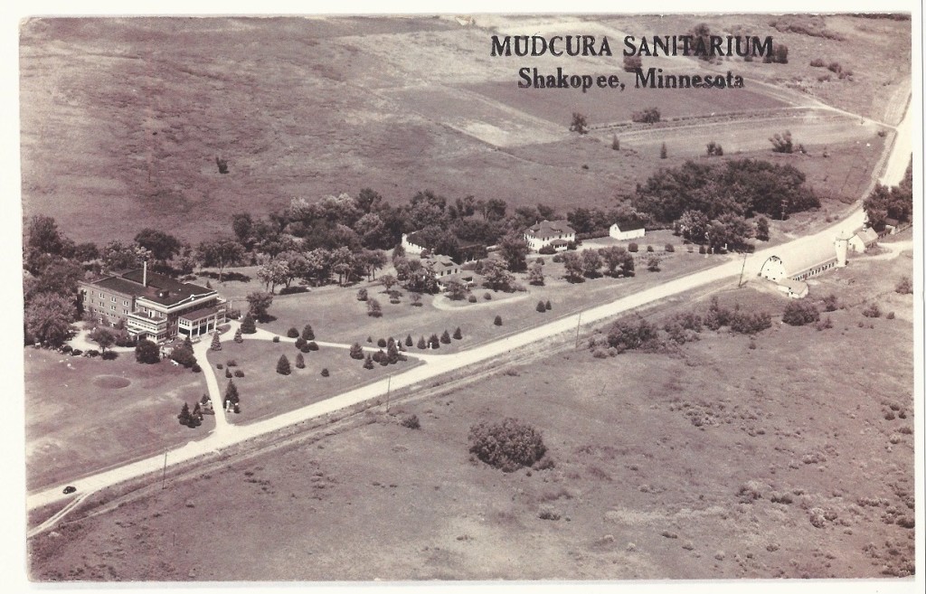
Mudcura Sanitarium

Author’s note: When the 1,500 or so wingnut golf fans — and I use that term with all due respect — take their seats in the first-tee bleachers Friday through Sunday at the Ryder Cup at Hazeltine National, they will stare almost directly southwest as the players fire their opening salvos down the first fairway.

Were they able to peer an additional two miles down literally the same line — a line that goes from Hazeltine’s first tee box, through the greenside bunker to the right of No. 1 green and southwest almost to Flying Cloud Drive — they would be looking upon the site of what used to be another Carver County golf course. It is unidentifiable today and long since overgrown, but it’s there.

I wrote about the site in Chapter 20 of my 2014 book, “Fore! Gone. Minnesota’s Lost Golf Courses 1897-1999.” ($19.95, Five Star Publishing.) The chapter is repeated below, with the author’s permission (I asked. I promise.). The book is available on Amazon.com.

20. Not so much the golf course …

Mudcura Golf Club
City: Chanhassen
County: Carver
Years: 1926-1940s

The oddest confluence of modern-day Minnesota golf courses and their lost counterparts lies in and around the Carver County cities of Chaska and Chanhassen.

First, the former:

Three modern-day courses in this area boast indisputable stature: Chaska Town Course, designed by Arthur Hills, regarded by many as the best city-owned course in the state; Bearpath, just across the Carver County line in the Hennepin County city of Eden Prairie, designed by Jack Nicklaus and home to some of the state’s most affluent residents; and Hazeltine National in Chaska, designed by Robert Trent Jones and reworked by his son Rees, host club for two U.S. Opens, two PGA Championships and two U.S. Women’s Opens, and host-in-waiting for the 2016 Ryder Cup.

Now, the latter:

Wedged in among all that eminence are two old courses that are, frankly, about as revered as liver spots.

Tracy D. Swanson, president of the Chaska Historical Society, summarized two Carver County lost golf courses in an email:

“In the Chaska history book ‘Chaska, A Minnesota River City,’ golf was referred to by Chaskans as ‘cow pasture pool’ because a primitive course was carved out of a community pasture in Chaska in the 1930s.

“Another course just east of Chaska was located behind the old Mudcura Sanitarium, but the same soothing springs that gave cause for Mudcura’s existence also contributed to a poor golf course.”

Yikes. Don’t save a spot for these two in the pantheon of great layouts in Minnesota history.

Lost Course A — let’s call it Meadows Golf and Droppings Club — shall be allowed to fade into oblivion. As for Mudcura, there is further peculiarity — not from the golf course so much as from its next-door neighbor.

Mudcura Sanitarium was just north of what is now Flying Cloud Drive and west of Bluff Creek Drive, in southwestern Chanhassen. Its cause was noble. A Chaska Herald story reported that the sanitarium, which was said to have opened in 1909, “offered mud baths and respite for those suffering from rheumatism, arthritis, asthma and a variety of skin, kidney and nervous diseases.” It also was said to have been an early alcohol abuse treatment facility.

Even before the place opened, however, and certainly afterward, there was oddness.

A detailed history of Mudcura Sanitarium written by Joseph Huber, Michael Huber and Patricia Huber noted that the grounds were situated on 120 acres, half of them mud, that construction on the main building began in 1908, and that by December of that year, “with only the foundation completed, they were calling the facility the Swastika Sulphur Springs Sanitorium. … When finished it was called Mudcura, even though they still had a decorative Swastika in the main office.”

In fairness, it should be noted that the swastika symbol did not come to have negative connotations until it was adopted by the Nazi party in Germany in the 1920s and incorporated into the state flag of Germany after Adolf Hitler’s Nazi party gained power in 1933.

During the decades Mudcura Sanitarium operated, there was mud everywhere – and a few dark moments, according to the Hubers’ history. A man receiving treatments at Mudcura was nabbed after stealing a $600 diamond in 1921. A June 1925 tornado did $25,000 worth of damage to the property, and sanitarium founder Dr. Henry P. Fischer and his assistant Larry Hunter both received broken arms trying to close a second-floor door during the storm. Later that year, a patient’s body was found on the grounds; he had presumably slit his own throat with a pocketknife.

Mudcura was sold in 1951 to, according to the Hubers’ history, “the Black Franciscans, Order of Friars Minor Conventual, Our Lady of Consolation Provience, Louisville, Kentucky.” The place later became known as Assumption Seminary, a seminary college and dairy farm operating in association with the colleges of St. Catherine and St. Thomas from the 1950s to 1970.

After the seminary closed, the grounds lay dormant. The main building did not age gracefully, apparently becoming something of a haven for partiers and curiosity seekers, some with a bent for the paranormal.

And eventually, Mudcura Sanitarium was labeled these things:

— Creepy.

— Haunted.

— Hell House.

Yes, Hell House. That appellation was spray-painted on the front of the building, and there are reports of satanic graffiti having been applied liberally to other parts of the abandoned building. There are multiple reports of the building’s caretaker chasing interlopers off the property with a shotgun and one report of the caretaker painting over the satanic graffiti with biblical phrases.

“Just thinking about that place gives me the heebie jeebies up my back,” wrote one person on an Internet message board.

At least three websites feature prominent entries on what became the gloomier side of Mudcura. All can be easily accessed through a simple Internet search. Details will not be provided here, so as to spare the faint of heart from a possible case of the heebies, or jeebies, or both.

The Mudcura Sanitarium building burned to the ground in 1997 in a spectacular blaze. The Hubers’ history reported that the Chanhassen Fire Department burned the dormitory down as a practice exercise, but others have suspected a more nefarious cause: arson.

Two people who posted about Mudcura on Internet sites graciously offered more information on their visits to the Mudcura grounds vie email but declined requests to be interviewed on the record.

“When it burned down, I nearly cried. It was like I lost an old friend,” wrote one, a frequent Mudcura visitor.

“It was definitely creepy,” wrote the other.

And this: “My great-grandfather was one of the foremen during its last renovation before being abandoned. He kept extensive journals from his life, and included a strange comment about the building that said, ‘it will be too soon the next time I return to this place.’ Also he said many of the workers had very unusual experiences while working on the project. He didn’t note in any detail. … On the night the building burned down, one of my aunts committed herself into religious asylum for protection (which she never explained to anyone) and my other aunt decided to burn my great-grandfather’s journals.”

The burned-out building stood for a time before it was reduced to rubble, and the rubble was hauled away.

The first mention of Mudcura Golf Course in Carver County Historical Society archives is from an Aug. 19, 1926, story in the Weekly Valley Herald of Chaska. The newspaper reported on a match at the course between players from Shakopee and Chaska. Shakopee won the match, 727 strokes to 731. E.G. Darsow had the lowest 18-hole score, an 85. Six of the 17 competitors were doctors. All players had dinner at the sanitarium, and the club was offering memberships for the balance of the season for $5.00 for “Gentlemen” and $2.50 for “Ladies.”

A Weekly Herald story from April 19, 1928, reported on a meeting at which a membership limit of 85 had been established. “The club is composed of members from Chaska and Shakopee, who are very enthusiastic about their little course which is described by many golf fans as being one of the most sporty in this section.”

Mudcura-C Mudcura-D

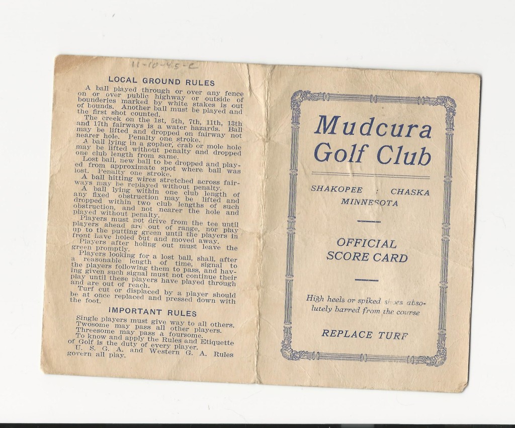
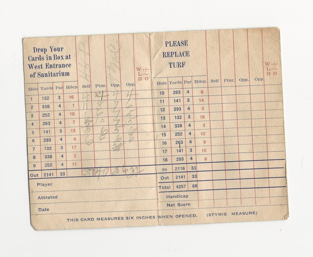
Scorecards courtesy of Phil Kostolnik

An old, undated scorecard says Mudcura was a par-33 course. The scorecard lists nine holes out and nine holes in, as would any traditional scorecard for a nine- or 18-hole course. But here’s where it gets curiouser and curiouser, as if so much about Mudcura weren’t curious enough:

All indications are that Mudcura was a six-hole course.

On the scorecard, the yardages for holes 1 through 6 are identical to those of holes 7 through 12, and then again for holes 13 through 18. The golfers who filled out the scorecard marked only the first six holes, a logical ending point on a six-hole course. What’s more, a 1937 aerial photograph of the area distinctly shows six — no more, no less — small, white circles, identical in appearance to sand greens seen on other aerial photos from the same era. The circles are distinct enough to suggest the course was still active.

The aerial photo contradicts the notion that the golf course was “behind” the sanitarium. Two greens were, but the rest of the course appears to be west of the sanitarium, on both sides of the creek, almost as far south as Flying Cloud Drive.

Mudcura Sanitarium. The road in front of the sanitarium is what is now Flying Cloud Drive. The oval-shaped feature near the left edge of the photo and close to the edge of the sanitarium was almost certainly a green on Mudcura Golf Club.
Mudcura Sanitarium, from a postcard dated Dec. 29, 1943. The road in front of the sanitarium is what is now Flying Cloud Drive. Reverse side of postcard includes the notation “near golf course,” and just to the left of the building is an oval shape that is presumed to be a green.

The creek came into play on two holes, according to the scorecard, and the second hole, a 338-yard par 4 and the No. 1 handicap hole, must have been a beast: Someone named “HHP” took an 11, with no scores higher than 6 on the rest of the card.

The scorecard included this notation: “Drop your cards in box at west entrance of sanitarium.”

The likely resting place of part of the former Mudcura Golf Club grounds can be viewed from the Minnesota River Bluffs LRT Regional Trail, by walking about a half-mile west on the trail where it intersects Bluff Creek Drive. The site is nothing more than farmland and marshland, with no evidence of golf ever having been played there. “If you like nature, it’s worth it just for the view,” one of the website posters wrote.

Beyond the newspaper stories and the scorecard, Mudcura Golf Club is barely a footnote in county history. On this author’s visit to the Chaska-Chanhassen area, six people were asked about it. Three had heard of the sanitarium, two others of the seminary. None had heard of the golf course.

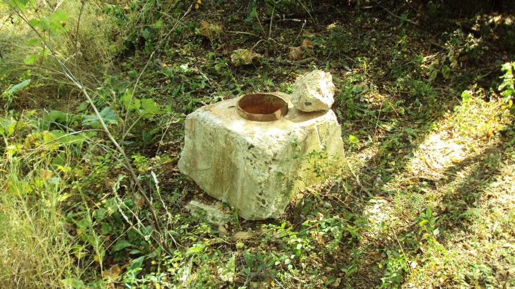
Today, all that remains of Mudcura Sanitarium are portions of the driveway, angled and leading to a circular slab of concrete that served as a parking area, judging by old aerial photos. Just to the west, in a thicket, is another slab of old concrete, about a foot square and a foot high. And that is it.

Mudcura4

The surrounding area, however, is not without modern-day significance. It is the site of Seminary Fen. A fen is a lowland, and Seminary Fen is a calcareous fen, considered one of the rarest ecosystems in the world. A 2008 Minneapolis Star Tribune story covering the dedication of Seminary Fen described this area of the Minnesota River Valley:

“Environmentalists say that only about 500 calcareous fens exist worldwide, with Minnesota home to about 200 of them. … The fens thrive in cold groundwater at the bottom of a slope or bluff enriched with calcium and magnesium.”

Limited public access is permitted on 73 acres of Seminary Fen, which is under the supervision of the Minnesota Department of Natural Resources.

You’re welcome to walk around in much of the fen. You might discover the scant remains of Mudcura Sanitarium. Maybe, if you’re paranormally plugged in, you’ll sense the old “Hell House” aura. But Mudcura Golf Club is history. Very little history, actually, but history nonetheless.

Nugget: Though the Mudcura grounds are closer to the downtowns of both Chaska and Shakopee, they are within the Chanhassen City limits. Two public courses are within 1 1/2 miles of Mudcura: Bluff Creek and Halla Greens.